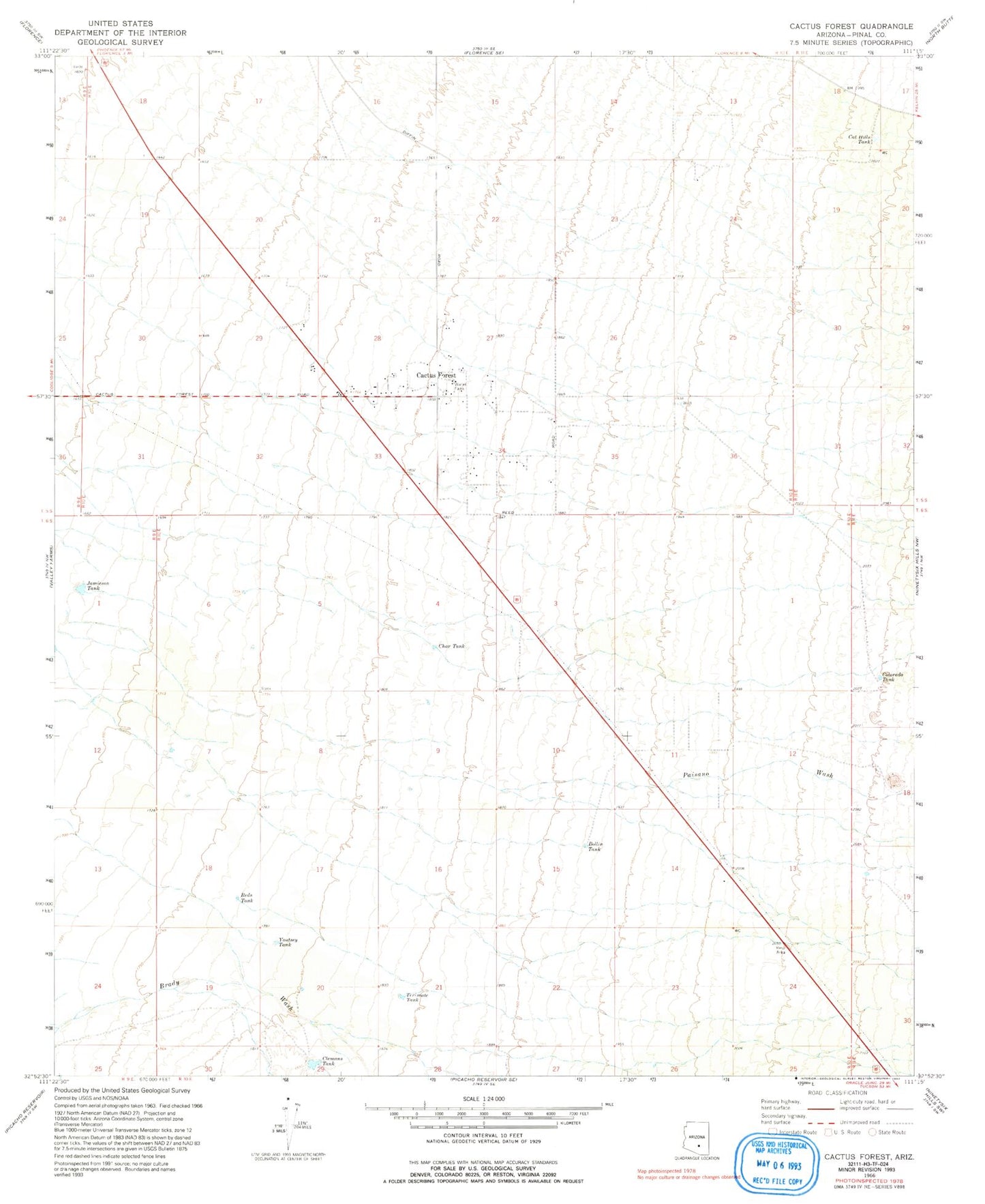
MyTopo
Classic USGS Cactus Forest Arizona 7.5'x7.5' Topo Map
Regular price
$16.95
Regular price
Sale price
$16.95
Unit price
per
Couldn't load pickup availability
Historical USGS topographic quad map of Cactus Forest in the state of Arizona. Map scale may vary for some years, but is generally around 1:24,000. Print size is approximately 24" x 27"
This quadrangle is in the following counties: Pinal.
The map contains contour lines, roads, rivers, towns, and lakes. Printed on high-quality waterproof paper with UV fade-resistant inks, and shipped rolled.
Contains the following named places: Bollin Tank, Cactus Forest, Cactus Forest Census Designated Place, Cat Hills Tank, Char Tank, Clemans Tank, Colorado Tank, Jamieson Tank, Paisano Wash, Pinal County, Pinal Pioneer Parkway Rest Area, Reds Tank, Terimate Tank, Youtsey Tank