MyTopo
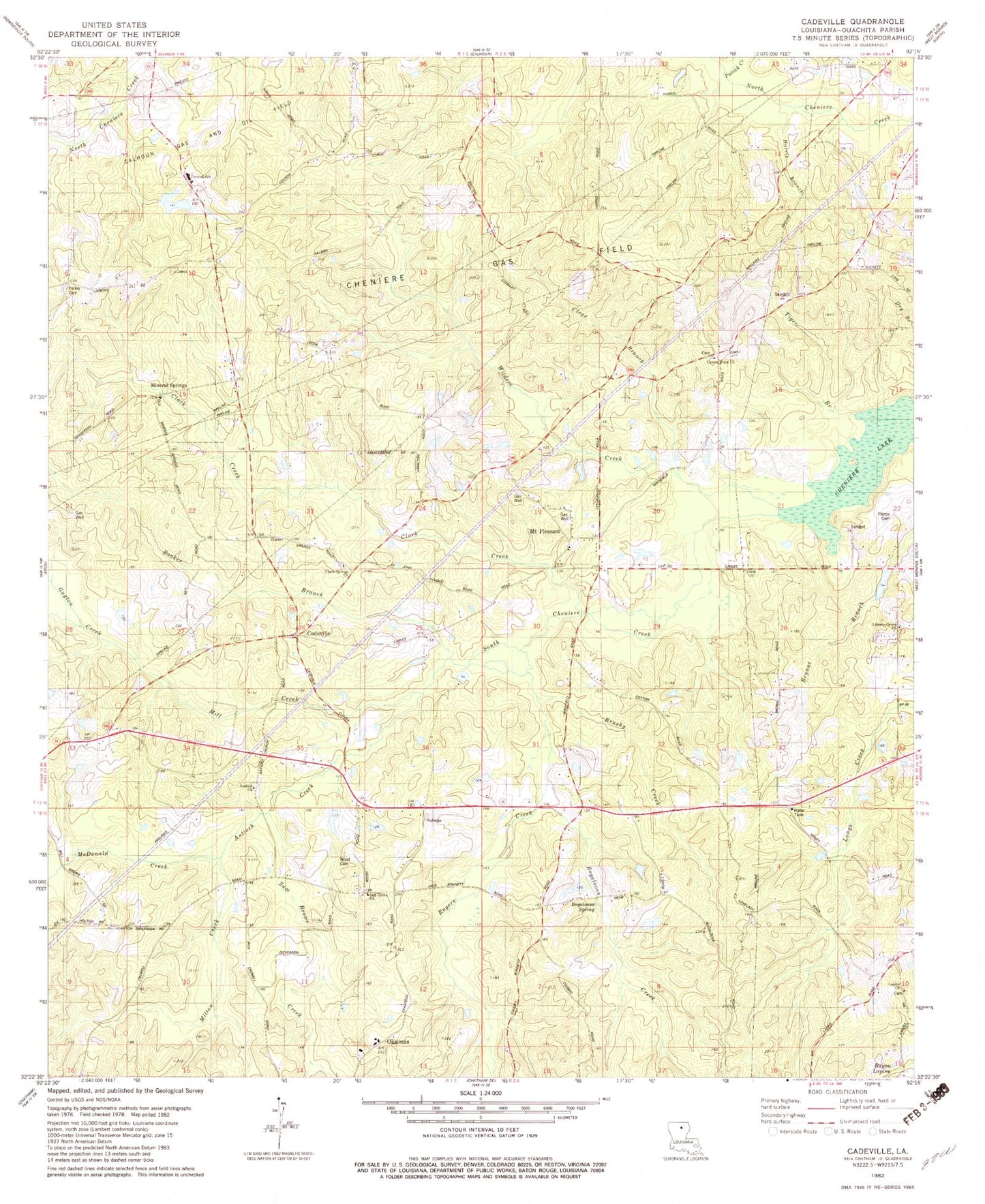
Classic USGS Cadeville Louisiana 7.5'x7.5' Topo Map
Couldn't load pickup availability
Historical USGS topographic quad map of Cadeville in the state of Louisiana. Map scale may vary for some years, but is generally around 1:24,000. Print size is approximately 24" x 27"
This quadrangle is in the following counties: Ouachita.
The map contains contour lines, roads, rivers, towns, and lakes. Printed on high-quality waterproof paper with UV fade-resistant inks, and shipped rolled.
Contains the following named places: Antioch Church, Antioch Creek, Bacons Branch, Beech Branch, Bogaloosa Creek, Bogaloosa Spring, Booker Branch, Brushy Creek, Cadeville, Centerpoint Baptist Church, Central Elementary School, Cheniere Gas Field, Clark Creek, Clark Springs Church, Clear Branch, Guyton Creek, Harris Branch, House Branch, Humbles Branch, Lapine, Lapine Church, Liberty Grove Church of God, Mallard Branch, McDonald Creek, Mill Creek, Milton Creek, Mineral Springs, Mount Pleasant, Mount Pleasant Baptist Church, Oak Grove Baptist Church, Okaloosa, Okaloosa School, Ouachita Parish Fire Department Fire Station 12, Parish Governing Authority District B, Parker Cemetery, Patrick Creek, Pierce Cemetery, Rogers Creek, Sam Brown Creek, Sanctified Church, South Cheniere Creek, Tiger Branch, Ward Seven, West Ouachita High School, Wilders Creek