MyTopo
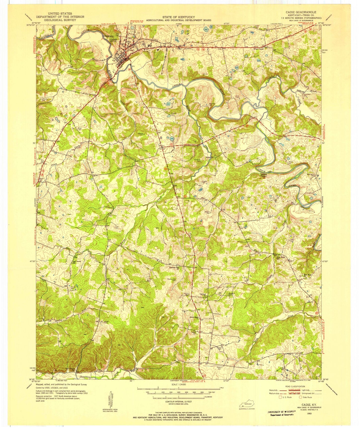
Classic USGS Cadiz Kentucky 7.5'x7.5' Topo Map
Couldn't load pickup availability
Historical USGS topographic quad map of Cadiz in the state of Kentucky. Map scale is 1:24000. Print size is approximately 24" x 27"
This quadrangle is in the following counties: Trigg.
The map contains contour lines, roads, rivers, towns, and lakes. Printed on high-quality waterproof paper with UV fade-resistant inks, and shipped rolled.
Contains the following named places: Belford Spring, Bethel Church, Burge Creek, Cadiz, Cadiz Division, Cadiz Fire Department, Cadiz Police Department, Cadiz Post Office, Calvary Church, Caney Creek, City of Cadiz, Ezell Cemetery, Grigsby Creek, Henry Cornelius Burnett Historical Marker, Jefferson Cemetery Number 1, Kings Chapel, Liberty Point Church, Lowe Airport, McUpton School, Montgomery Volunteer Fire Department, New Hope Church, Oak Grove Baptist Church, Oakland Church, Pleasant Hill Church, Saint Stephens Church, Sinking Fork, South Road Church, South Road Church, South Road Volunteer Fire Department, Stillhouse Branch, Trigg County, Trigg County Hospital, Trigg County Sheriff's Office