MyTopo
Classic USGS Cadle Butte Oregon 7.5'x7.5' Topo Map
Regular price
$16.95
Regular price
Sale price
$16.95
Unit price
per
Couldn't load pickup availability
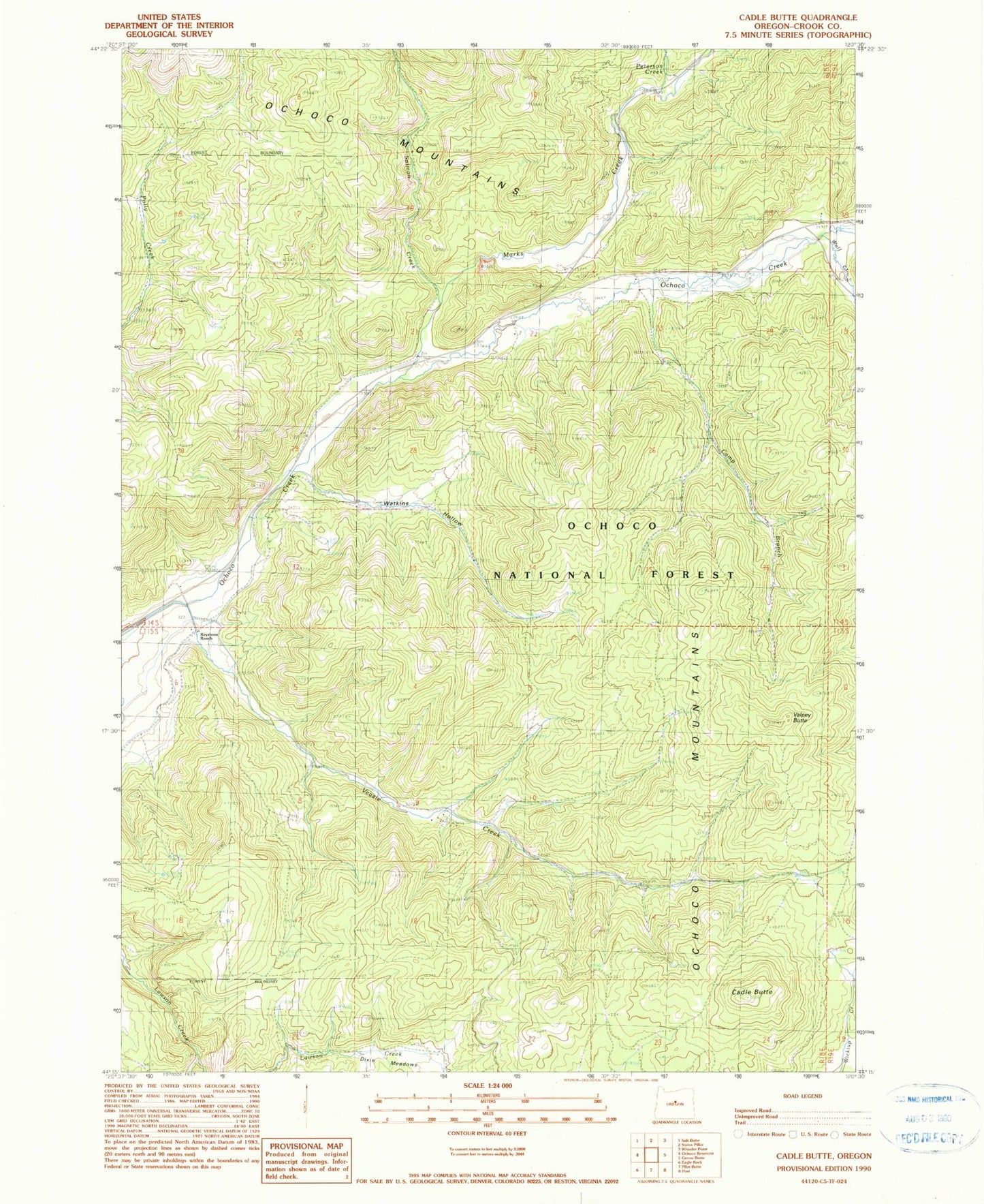
Historical USGS topographic quad map of Cadle Butte in the state of Oregon. Map scale may vary for some years, but is generally around 1:24,000. Print size is approximately 24" x 27"
This quadrangle is in the following counties: Crook.
The map contains contour lines, roads, rivers, towns, and lakes. Printed on high-quality waterproof paper with UV fade-resistant inks, and shipped rolled.
Contains the following named places: Cadle Butte, Camp Branch, Dixie Meadows, Howard, Howard Post Office, Howard School, Keystone Ranch, Marks Creek, Peterson Creek, Salmon Creek, Smith Ditch, Valpey Butte, Veazie Creek, Watkins Hollow, Wolf Creek