MyTopo
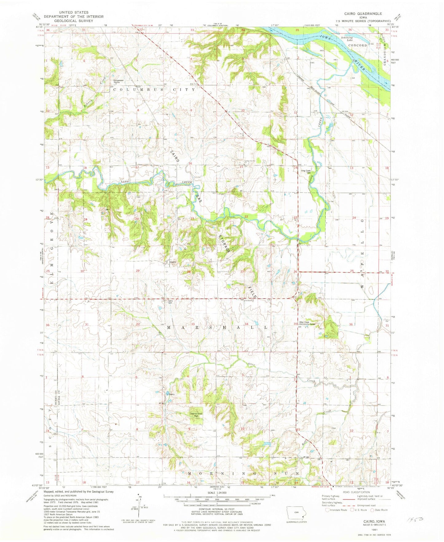
Classic USGS Cairo Iowa 7.5'x7.5' Topo Map
Couldn't load pickup availability
Historical USGS topographic quad map of Cairo in the state of Iowa. Map scale may vary for some years, but is generally around 1:24,000. Print size is approximately 24" x 27"
This quadrangle is in the following counties: Henry, Louisa.
The map contains contour lines, roads, rivers, towns, and lakes. Printed on high-quality waterproof paper with UV fade-resistant inks, and shipped rolled.
Contains the following named places: Bard, Bard Post Office, Bretz Cemetery, Cairo, Cairo Cemetery, Cairo Gas Storage Field, Cairo Post Office, Cairo Woods Wildlife Area, Grim Cemetery, Griswold Cemetery, Long Creek, Long Creek Cemetery, Louisa Center Church, Louisa Centre Post Office, Louisa County, Marshall Cemetery, Oakland Cemetery, Oakland Church, Otter Creek Community Center, Port Paradise Farms Airport, Roff Creek, Schlitzing Lake, Slaughter Cemetery, Spring Run Post Office, Township of Marshall, Virginia Grove Cemetery, Virginia Grove Park, Virginia Grove Post Office