MyTopo
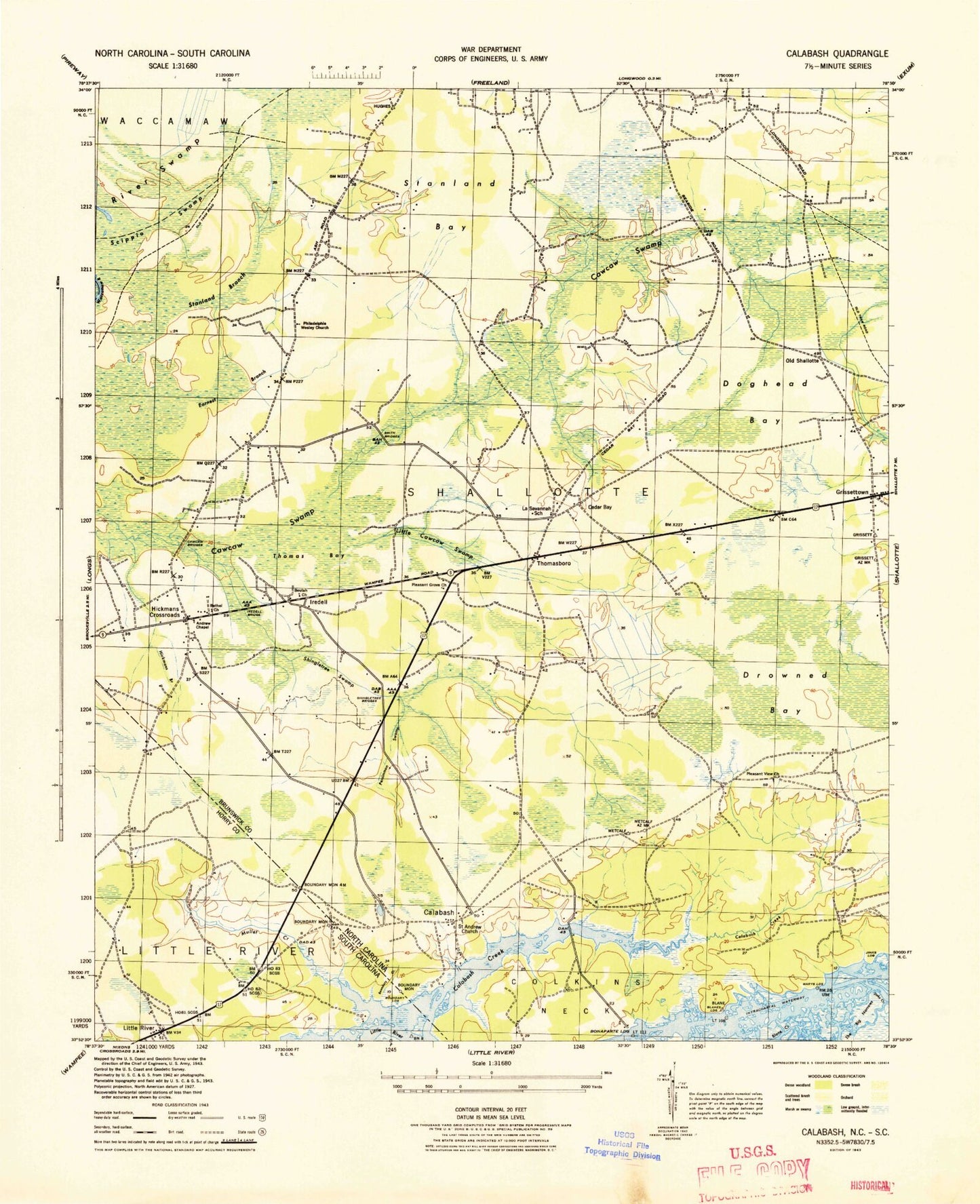
Classic USGS Calabash North Carolina 7.5'x7.5' Topo Map
Couldn't load pickup availability
Historical USGS topographic quad map of Calabash in the states of North Carolina, South Carolina. Map scale may vary for some years, but is generally around 1:24,000. Print size is approximately 24" x 27"
This quadrangle is in the following counties: Brunswick, Columbus, Horry.
The map contains contour lines, roads, rivers, towns, and lakes. Printed on high-quality waterproof paper with UV fade-resistant inks, and shipped rolled.
Contains the following named places: Andrew Chapel, Bennett Cemetery, Bethel Church, Beulah Church, Blane Landing, Blanes Landing, Blanton Cemetery, Bonaparte Landing, Boundary Creek, Brunswick County Emergency Medical Services Base 6, Calabash, Calabash Creek, Calabash Fire Department Station 12 - 1 Headquarters, Calabash Fire Department Station 12 - 2, Calabash Post Office, Calabash River, Carolina Shores, Carolina Shores Golf and Country Club, Cawcaw Bridges, Cedar Bay, Corkins Neck, Cypress Bay Golf Course, Doghead Bay, Drowned Bay, Earnest Branch, First Apostolic Church, Friendship Church, Greenbriar Lake, Grissettown, Grissettown - Longwood Fire and Rescue, Heather Glen Golf Course, Hickmans Branch, Hickmans Crossroads, Iredell, Iredell Bridge, Jinks Landing, La Savannah School, Lewis Cemetery, Little Cawcaw Swamp, Little River Medical Center, Little River School, Little River United Methodist Church, Little River Village Shopping Center, Manley Bennett Cemetery, Marys Landing, Milliken Cove, Mullet Creek, Old Shallotte, Oyster Bay Golf Links, Pearl Golf Links, Persimmon Swamp, Pleasant Grove Church, Pleasant View Cemetery, Pleasant View Church, Saint Andrew Church, Sea Trail Golf Links, Shady Forest, Shingletree Bridges, Shingletree Swamp, Smith Bridges, South Carolina Noname 26020 D-3623 Dam, Stanland Bay, Stanland Branch, Sunset Beach, Sunset Beach Fire Station 11 - 1, Sunset Beach Post Office, The Big Narrows, Thomas Bay, Thomasboro, Town of Calabash, Town of Carolina Shores, Town of Sunset Beach, United Church, Wesleyan Church, Wilson Cemetery, ZIP Codes: 28452, 28467, 28468