
MyTopo
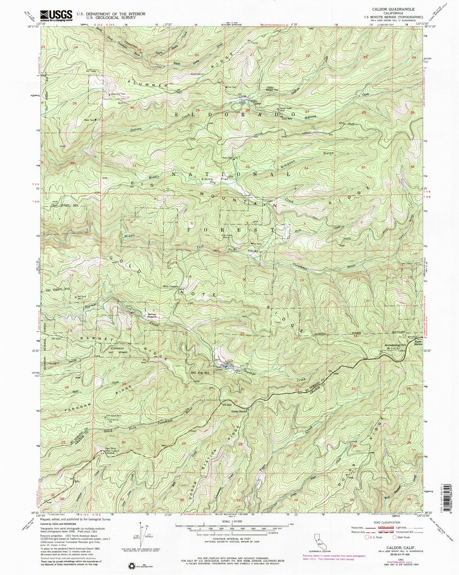
Classic USGS Caldor California 7.5'x7.5' Topo Map
Couldn't load pickup availability
Historical USGS topographic quad map of Caldor in the state of California. Map scale is 1:24000. Print size is approximately 24" x 27"
This quadrangle is in the following counties: Amador, El Dorado.
The map contains contour lines, roads, rivers, towns, and lakes. Printed on high-quality waterproof paper with UV fade-resistant inks, and shipped rolled.
Contains the following named places: Arbor Mine, Armstrong Hill, Armstrong Hill Lookout, Barney Meadow, Barney Ridge, Blacks Station, Caldor, Caldor Ranger Station, California Department of Forestry and Fire Protection Dew Drop Fire Station, Cooks Station, Cooks Station Ridge, Croft, Dew Drop (historical), Dew Drop Fire Control Station, Doaks Ridge, Elkins Flat, Farnham Ridge, Five Corners, Fort Grizzly Site, Gold Note Ridge, Haase, Hams Station, John Schell Mine, Leoni Fire Tank, Louis Jordan Mine, McKinney Creek, Middle Dry Creek, Myers Fire Tank, North Steely Creek, Pi-Pi Campground, Pi-Pi Creek, Pi-Pi Valley, Plummer Ridge Forest Service Station, Prospect Creek, Red Gold Mine, Simpson Gulch, South Steely Creek, Spread Eagle Mine, Tie Cabin Fire Tank, Twin Gulch


