MyTopo
Classic USGS Caldwell Lake Wyoming 7.5'x7.5' Topo Map
Couldn't load pickup availability
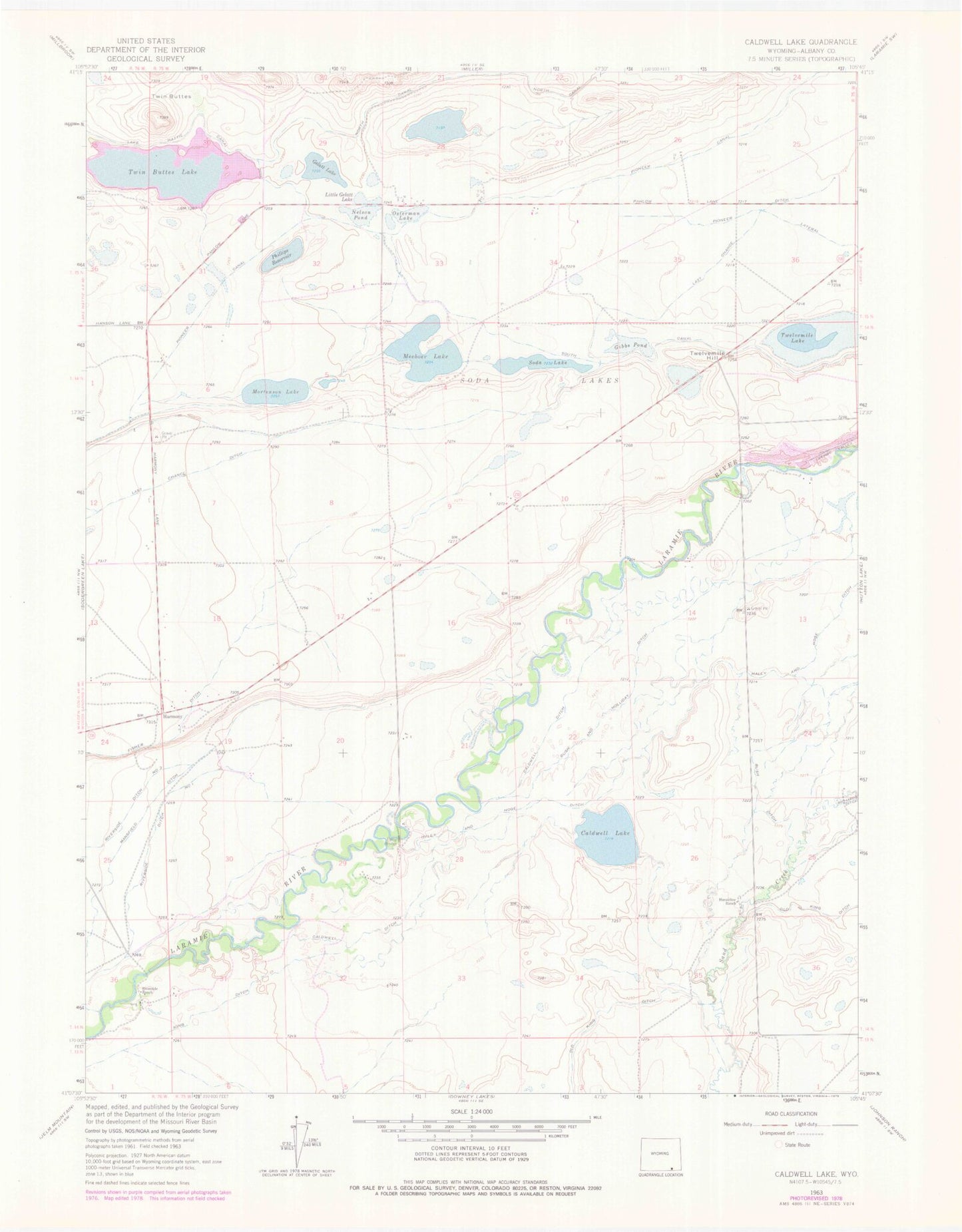
Historical USGS topographic quad map of Caldwell Lake in the state of Wyoming. Map scale may vary for some years, but is generally around 1:24,000. Print size is approximately 24" x 27"
This quadrangle is in the following counties: Albany.
The map contains contour lines, roads, rivers, towns, and lakes. Printed on high-quality waterproof paper with UV fade-resistant inks, and shipped rolled.
Contains the following named places: Bush and Holliday Ditch, Bush Ditch, Caldwell Ditch, Caldwell Lake, Gelatt Lake, Gibbs Pond, Haley and Hoge Ditch, Harman Dam, Harman Reservoir, Harmony, Hunzicker Ranch, King Ditch, Lake Hattie Canal, Lake Mildred, Last Chance Ditch, Leroy Bridge, Little Gelatt Lake, Mansfield Ditch, Meeboer Lake, Mortenson Lake, Mortenson Lake National Wildlife Refuge, Nelson Pond, Osterman Lake, Phillips Reservoir, Riverside Ditch Number 1, Riverside Ranch, Sand Creek Mine, Soda Lake, Soda Lake Draw Number 1 Dam, Soda Lake Draw Number 1 Reservoir, South Canal, Twelvemile Hill, Twelvemile Lake, Twin Buttes Lake, ZIP Code: 82070