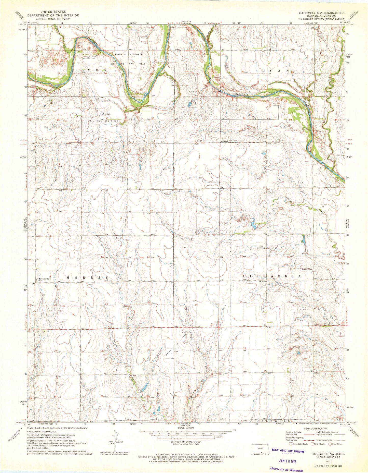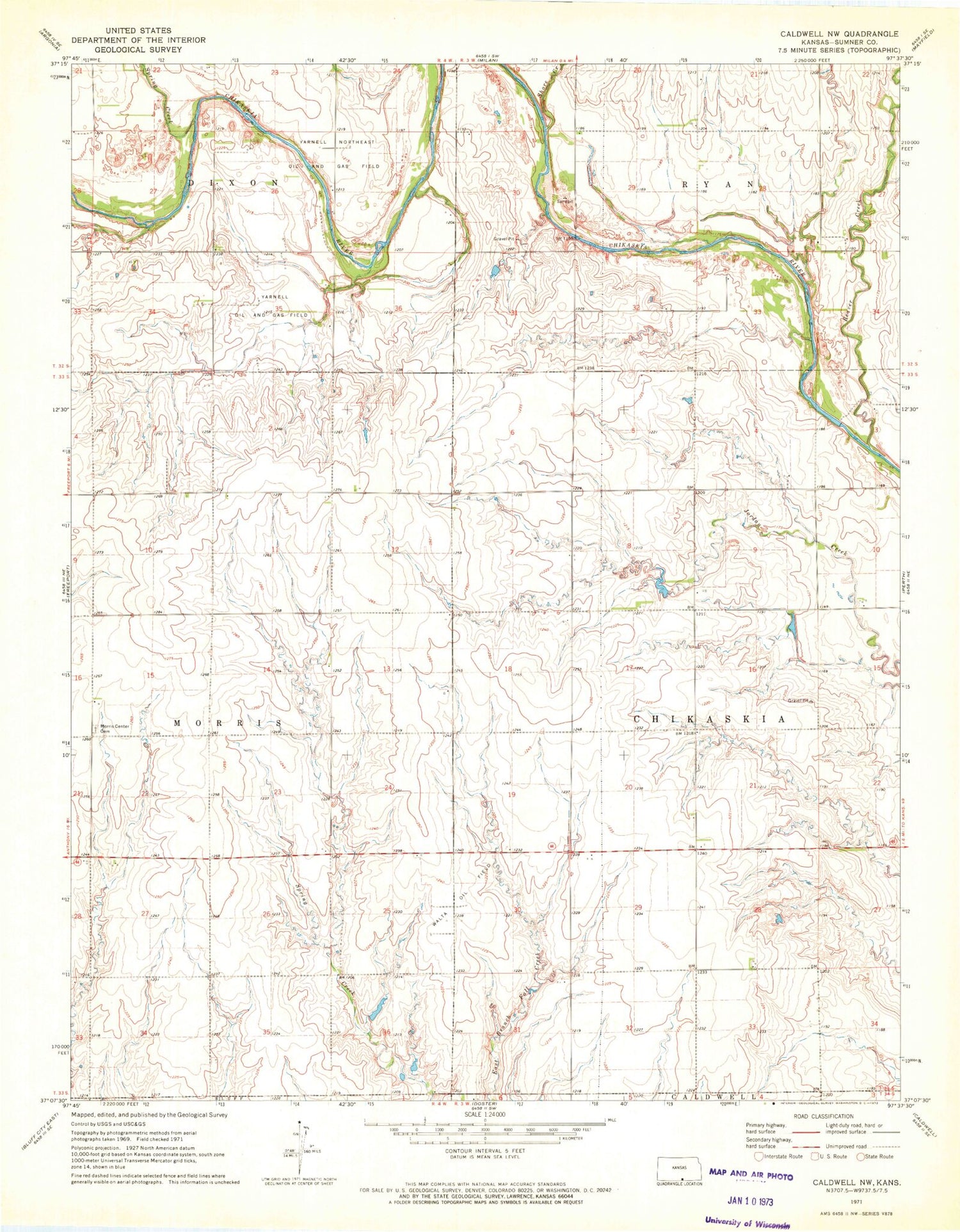
MyTopo
Classic USGS Caldwell NW Kansas 7.5'x7.5' Topo Map
Regular price
$16.95
Regular price
Sale price
$16.95
Unit price
per
Couldn't load pickup availability
Historical USGS topographic quad map of Caldwell NW in the state of Kansas. Map scale may vary for some years, but is generally around 1:24,000. Print size is approximately 24" x 27"
This quadrangle is in the following counties: Sumner.
The map contains contour lines, roads, rivers, towns, and lakes. Printed on high-quality waterproof paper with UV fade-resistant inks, and shipped rolled.
Contains the following named places: Beaver Creek, Morris Center Cemetery, Shore Creek, Spring Creek, Township of Chikaskia, Township of Morris, Walta Oil Field, Yarnell Northeast Oil and Gas Field, Yarnell Oil and Gas Field, ZIP Code: 67105