MyTopo
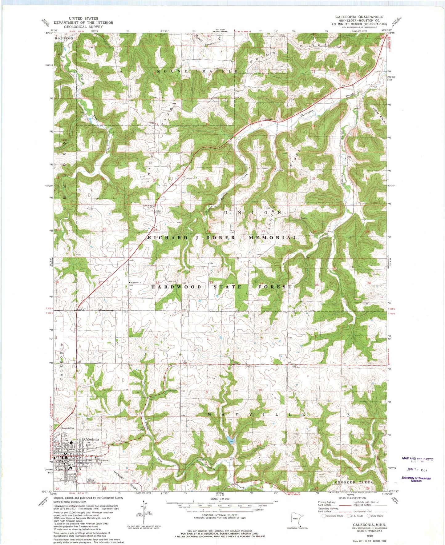
Classic USGS Caledonia Minnesota 7.5'x7.5' Topo Map
Couldn't load pickup availability
Historical USGS topographic quad map of Caledonia in the state of Minnesota. Map scale may vary for some years, but is generally around 1:24,000. Print size is approximately 24" x 27"
This quadrangle is in the following counties: Houston.
The map contains contour lines, roads, rivers, towns, and lakes. Printed on high-quality waterproof paper with UV fade-resistant inks, and shipped rolled.
Contains the following named places: Caledonia, Caledonia Ambulance Service, Caledonia City Hall, Caledonia Fire Department, Caledonia Lutheran Home, Caledonia Mobile Home Park, Caledonia Police Department, Caledonia Post Office, Caledonia Public Library, Calvary Cemetery, Crooked Creek R-2 Dam, Crooked Creek S1-B Dam, Eastside Mobile Home Park, Gazebo Park, German Lutheran Cemetery, Highland Park Estates, Houston County, Houston County Courthouse, Houston County Jail, Houston County Sheriff's Office, Immanuel Lutheran Church, Indian Spring Creek, KKOO-FM (Caledonia), North Park, Peacock Ridge, Pine Estates, R-1 Pool, R-4 Pool, Saint John Evangelical Lutheran Church, Saint John Evangelical Lutheran School, Saint Mary's Catholic School, Saint Mary's Church, Saint Peters Church, Structure R-1 Dam, Sullivan Creek, Township of Mayville, Township of Union, Trinity Episcopal Church Cemetery, Union Ridge, Union Ridge Cemetery, Union Ridge Church, Union Valley Cemetery, United Methodist Church, Veterans Recreation Area, Vineyard Christian Church, ZIP Code: 55921