MyTopo
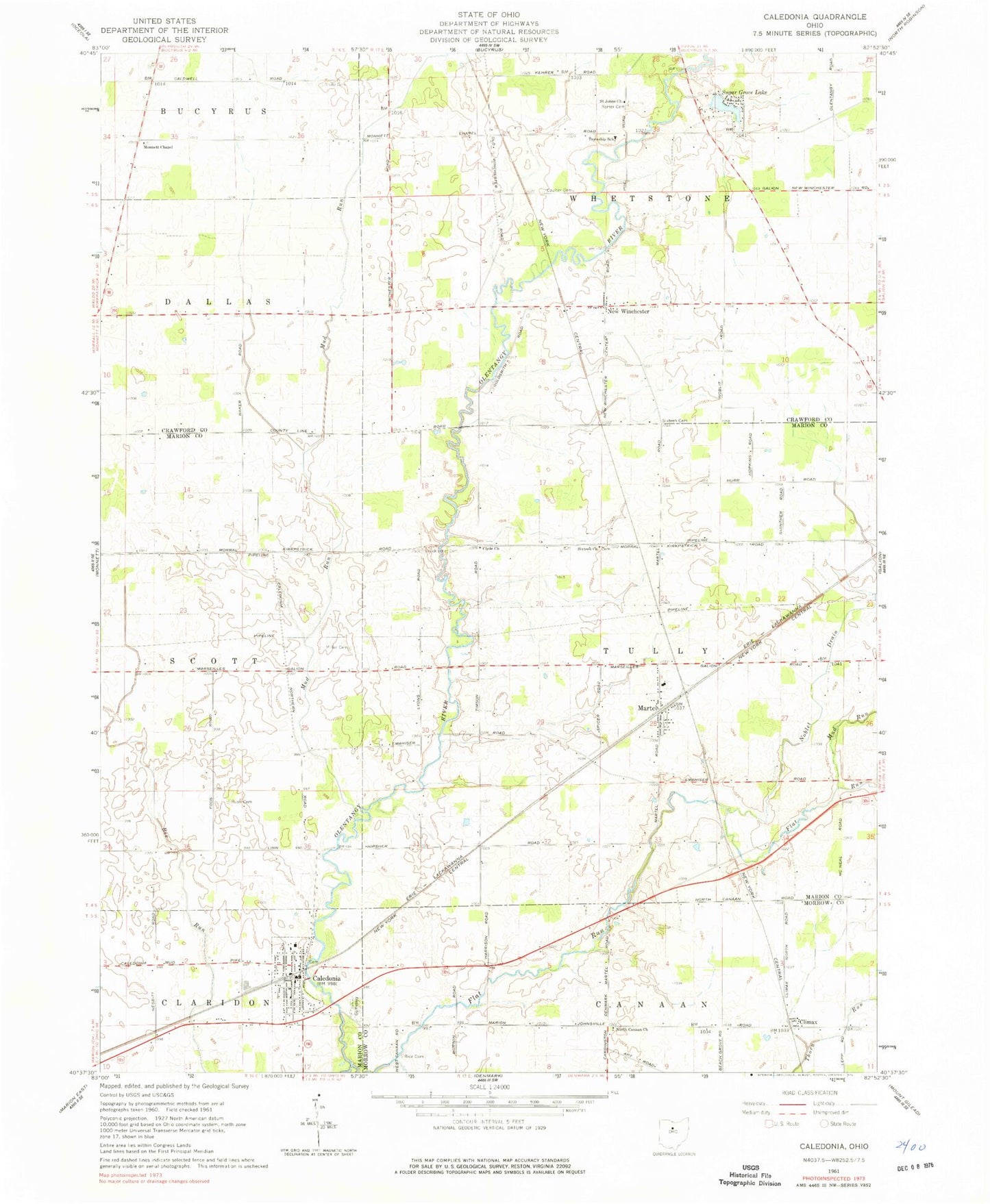
Classic USGS Caledonia Ohio 7.5'x7.5' Topo Map
Couldn't load pickup availability
Historical USGS topographic quad map of Caledonia in the state of Ohio. Map scale may vary for some years, but is generally around 1:24,000. Print size is approximately 24" x 27"
This quadrangle is in the following counties: Crawford, Marion, Morrow.
The map contains contour lines, roads, rivers, towns, and lakes. Printed on high-quality waterproof paper with UV fade-resistant inks, and shipped rolled.
Contains the following named places: Albright School, Brucklacher Cemetery, Bunker Hill School, Caledonia, Caledonia Cemetery, Caledonia Elementary School, Caledonia Graveyard, Caledonia Memorial United Methodist Church, Caledonia Police Department, Caledonia Post Office, Church of Christ in Caledonia, Climax, Climx Post Office, Clyde Church, Cohan School, Coulter Cemetery, Craner School, Douce School, First Consolidated Fire District Station, Flat Run, Hipscher School, Hog Swamp School, Huntly School, Lee School, Maple Grove School, Martel, Martel United Methodist Church, Mellott Cemetery, Miller Cemetery, Monnett Chapel, Monnett Chapel Cemetery, Mud Run, Neff Cemetery, New Winchester, New Winchester Golf Course, New Winchester Post Office, Noblet Drain, North Canaan School, Remer Cemetery, Rice Cemetery, Rush Cemetery, Saint Johns Church, School Number 8, Sixteen Cemetery, Sixteen Church, Sixteen School, Stoltz Cemetery, Stringtown, Stringtown School, Sugar Grove Lake, Sugar Grove Lake Dam, Thorn Run, Township of Tully, Village of Caledonia, Whetstone Elementary School, Whetstone Township Fire Department Station 1, ZIP Code: 43314