MyTopo
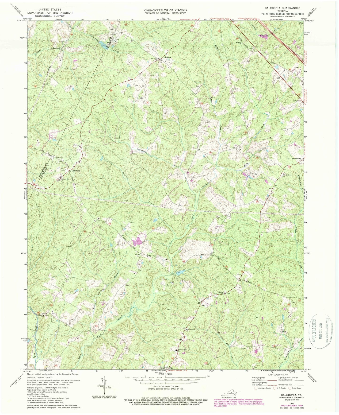
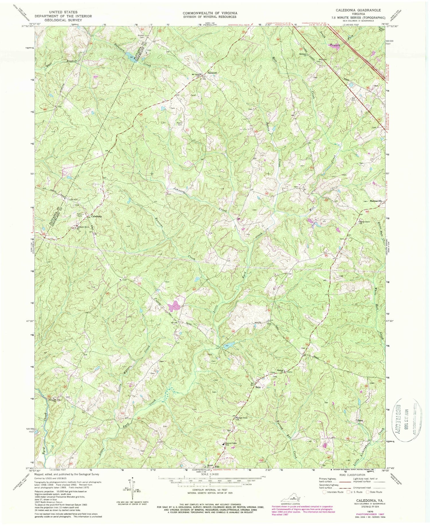
Classic USGS Caledonia Virginia 7.5'x7.5' Topo Map
Couldn't load pickup availability
Historical USGS topographic quad map of Caledonia in the state of Virginia. Map scale may vary for some years, but is generally around 1:24,000. Print size is approximately 24" x 27"
This quadrangle is in the following counties: Fluvanna, Goochland, Louisa.
The map contains contour lines, roads, rivers, towns, and lakes. Printed on high-quality waterproof paper with UV fade-resistant inks, and shipped rolled.
Contains the following named places: Bethany Church, Bonneys Dam, Bonneys Pond, Bowles Cemetery, Bowles Dam, Bowles Pond, Bula, Byrd Creek Airport, Byrd Elementary School, Caledonia, Chimney Springs, District 1, Enon, Forest Grove Church, Georges Landing, Hidden Acres, Horsepen Creek, Johnson Creek, Little Byrd Creek Community House, Little White Creek, Little Whittle Creek, Mayo-Alexander and Hadens Dam, Mill Creek, Mispah Church, Mount Gilead Church, Payne Cemetery, Perkins Church, Peters Creek, Pleasant Grove Church, Ransome Creek, Rattlesnake Run, Rising Mount Zion Baptist Church, Royal Oaks Estates, Second Union Church, Shannon Hills Farms, Tabscott, Tabscott East, Windsor Park, Windsor Park Lake Dam