MyTopo
Classic USGS Calf Ranch Mountain Oregon 7.5'x7.5' Topo Map
Couldn't load pickup availability
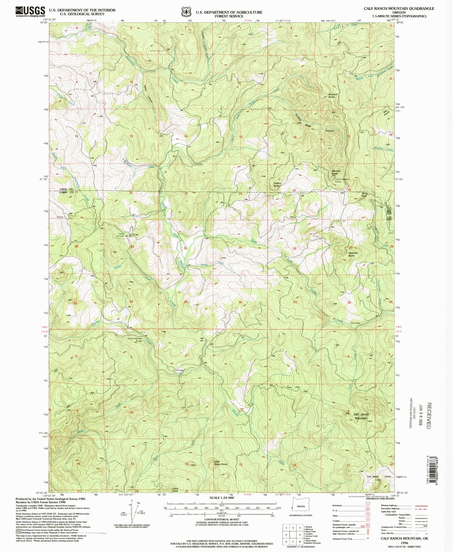
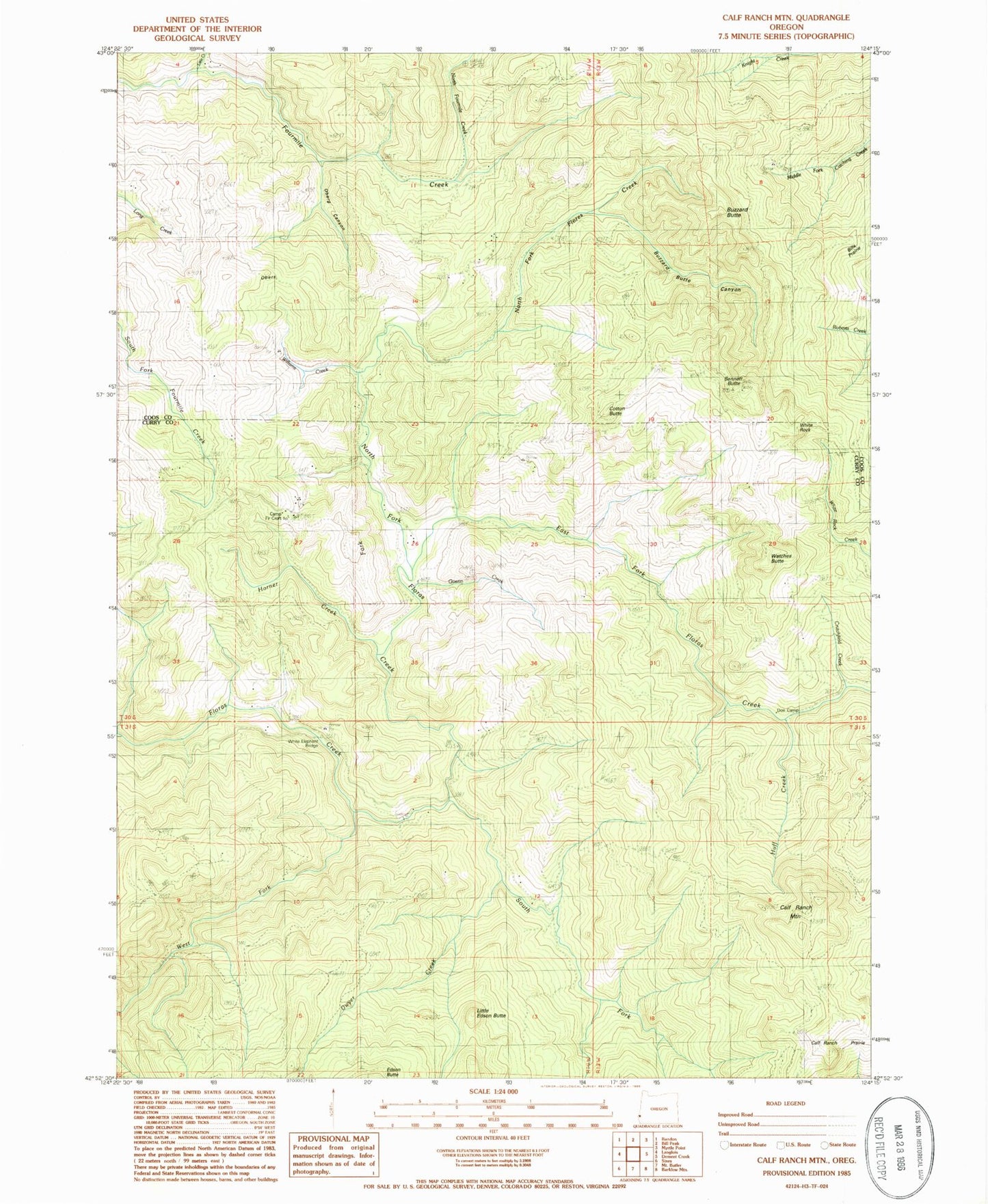
Historical USGS topographic quad map of Calf Ranch Mountain in the state of Oregon. Map scale may vary for some years, but is generally around 1:24,000. Print size is approximately 24" x 27"
This quadrangle is in the following counties: Coos, Curry.
The map contains contour lines, roads, rivers, towns, and lakes. Printed on high-quality waterproof paper with UV fade-resistant inks, and shipped rolled.
Contains the following named places: Bennett Butte, Bennett Post Office, Buzzard Butte, Buzzard Butte Canyon, Calf Ranch Mountain, Calf Ranch Prairie, Camp Fir Croft, Cotton Butte, Crutchfield Creek, Doe Camp, Dwyer Creek, East Fork Floras Creek, Guerin Creek, Hare, Hare Post Office, Horner Creek, Huff Creek, Little Creek, Little Edson Butte, North Fork Floras Creek, North Fourmile Creek, Oberg Canyon, Ocean View Cemetery, Okietown, South Fork Floras Creek, Triangle Post Office, Watches Butte, West Fork Floras Creek, White Elephant Bridge, White Rock, Williams Creek