MyTopo
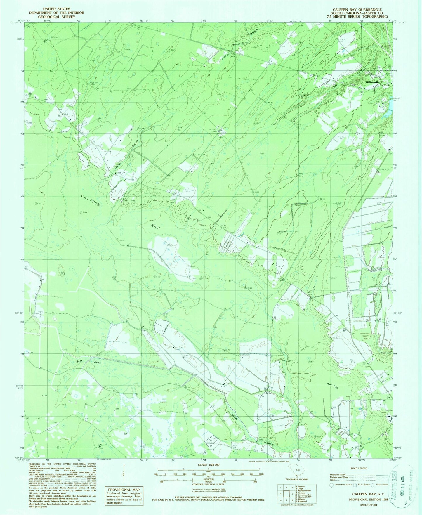
Classic USGS Calfpen Bay South Carolina 7.5'x7.5' Topo Map
Couldn't load pickup availability
Historical USGS topographic quad map of Calfpen Bay in the state of South Carolina. Map scale may vary for some years, but is generally around 1:24,000. Print size is approximately 24" x 27"
This quadrangle is in the following counties: Jasper.
The map contains contour lines, roads, rivers, towns, and lakes. Printed on high-quality waterproof paper with UV fade-resistant inks, and shipped rolled.
Contains the following named places: Bay Swamp, Beaverdam Branch, Buck Drive, Calfpen Bay, Cypress Ridge Business Park, Cypress Woods Plantation Dam D-2582, Gillison Branch, Gillison Branch Baptist Church, Gillisonville, Gillisonville Census Designated Place, Grays-Tillman Division, Little Rock Church, Liveoak School, Nazarene Church, Nazarene School, Pilot Hunting Club, Pine Savannah Branch, Poli Bay, Savannah Branch, South Carolina Noname 27002 D-2585 Dam, South Carolina Noname 27003 D-2584 Dam, South Carolina Noname 27004 D-2583 Dam, Thompsons Pond Dam D-2586, ZIP Code: 29934