MyTopo
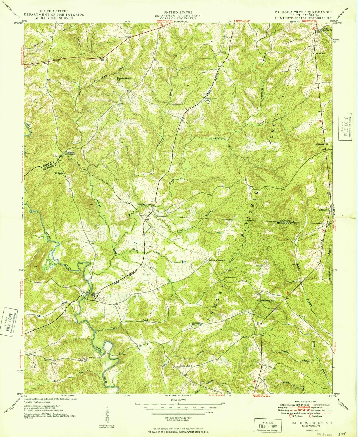
Classic USGS Calhoun Creek South Carolina 7.5'x7.5' Topo Map
Couldn't load pickup availability
Historical USGS topographic quad map of Calhoun Creek in the state of South Carolina. Map scale may vary for some years, but is generally around 1:24,000. Print size is approximately 24" x 27"
This quadrangle is in the following counties: Abbeville, McCormick.
The map contains contour lines, roads, rivers, towns, and lakes. Printed on high-quality waterproof paper with UV fade-resistant inks, and shipped rolled.
Contains the following named places: Abbeville County Fire Department Bethiah, Belcher Crossroads, Bell Creek, Bethea School, Bethel, Bethel Methodist Church, Bethel School, Bethiah, Bethiah Cemetery, Bethiah Presbyterian Church, Bold Branch School, Bowie Branch, Calhoun Cemetery, Calhoun Creek, Calhoun Mill, Candys Chapel, Charleston Crossroads, Hammond Branch, Hartzog Branch, Hillbern Creek, Hopewell Baptist Church, Hopewell Cemetery, Horton Branch, Jim Knox Branch, Lebanon Cemetery, Lebanon Presbyterian Church, Lee Creek, Lott Creek, Mars Bridge, Morrah Branch, Mountain Church, Mulberry Church, Mulberry School, Oak Grove Church, Pleasant Grove School, Rock Buffalo Church, Saint Marys Church, Saint Marys School, Saint Paul Church, Saint Pauls School, Sawney Creek, Sumter National Forest, Tanyard Branch, Walnut Grove Church, Walnut Grove School, White Creek