MyTopo
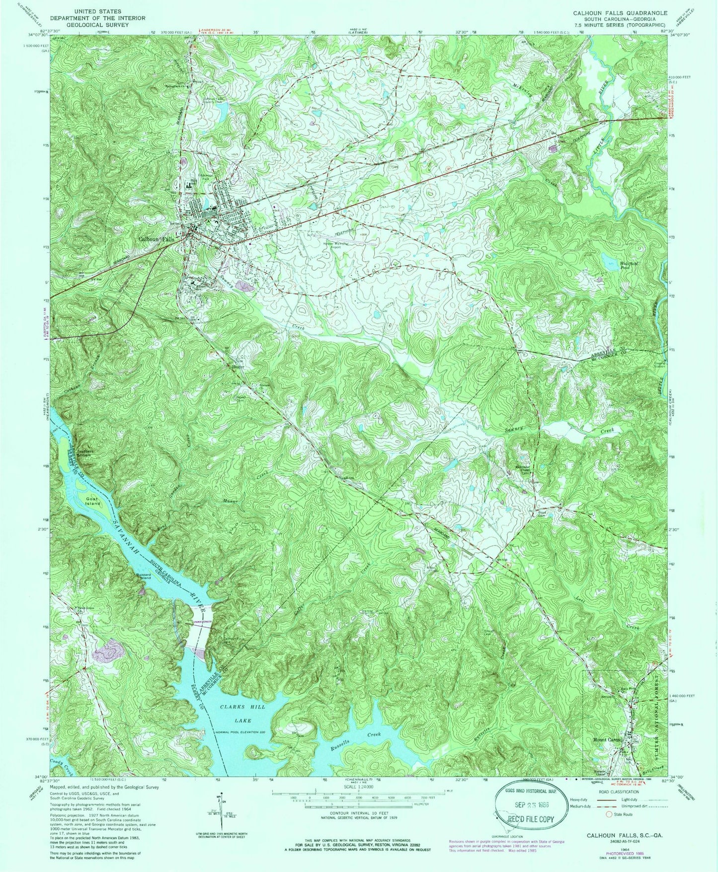
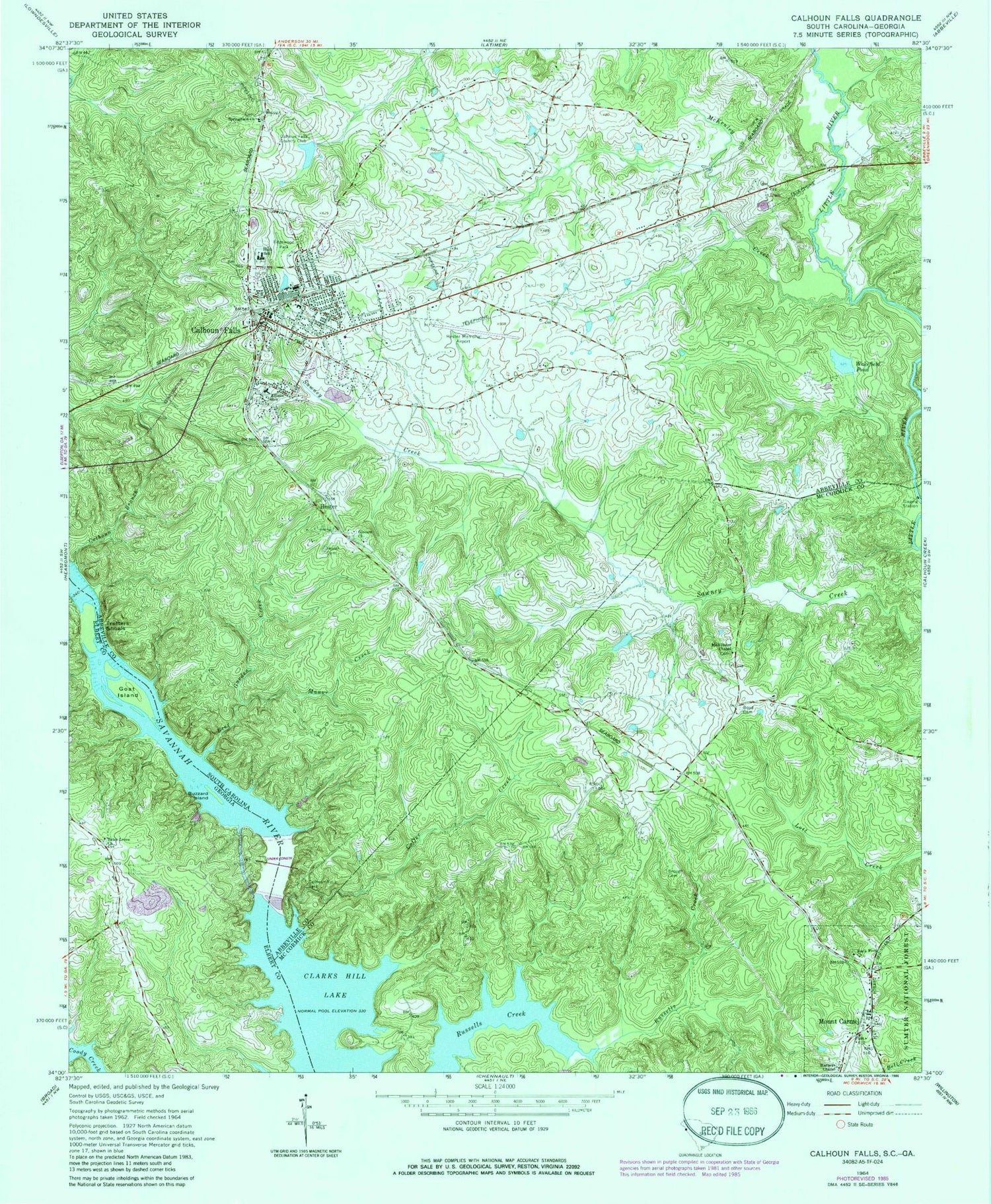
Classic USGS Calhoun Falls South Carolina 7.5'x7.5' Topo Map
Couldn't load pickup availability
Historical USGS topographic quad map of Calhoun Falls in the states of South Carolina, Georgia. Map scale may vary for some years, but is generally around 1:24,000. Print size is approximately 24" x 27"
This quadrangle is in the following counties: Abbeville, Elbert, McCormick.
The map contains contour lines, roads, rivers, towns, and lakes. Printed on high-quality waterproof paper with UV fade-resistant inks, and shipped rolled.
Contains the following named places: Beer Garden Creek, Boyd Cemetery, Boyds Chapel School, Brough Cemetery, Burnt House School, Buzzard Island, Calhoun Branch, Calhoun Falls, Calhoun Falls Church of God, Calhoun Falls Country Club, Calhoun Falls Country Club Lake, Calhoun Falls Fire Department, Calhoun Falls High School, Calhoun Falls Park, Calhoun Falls Police Department, Calhoun Falls United Methodist Church, Calhoun Ferry, Chesnut Hill, Church of God of Prophecy, Coffer Creek, Dresden, Edgewood Park, Ellison School, First Baptist Church, Glovers Church, Goat Island, Harpers Chapel, Hester, Hester Cemetery, Hester Memorial Airport, John C Calhoun Elementary School, Lake Forrest, Lake Forrest Subdivision Dam, Little River Volunteer Fire Department, Manor Creek, McAllister Chapel, McKenley Creek, Mount Carmel, Mount Carmel Cemetery, Mount Carmel Census Designated Place, Mount Carmel Historic District, Mount Olive Holiness Church of God, Northside Baptist Church, Petersburg School, Reileys School, Richard B Russell Dam, Rock Ford Church, Sherard Lake, Smith Store, South Carolina Noname 01004 D-3035 Dam, South Carolina Noname 01005 D-3034 Dam, Springfield Baptist Church, Tates Grove Baptist Cemetery, Tates Grove Church, Town of Calhoun Falls, Trotters Shoals, Wakefield Pond, ZIP Codes: 29628, 29840