
MyTopo
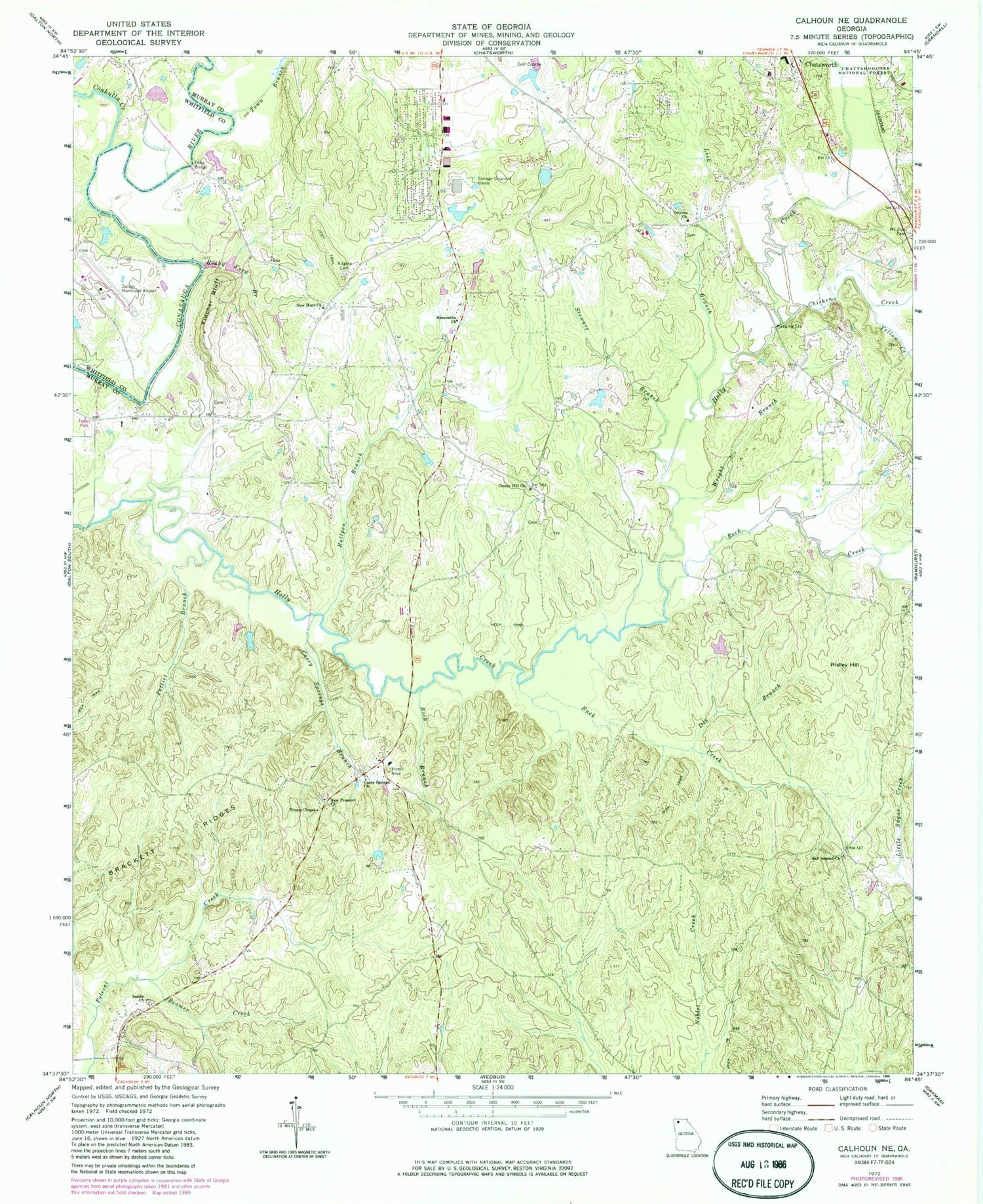
Classic USGS Calhoun NE Georgia 7.5'x7.5' Topo Map
Couldn't load pickup availability
Historical USGS topographic quad map of Calhoun NE in the state of Georgia. Map scale may vary for some years, but is generally around 1:24,000. Print size is approximately 24" x 27"
This quadrangle is in the following counties: Murray, Whitfield.
The map contains contour lines, roads, rivers, towns, and lakes. Printed on high-quality waterproof paper with UV fade-resistant inks, and shipped rolled.
Contains the following named places: Ball Ground, Ball Ground Church, Beamer Creek, Brindle Lake, Brindle Lake Dam, Browns Bridge, Buck Creek, Bullpen Branch, Casey Springs Branch, Casey Springs Church, Casey Springs Division, Casey Springs School, Center Hill Church, Center Hill School, Chatsworth Christian Academy, Chicken Creek, Coahulla Creek, Cochran Cemetery, Connally Cemetery, Dalton Municipal Airport, Doe Branch, Fincher Bluff, Holley, Hooker School, Kanaanland Christian School, Kilgore Cemetery, Lick Branch, Lower Oak Grove School, Macedonia Church, Maranatha Church, Mashburn Lake East, Mashburn Lake East Dam, Mashburn Lake West, Mount Zion Cemetery, Murray County Fire Department Station 5, Nashburn Lake West Dam, New Hope Church, New Prospect Baptist Church Cemetery, New Prospect Church, Oakland School, Old Fashion Baptist Church, Osborn Cemetery, Pettiet Branch, Ridley Hill, Rock Branch, Rock Creek, Rocky Ford Branch, Sardis Cemetery, Sardis Church, Smoke Ford, Smyrna Church, Stewart Branch, Sugar Creek School, Tibbs Bridge, Timms Chapel, Town Branch, Wagnon Cemetery, Wells, Williams Cemetery, Wright Branch, Yellow Creek


