MyTopo
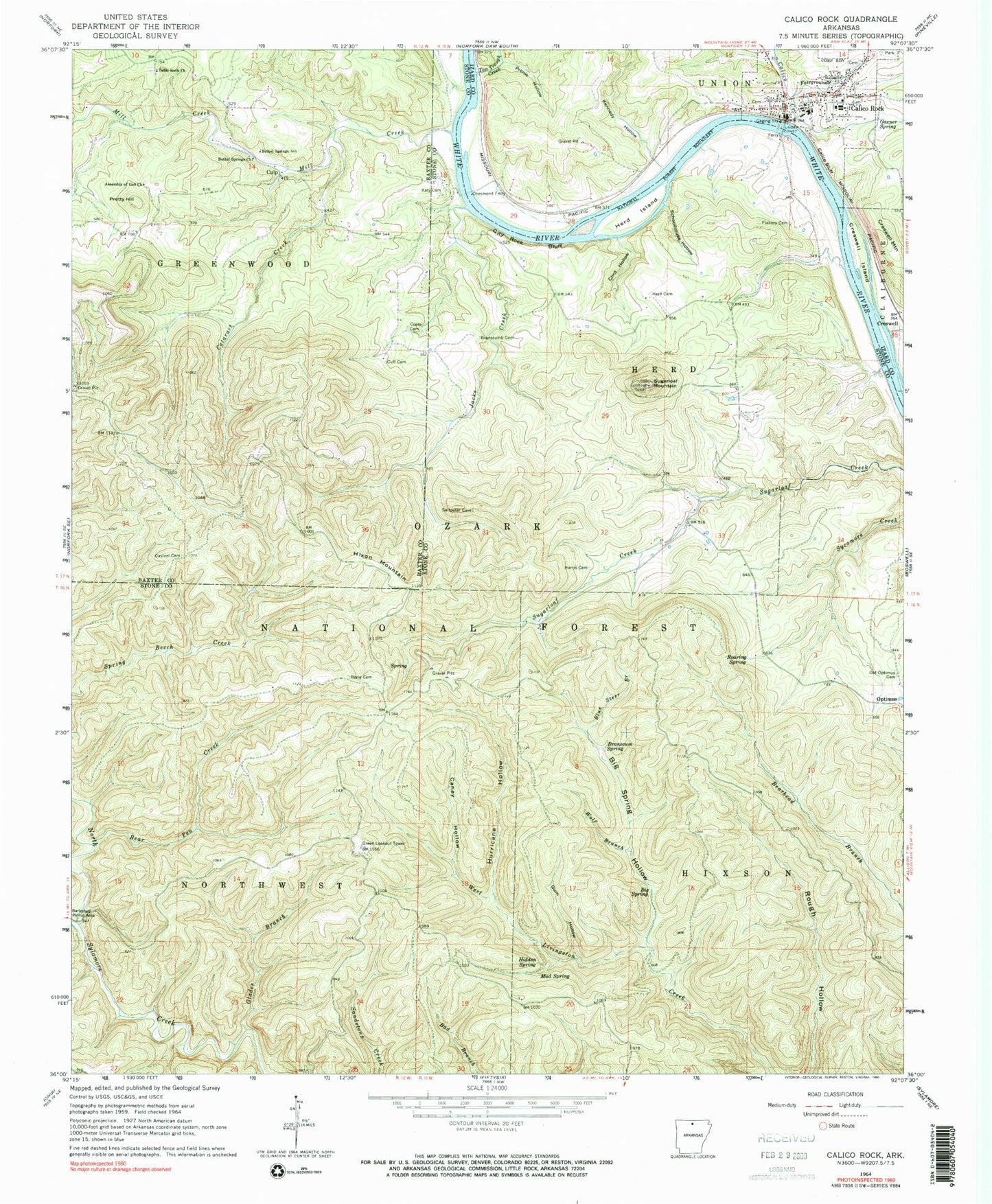
Classic USGS Calico Rock Arkansas 7.5'x7.5' Topo Map
Couldn't load pickup availability
Historical USGS topographic quad map of Calico Rock in the state of Arkansas. Typical map scale is 1:24,000, but may vary for certain years, if available. Print size: 24" x 27"
This quadrangle is in the following counties: Baxter, Izard, Stone.
The map contains contour lines, roads, rivers, towns, and lakes. Printed on high-quality waterproof paper with UV fade-resistant inks, and shipped rolled.
Contains the following named places: Boyle (historical), Calico Rock Elementary School, Calico Rock High School, Calico Rock Historic District, Roselawn Cemetery, Assembly of God Church, Casteel (historical), Table Rock Cemetery, Township of Herd (historical), Township of Hixson (historical), Bear Pen Creek, Bethel Springs Church, Bethel Springs School, Big Spring, Big Spring Hollow, Blue Steer Branch, Branscum Spring, Branscumb Cemetery, Calico Bluff, Calico Creek, Caney Hollow, Casteel Cemetery, Cat Creek, Cataract Creek, Chesmond Ferry, City Rock Bluff, Clint Hollow, Coots Cemetery, Creswell Island, Creswell Mountain, Cuff Cemetery, Culp, Flanery Cemetery, Garner Spring, Glades Branch, Gum Hollow, Harris Cemetery, Herd Cemetery, Herd Island, Hidden Spring, Hixon Mountain, Hurricane Hollow, Jacks Creek, Katy Cemetery, Kennedy Hollow, Mill Creek, Mud Spring, Old Optimus Cemetery, Optimus, Picnic Hollow, Pretty Hill, Roaring Spring, Rorie Cemetery, Schoolhouse Hollow, Table Rock Church, Tan Trough Creek, Wolf Branch, Sandstone Hollow Special Interest Area, Slaymore Experimental Forest, City Rock Bluff Special Interest Area, Sylamore Experimental Station, Calico Rock, Fairgrounds Creek, Sugarloaf Mountain, Township of Rorie (historical), Green Lookout Tower, Sugarloaf Mountain Lookout Tower, Township of Optimus