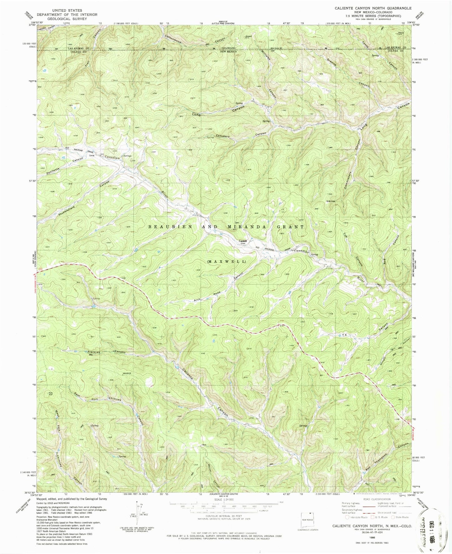
MyTopo
Classic USGS Caliente Canyon North New Mexico 7.5'x7.5' Topo Map
Regular price
$16.95
Regular price
Sale price
$16.95
Unit price
per
Couldn't load pickup availability
Historical USGS topographic quad map of Caliente Canyon North in the state of New Mexico. Map scale may vary for some years, but is generally around 1:24,000. Print size is approximately 24" x 27"
This quadrangle is in the following counties: Colfax, Las Animas.
The map contains contour lines, roads, rivers, towns, and lakes. Printed on high-quality waterproof paper with UV fade-resistant inks, and shipped rolled.
Contains the following named places: Arch Redd Canyon, Armstrong Camp, Bog Canyon, Catskill, Catskill Cemetery, Catskill Post Office, Cemetery Canyon, Commissary Canyon, Frankies Canyon, Granite Canyon, Parsons Ranch, Penitente Canyon, Stubblefield Canyon, Tub Canyon, Williams Canyon