MyTopo
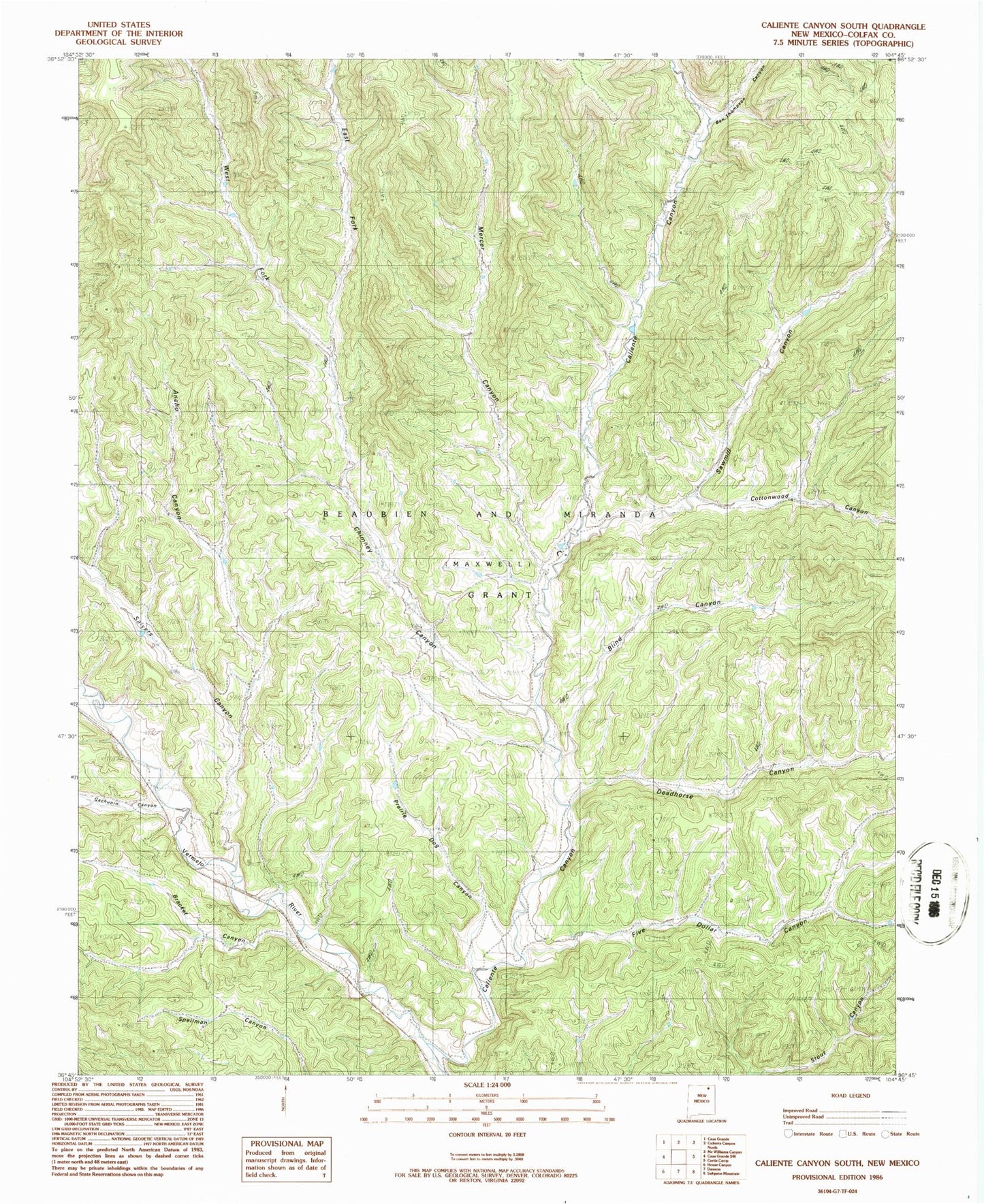
Classic USGS Caliente Canyon South New Mexico 7.5'x7.5' Topo Map
Couldn't load pickup availability
Historical USGS topographic quad map of Caliente Canyon South in the state of New Mexico. Map scale may vary for some years, but is generally around 1:24,000. Print size is approximately 24" x 27"
This quadrangle is in the following counties: Colfax.
The map contains contour lines, roads, rivers, towns, and lakes. Printed on high-quality waterproof paper with UV fade-resistant inks, and shipped rolled.
Contains the following named places: Ancho Canyon, Ben Thompson Canyon, Blind Canyon, Bracket Canyon, Caliente Canyon, Chimney Canyon, Cottonwood Canyon, Deadhorse Canyon, East Fork Chimney Canyon, Five Dollar Canyon, Five Dollar Creek, Gachupin Canyon, Hells Canyon, Horse Ranch Camp, Mercer Canyon, Prairie Dog Canyon, Salyers Canyon, Sawmill Canyon, W S Ranch Camp, West Fork Chimney Canyon