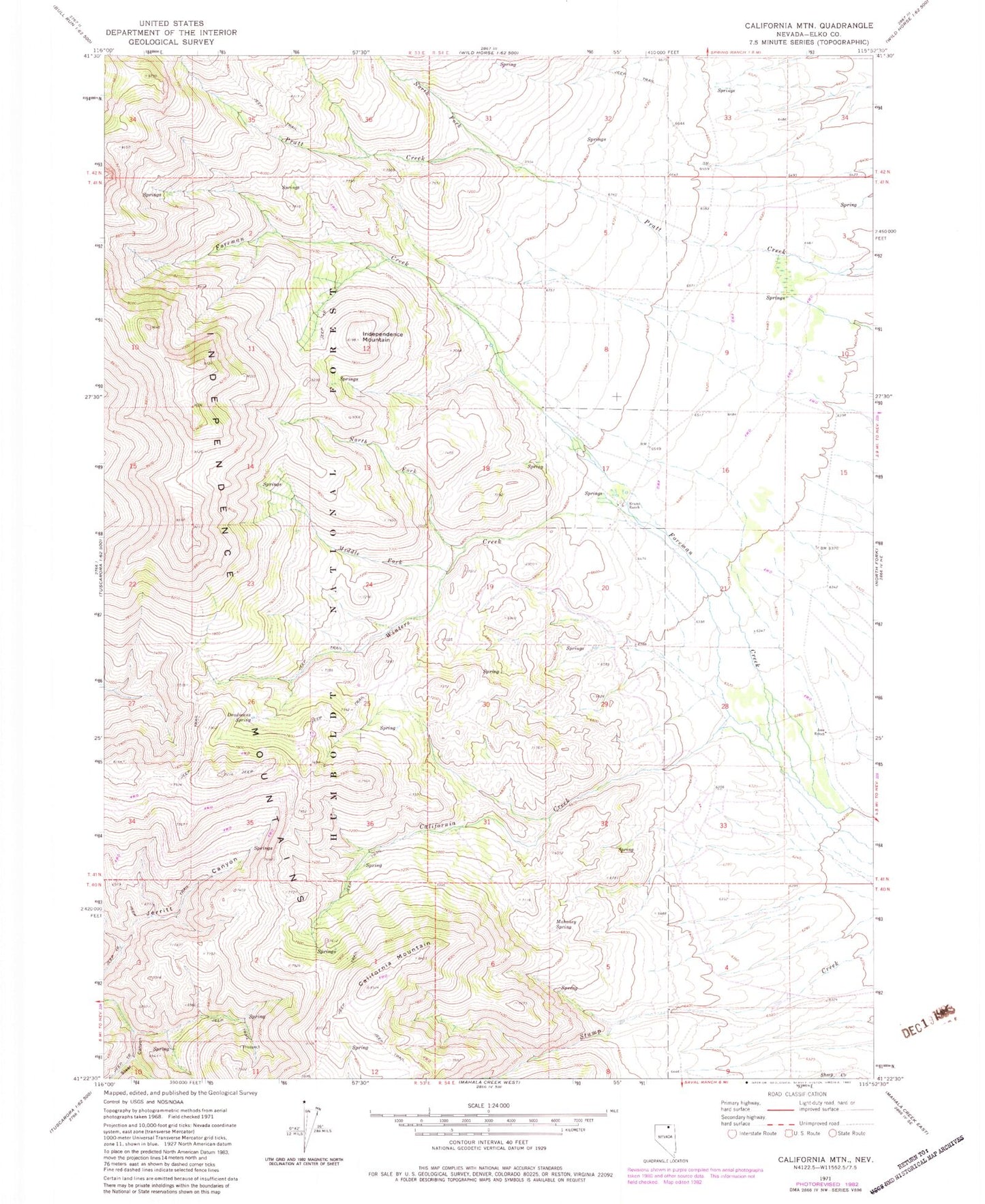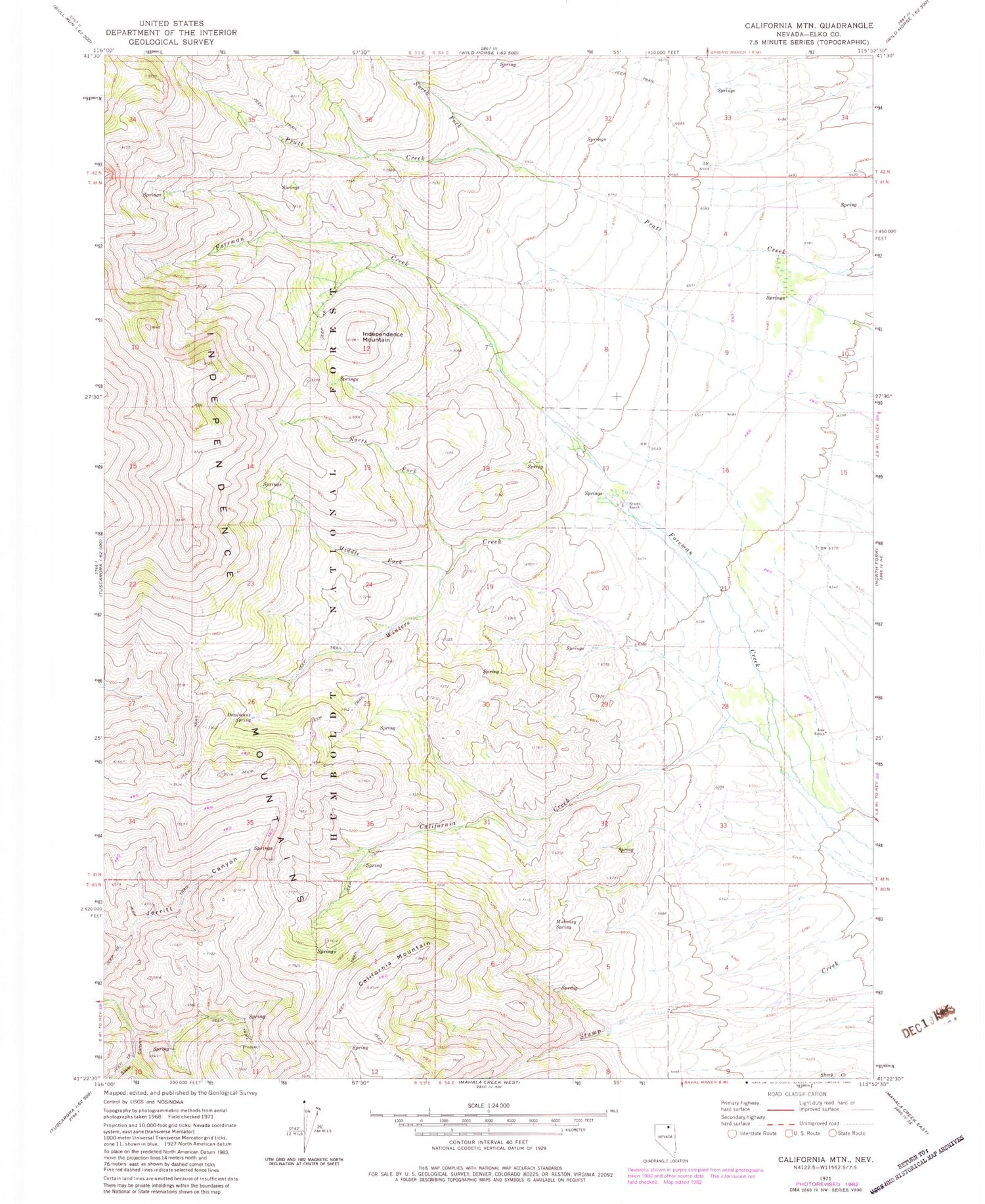
MyTopo
Classic USGS California Mountain Nevada 7.5'x7.5' Topo Map
Couldn't load pickup availability
Historical USGS topographic quad map of California Mountain in the state of Nevada. Map scale may vary for some years, but is generally around 1:24,000. Print size is approximately 24" x 27"
This quadrangle is in the following counties: Elko.
The map contains contour lines, roads, rivers, towns, and lakes. Printed on high-quality waterproof paper with UV fade-resistant inks, and shipped rolled.
Contains the following named places: Arthenice Spring, California Creek, California Mountain, Deadmans Spring, Evans Ranch, Independence Mountain, Jerritt Canyon Mill, Jerritt Canyon Mine, Jerritt Canyon Mine Fire and Emergency Medical Services, Jose Ranch, Mahoney Spring, Middle Fork Winters Creek, North Fork Pratt Creek, North Fork Winters Creek, Steer Canyon, Winters Creek