
MyTopo
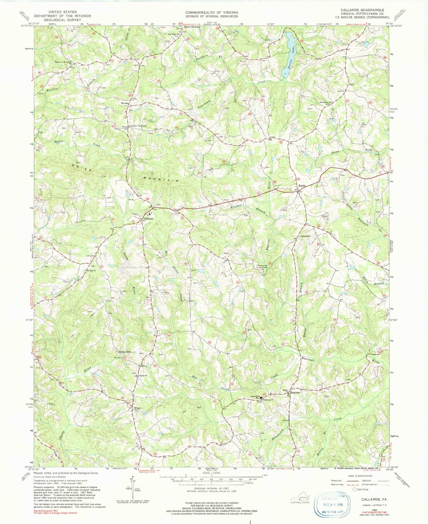
Classic USGS Callands Virginia 7.5'x7.5' Topo Map
Couldn't load pickup availability
Historical USGS topographic quad map of Callands in the state of Virginia. Map scale may vary for some years, but is generally around 1:24,000. Print size is approximately 24" x 27"
This quadrangle is in the following counties: Pittsylvania.
The map contains contour lines, roads, rivers, towns, and lakes. Printed on high-quality waterproof paper with UV fade-resistant inks, and shipped rolled.
Contains the following named places: Aaron Dam, Anderson Dam, Banister, Brier Mountain, Buckhorn Branch, Burton Lake, Callands, Callands Church, Callands Post Office, Callands Volunteer Fire and Rescue Department, Cherrystone Youth Camp, Christian Tabernacle, Gregory Cemetery, Hackberry Church, Hackberry School, High Point School, Hollys Mill, Liberty Church, Macedonia Church, Matthews Memorial Church, Mineola School, Mitchell Branch, Morris Branch, Mount Parris School, Mount Zion Church, Oak Ridge Church, Robins Branch, Rondo, Rondo School, Salem Church, Swansons Mill, Swansonville, Toler School, Tomahawk School, Triangle School, Trinity Church, Trinity School, Union Hall Elementary School, Wet Sleeve Creek, Worlds, ZIP Code: 24530


