MyTopo
Classic USGS Callicoon New York 7.5'x7.5' Topo Map
Couldn't load pickup availability
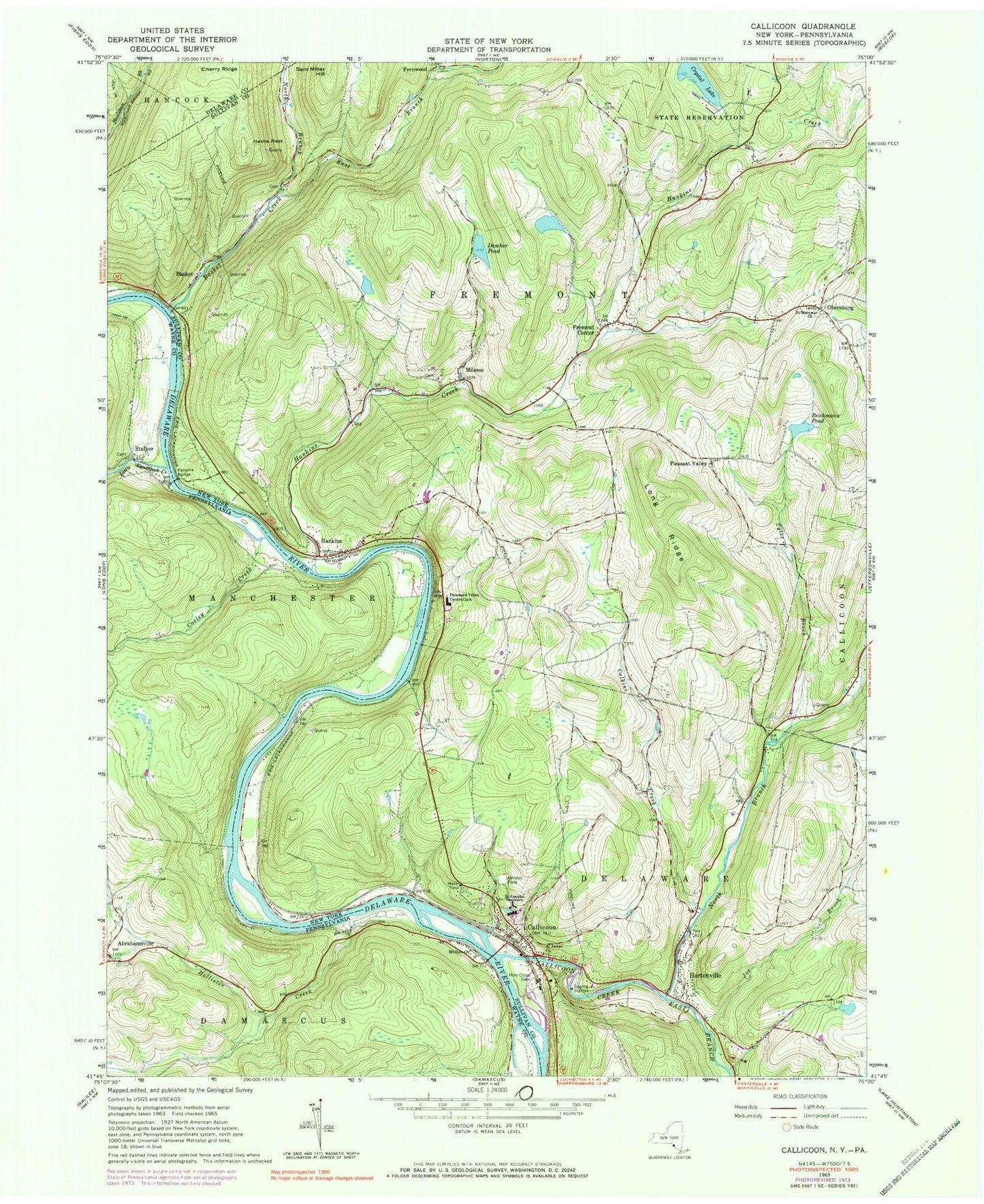
Historical USGS topographic quad map of Callicoon in the states of New York, Pennsylvania. Typical map scale is 1:24,000, but may vary for certain years, if available. Print size: 24" x 27"
This quadrangle is in the following counties: Delaware, Sullivan, Wayne.
The map contains contour lines, roads, rivers, towns, and lakes. Printed on high-quality waterproof paper with UV fade-resistant inks, and shipped rolled.
Contains the following named places: Basket Creek, Calkins Creek, Callicoon, Callicoon Creek, Dascher Pond, Delaware Valley Central School, East Branch Basket Creek, East Branch Callicoon Creek, Fremont Center, Hankins, Hankins Creek, Hawks Nest, Holy Cross Cemetery, Hortonville, Joe Brook, Kellams Bridge, Long Ridge, Mileses, North Branch Basket Creek, North Branch Callicoon Creek, Obernburg, Reichmann Pond, Saint James Church, Saint Josephs Seminary, Saint Marys Church, Tyler Brook, Crystal Lake, Sam Miller Hill, Basket, Fernwood, Pleasant Valley, Town of Delaware, Town of Fremont, Callicoon Census Designated Place, Saint Mary's Cemetery, Basket Cemetery, Hortonville Census Designated Place, Grace Baptist Church, Holy Cross Church, Hortonville Volunteer Fire Company, Hankins - Fremont Volunteer Fire Company 1 Station 2, Hankins - Fremont Fire Department, Obernburg Post Office, Hankins Post Office, Fremont Center Post Office, Hortonville Post Office, Callicoon Post Office, Fremont Center Cemetery, Hankins Census Designated Place, Cooley Creek, Hollister Creek, Kellams Bridge, Little Equinunk Creek, Mount Zion Church, Abrahamsville, Pine Flat School, Cooley School (historical), Stalker