MyTopo
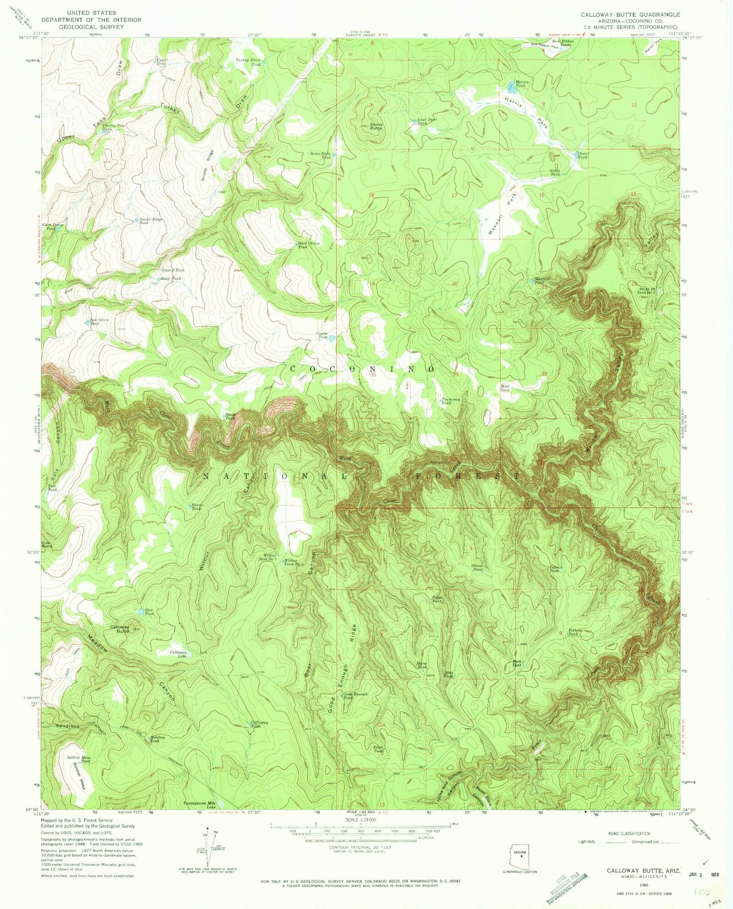
Classic USGS Calloway Butte Arizona 7.5'x7.5' Topo Map
Couldn't load pickup availability
Historical USGS topographic quad map of Calloway Butte in the state of Arizona. Typical map scale is 1:24,000, but may vary for certain years, if available. Print size: 24" x 27"
This quadrangle is in the following counties: Coconino.
The map contains contour lines, roads, rivers, towns, and lakes. Printed on high-quality waterproof paper with UV fade-resistant inks, and shipped rolled.
Contains the following named places: Back Tank, Bear Canyon, Bow Ribbon Park, Bow Ribbon Tanks, Bueno Tank, Calloway Butte, Calloway Lake, Calloway Tank, Cave Draw Tank, Cherry Tree Tank, Clover Creek, Coyote Tank, Dead Horse Tank, Ditch Tank, Dozer Tank, Good Enough Ridge, Good Enough Tank, Harris Park, Harris Tank, Hicks and Duncan Canyon, Horse Tank, Idas Tank, Island Tank, Island Tank, Link Dart Tank, Maxwell Park, Maxwell Tank, Meadow Tank, New Tank, Oak Grove Tank, Pecks Point Tank Number One, Pecks Point Tank Number Three, Pivot Rock Canyon, Point Tank, Pothole Tank, Road Tank, Sams Butte, Sams Butte Tank, Scotts Tank, Snake Ridge, Snake Ridge Tank, Snake Tank, Soldier Mesa, Soldier Mesa Tank, Toms Creek, Toms Tank, Tramway Tank, Tule Tank, Turkey Draw, Turkey Draw Tank, Twentyseven Mile Lake, Upper Tank, West Tank, Wilbur Canyon, Wilbur Tank Number One, Wilbur Tank Number Two, Willow Valley, Bear Tank, Horse Knoll Tank, Jack Pine Tank, Poor Tank, Rock Tank, Toilet Paper Tank, Walker Tank, Sandy Tank, Corral Tank, Juniper Tank, Doghair Tank, Neilson Tank, Orchard Grass Tank, Dukey Tank, Flatrock Tank, Pecks Point Tank Number 3, Between Tank, Dirty Name Tank, Pothole Tank