MyTopo
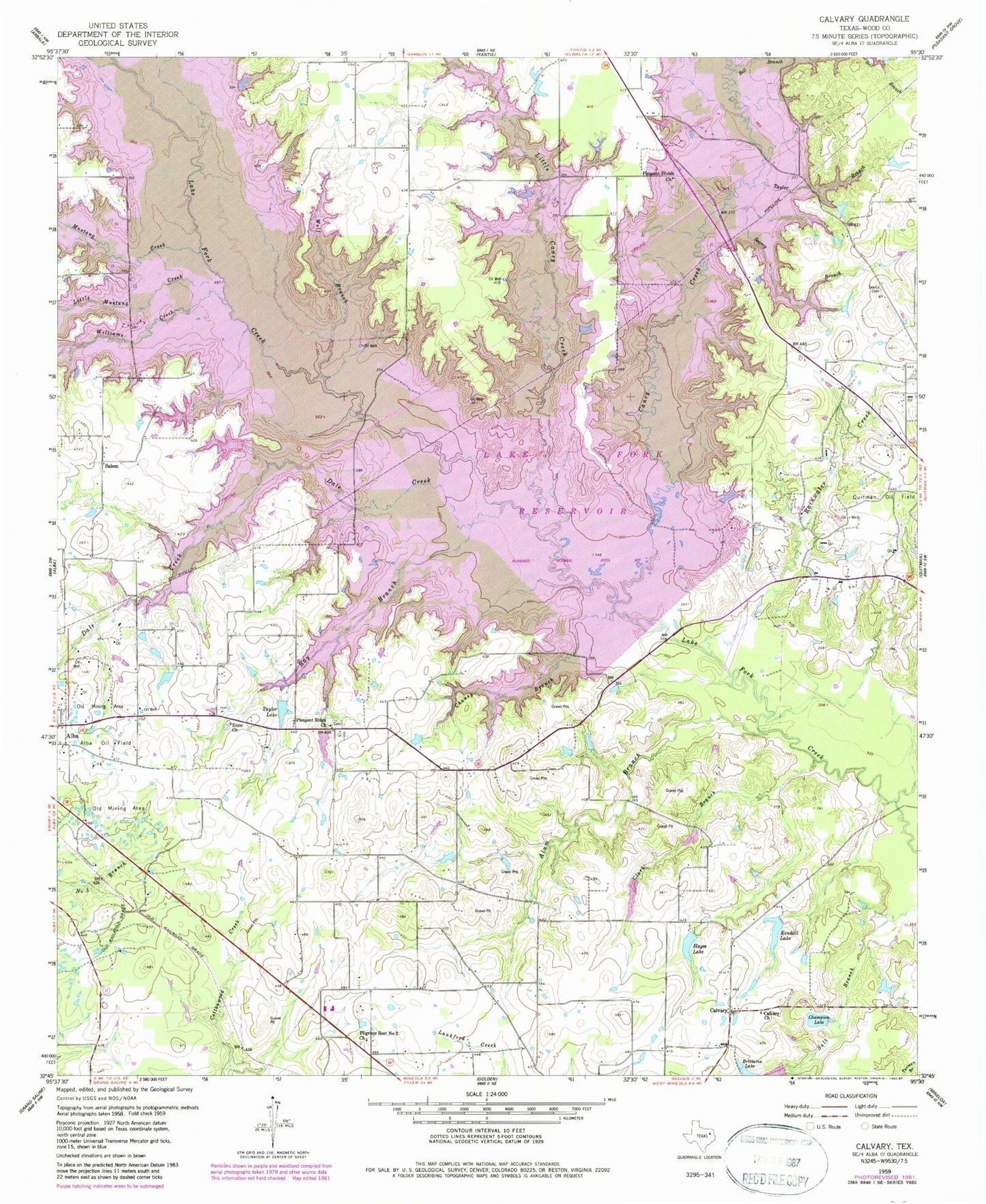
Classic USGS Calvary Texas 7.5'x7.5' Topo Map
Couldn't load pickup availability
Historical USGS topographic quad map of Calvary in the state of Texas. Map scale may vary for some years, but is generally around 1:24,000. Print size is approximately 24" x 27"
This quadrangle is in the following counties: Wood.
The map contains contour lines, roads, rivers, towns, and lakes. Printed on high-quality waterproof paper with UV fade-resistant inks, and shipped rolled.
Contains the following named places: Alba Division, Alba Oil Field, Alum Branch, Bell Branch, Brittain Lake Dam, Calvary, Calvary Church, Caney Creek, Case Lake, Champion Lake, Chaney Branch, Clark Branch, Dale Creek, Enon Church, Fly 1 On Airport, Hayes Lake, Hayes Lake Dam, Kendall Lake, Kindle Lake Dam, KMOO-FM (Mineola), Lake Fork Dam, Lake Fork Reservoir, Lands End Volunteer Fire Department, Little Caney Creek, Little Mustang Creek, Mustang Creek, Pilgrims Rest Number 2 Church, Pleasant Divide Church, Pleasant Ridge Church, Rainwater Creek, Ray Branch, Ring Branch Library, Robinson - Westchase Branch Library, Salem, Searcy Branch, Searcy Cemetery, Spring Branch Library, Taylor Branch, Taylor Lake, The Links at Land's End, Tomball Branch Library, Walter Branch Library, Williams Creek, Wolf Branch