MyTopo
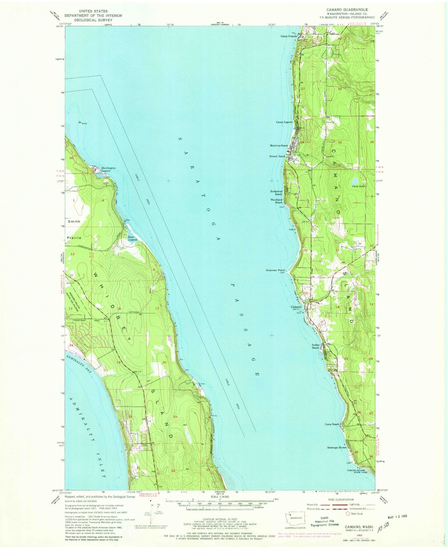
Classic USGS Camano Washington 7.5'x7.5' Topo Map
Couldn't load pickup availability
Historical USGS topographic quad map of Camano in the state of Washington. Map scale may vary for some years, but is generally around 1:24,000. Print size is approximately 24" x 27"
This quadrangle is in the following counties: Island.
The map contains contour lines, roads, rivers, towns, and lakes. Printed on high-quality waterproof paper with UV fade-resistant inks, and shipped rolled.
Contains the following named places: Cama Beach, Camano, Camano Chapel, Camano Island, Camp Grande, Camp Lagoon, Carp Lake, Dry Lake, Gilbertson Pit, Greenbank Sand and Gravel Quarry, Harrington Lagoon, Indian Beach, Island County, Island County Fire District 1 Camano Island Fire and Rescue Station 1 Camano City, Island County Fire District 1 Camano Island Fire and Rescue Station 4 Vista Madrona, Island County Fire District 5 Central Whidbey Island Fire and Rescue Station 52, Island County Fire District 5 Central Whidbey Island Fire and Rescue Station 53 Headquarters, Madrona Beach, Miracle Mine Quarry, North Bluff, Onamac Point, Race Lagoon, Rockaway Beach, Rocky Point Quarry, Saratoga Passage, Saratoga Shores, Stanwood - Camano Yacht Club, Sunset Beach, Woodland Beach, ZIP Code: 98282