MyTopo
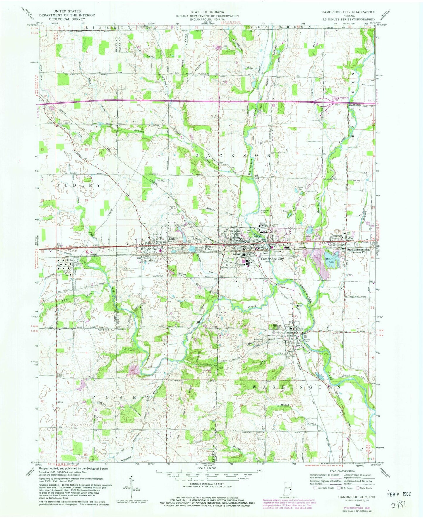
Classic USGS Cambridge City Indiana 7.5'x7.5' Topo Map
Couldn't load pickup availability
Historical USGS topographic quad map of Cambridge City in the state of Indiana. Map scale may vary for some years, but is generally around 1:24,000. Print size is approximately 24" x 27"
This quadrangle is in the following counties: Fayette, Henry, Wayne.
The map contains contour lines, roads, rivers, towns, and lakes. Printed on high-quality waterproof paper with UV fade-resistant inks, and shipped rolled.
Contains the following named places: Auburn Brook, Beard Cemetery, Beard Run, Cambridge City, Cambridge City Pit, Cambridge City Police Department, Cambridge City Post Office, Cambridge City Volunteer Fire Department, Capitol Hill Cemetery, Central Elementary School, City Run, Coon Creek, Crietz Creek, Criotz Park, Davis Rich Ditch, Dry Branch, Dublin, Dublin Elementary School, Dublin Fire and EMS, Dublin Post Office, East Cemetery, East Germantown, Gilbert Ditch, Glue Run, Hi-Way Springs, Horn Creek, Lick Branch, Lincoln High School, Locust Grove Church, Martindale Creek, Milford Friends Cemetery, Milton, Milton Cemetery, Milton Drain, Milton Elementary School, Milton Police Department, Milton Post Office, Milton Washington Township Fire Department, Mount Auburn, Parkway Junior High School, Pershing Elementary School, Pronghorn Run, Riverside Cemetery, Roy Run, Simple Branch, South Lawn Cemetery, South Side Cemetery, Springs Run, Symonds Creek, Symons Creek, Town of Cambridge City, Town of Dublin, Town of East Germantown, Town of Milton, Town of Mount Auburn, Township of Jackson, Township of Posey, We-Hi Lake, Wilson Park, Wilson Run, Zion Church, ZIP Codes: 47327, 47335, 47357