MyTopo
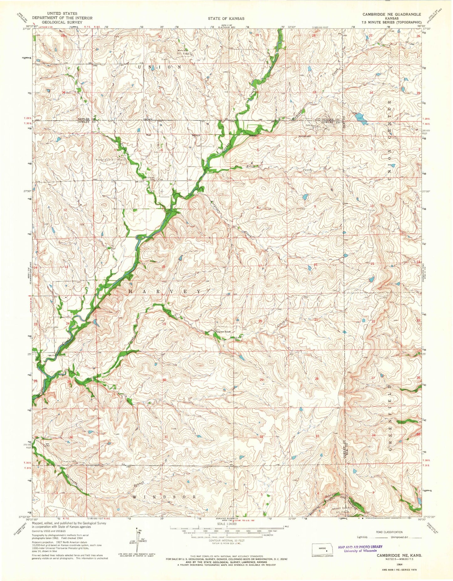
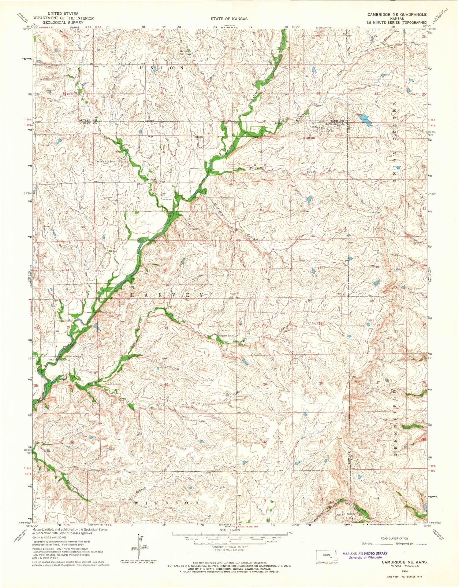
Classic USGS Cambridge NE Kansas 7.5'x7.5' Topo Map
Regular price
$16.95
Regular price
Sale price
$16.95
Unit price
per
Couldn't load pickup availability
Historical USGS topographic quad map of Cambridge NE in the state of Kansas. Map scale may vary for some years, but is generally around 1:24,000. Print size is approximately 24" x 27"
This quadrangle is in the following counties: Butler, Cowley, Elk.
The map contains contour lines, roads, rivers, towns, and lakes. Printed on high-quality waterproof paper with UV fade-resistant inks, and shipped rolled.
Contains the following named places: Dory Oil Field, Ferguson Creek, Ferguson Ranch, Franklin Creek, Glen Crouse, Glen Grouse, Glen Grouse Cemetery, Grand Summit Oil Field, Hannah Oil Field, Mahannah Oil Field, Riley Creek, Township of Harvey, Wagoner Creek, Wehrman Oil Field