MyTopo
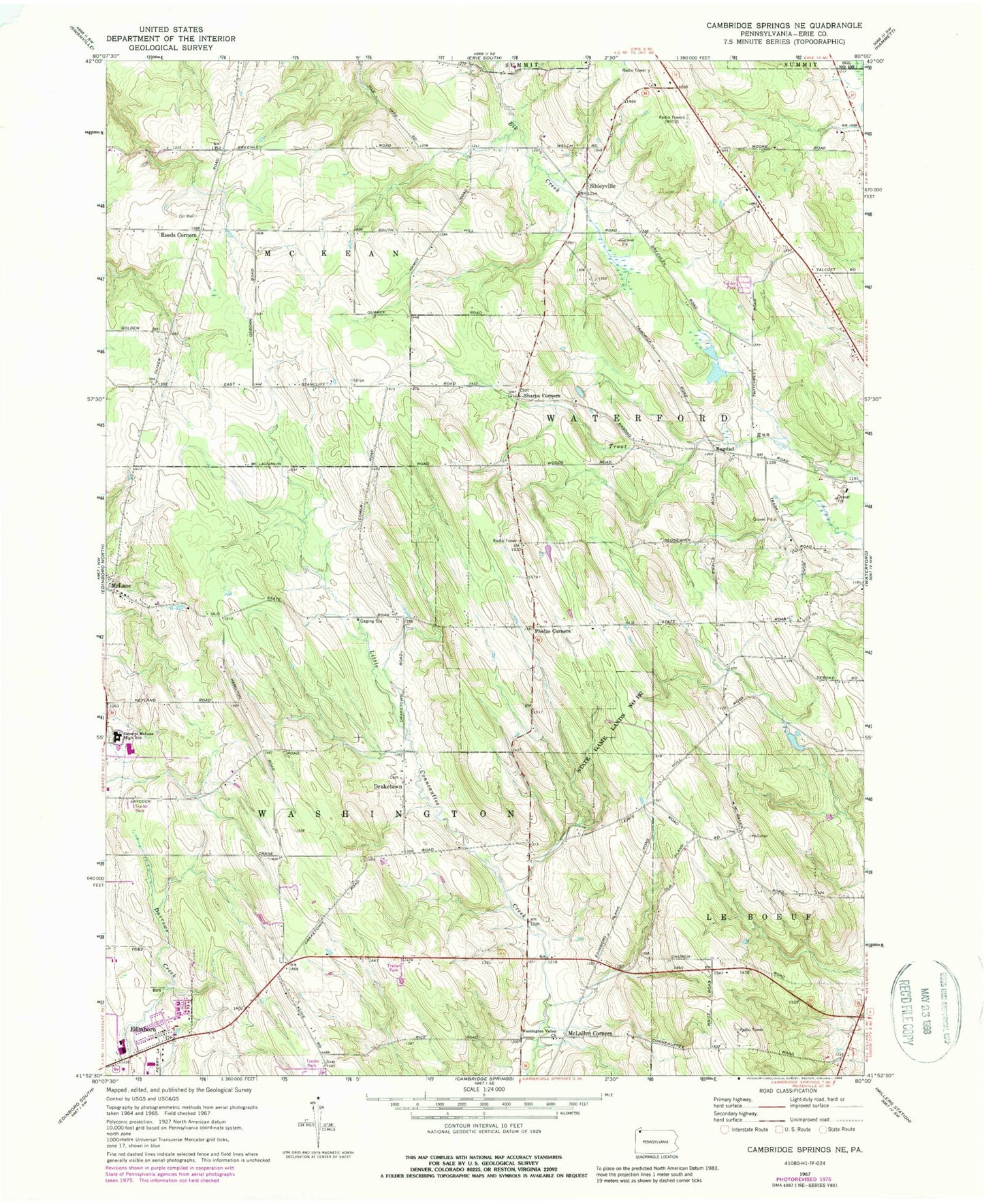
Classic USGS Cambridge Springs NE Pennsylvania 7.5'x7.5' Topo Map
Couldn't load pickup availability
Historical USGS topographic quad map of Cambridge Springs NE in the state of Pennsylvania. Map scale may vary for some years, but is generally around 1:24,000. Print size is approximately 24" x 27"
This quadrangle is in the following counties: Erie.
The map contains contour lines, roads, rivers, towns, and lakes. Printed on high-quality waterproof paper with UV fade-resistant inks, and shipped rolled.
Contains the following named places: Albrecht Farms, Ash School, Aubury School, Bagdad, Black School, Borough of Edinboro, Carlson Airport, Crescent Hill Farms, Draketown, Draketown Cemetery, Edinboro Post Office, Elegeer Farms, Gardner School, General McLane High School, Gleeten School, James W Parker Middle School, Kula Farms, Macon School, McLallen Corners, McLallen Post Office, Phelps Corners, Reeds Corners, Saints Church, Sedgewick School, Sharpes Corners Cemetery, Sharps Corners, Showman Farms, Sibleyville, South Hill Cemetery, South Woods Golf Course, Stancliff School, State Game Lands Number 192, Strong School, Strongs Corners, Township of Washington, Union School, Washington Valley Cemetery, Washington Valley Church, Waterford Cemetery - Old State Road Annex, WRIE-AM (Erie)