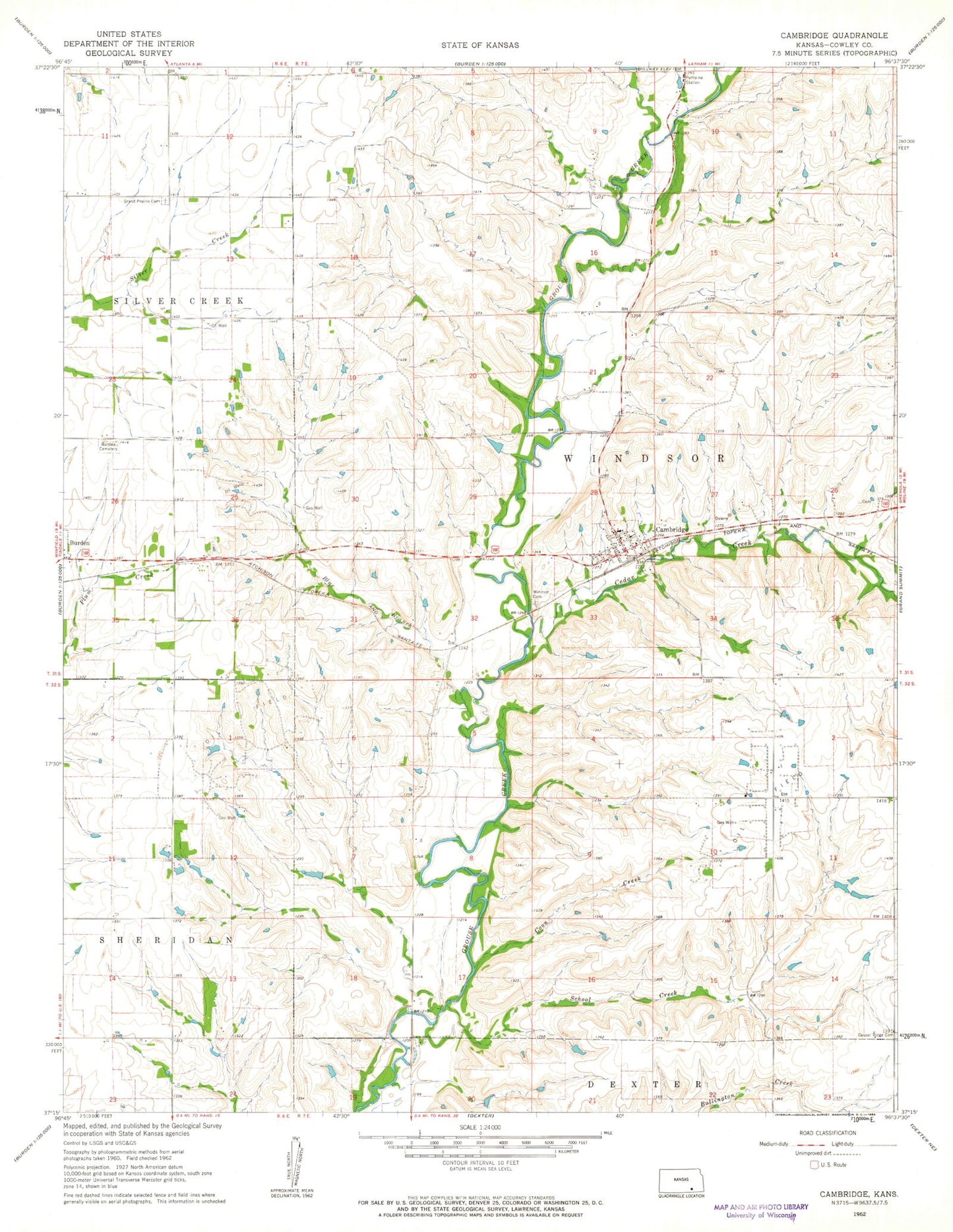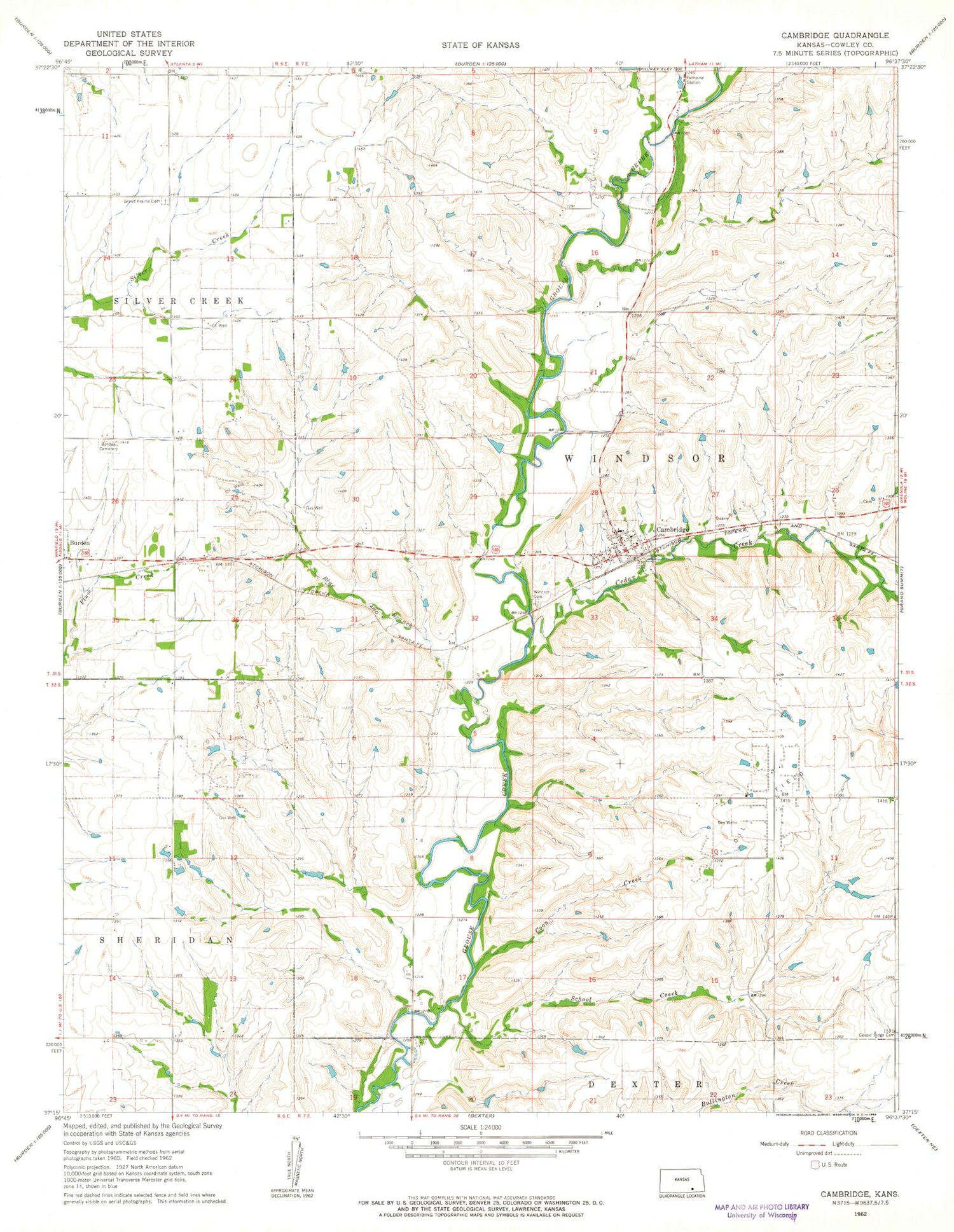
MyTopo
Classic USGS Cambridge Kansas 7.5'x7.5' Topo Map
Couldn't load pickup availability
Historical USGS topographic quad map of Cambridge in the state of Kansas. Map scale may vary for some years, but is generally around 1:24,000. Print size is approximately 24" x 27"
This quadrangle is in the following counties: Cowley.
The map contains contour lines, roads, rivers, towns, and lakes. Printed on high-quality waterproof paper with UV fade-resistant inks, and shipped rolled.
Contains the following named places: Blue Branch, Burden Cemetery, Cambridge, Cambridge Baptist Church, Cambridge Post Office, Cambridge Presbyterian Church, Cambridge Wastewater Plant, Cedar Creek, City of Cambridge, Coon Creek, Cowley County Fire District 8 Cambridge, Flint Hills, Gospel Ridge Cemetery, Grand Prairie Cemetery, Grand Prairie School, School Creek, Shaw School, South Torrance School, Torrance, Windsor Cemetery