MyTopo
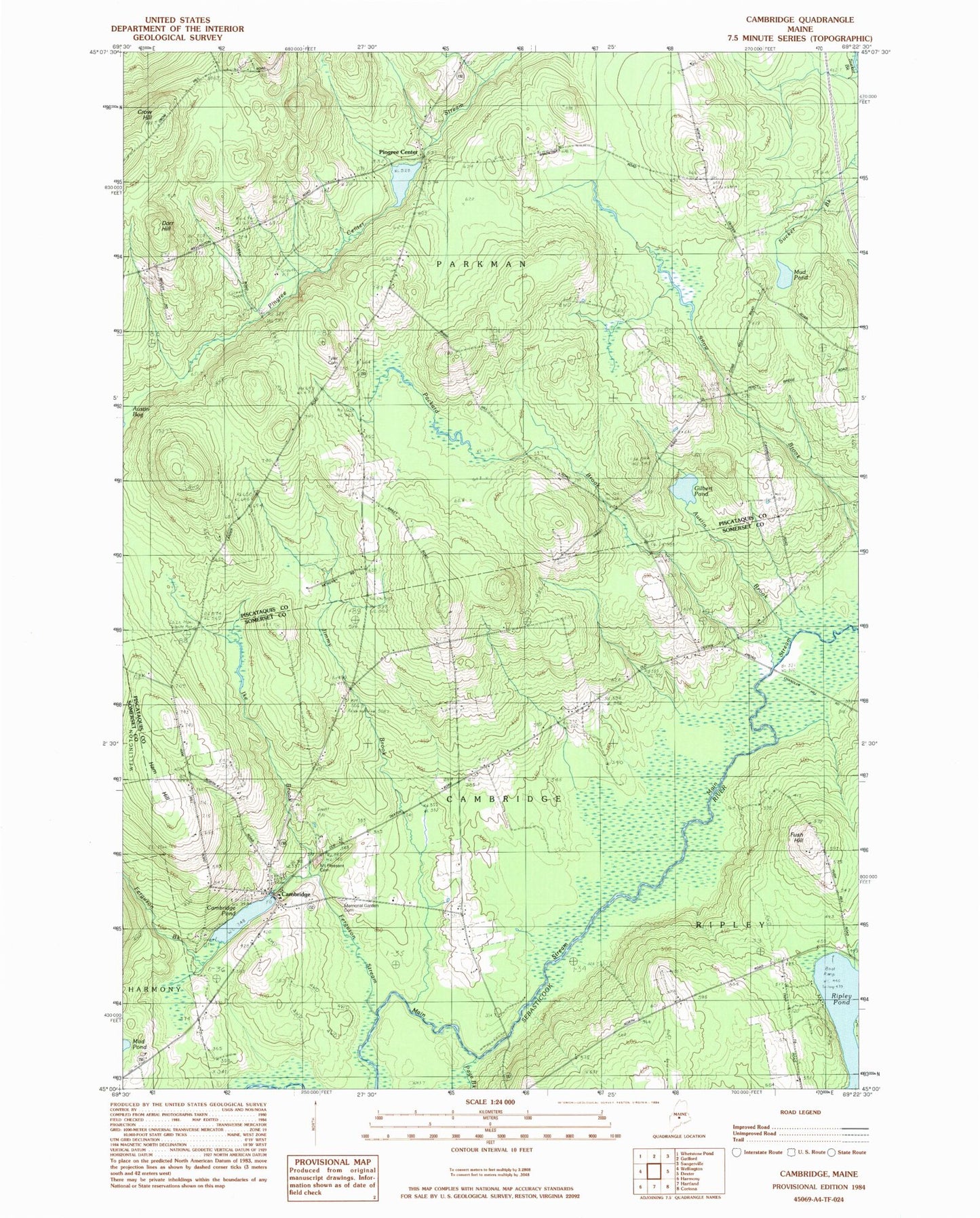
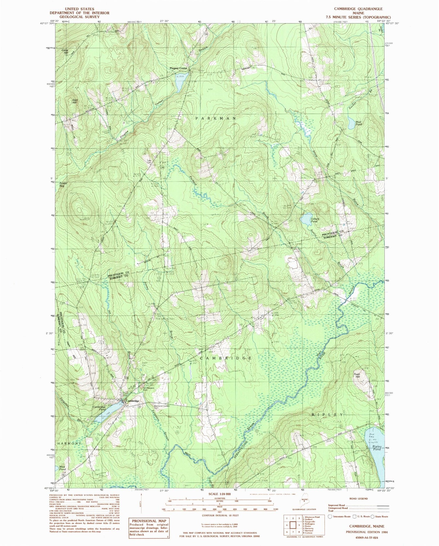
Classic USGS Cambridge Maine 7.5'x7.5' Topo Map
Couldn't load pickup availability
Historical USGS topographic quad map of Cambridge in the state of Maine. Typical map scale is 1:24,000, but may vary for certain years, if available. Print size: 24" x 27"
This quadrangle is in the following counties: Piscataquis, Somerset.
The map contains contour lines, roads, rivers, towns, and lakes. Printed on high-quality waterproof paper with UV fade-resistant inks, and shipped rolled.
Contains the following named places: Austin Brook, Cambridge, Cambridge Flats School, Cambridge Pond, Dorr Hill, Dorr Hill School, Ferguson Brook, Ferguson Stream, Gilbert Pond, Ham Hill, Head of Pond School, Ike Brook, Jimmy Brook, Main Stream Sebasticook River, Manter School, Mount Pleasant Cemetery, Mud Pond, Packard Brook, Page Brook, Ripley Pond, Smart School, Southworth School, Webber School, Town of Parkman, Pingree Center, Greenfield Hill Airport, Town of Cambridge, Town of Ripley, Pingree Dam, Pingree Pond, Cambridge Pond Dam, Cambridge Elementary School, Cambridge Post Office, Fush Hill, Cambridge Memorial Garden, Pingree Cemetery, Cambridge Fire Department, Gilbert Cemetery, Tyler Cemetery