MyTopo
Classic USGS Camden North South Carolina 7.5'x7.5' Topo Map
Couldn't load pickup availability
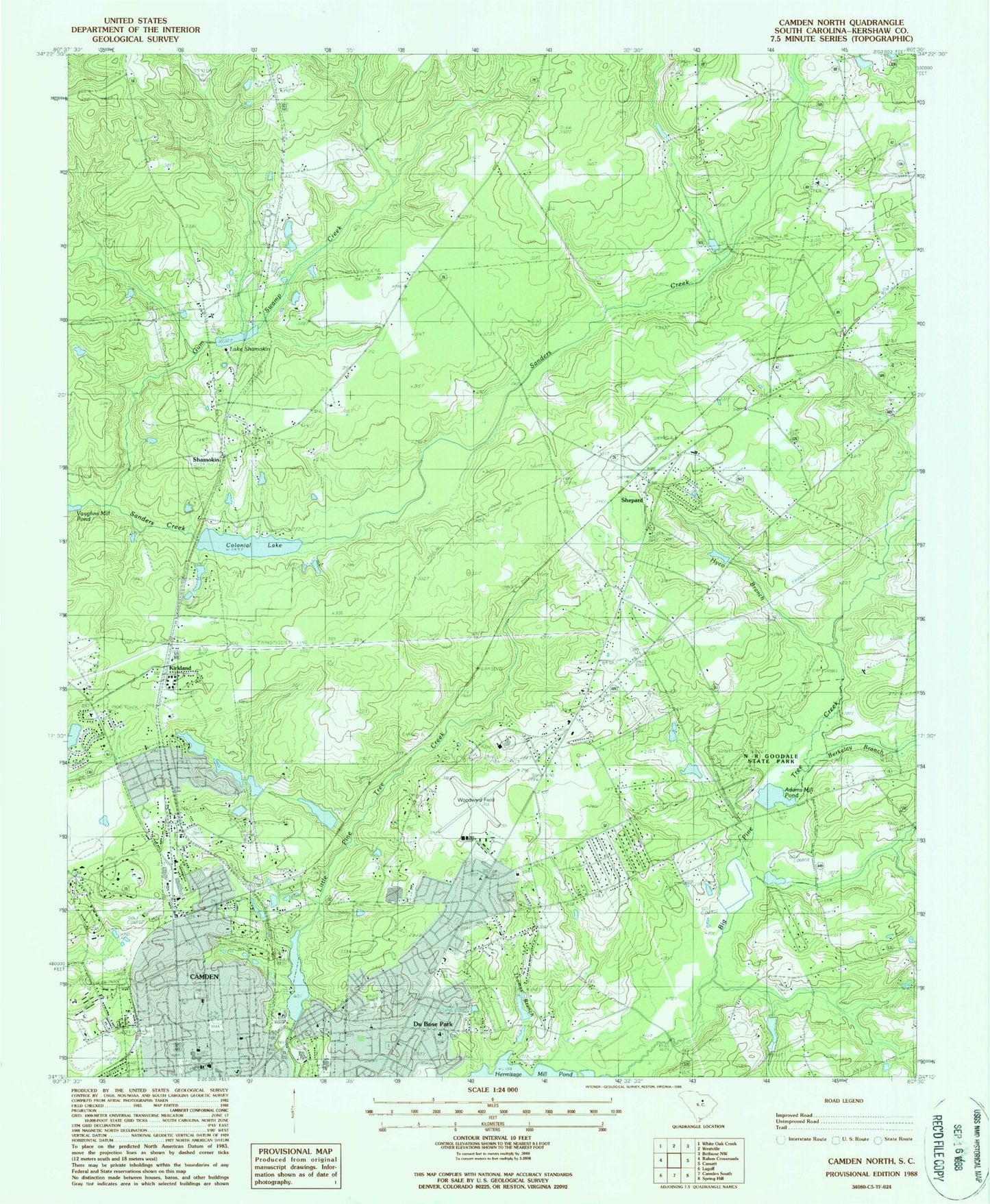
Historical USGS topographic quad map of Camden North in the state of South Carolina. Typical map scale is 1:24,000, but may vary for certain years, if available. Print size: 24" x 27"
This quadrangle is in the following counties: Kershaw.
The map contains contour lines, roads, rivers, towns, and lakes. Printed on high-quality waterproof paper with UV fade-resistant inks, and shipped rolled.
Contains the following named places: Adams Mill Pond, Berkeley Branch, Colonial Lake, Cool Spring Church, Hickman School, Hyco Branch, Joshua School, Kirkland, Malvern Hill School, Shamokin, Thomas Branch, Thoroughfare Branch, Lake Shamokin, Adams Mill (historical), Arrowwood, Bethseda Freewill Baptist Church, Boltons Mill (historical), Boykin Park, Brevards Spring, Camden Archives and Museum Library, Camden Church of God, Camden Country Club, Camden High School, Camden Junior High School, Camden Military Academy, Camden Plaza Shopping Center, Camden Polo Club, Camden Primary School, Childers Mill (historical), Cold Spring, Cool Springs, Cornerstone Baptist Church, Dusty Bend, Edgewood, Fairfax, Forest Heights, Forest Lawn Memorial Park, Grace Episcopal Church, Green Spring, Hillsdale, Hobkirk Hill, Hyco, Hyco Baptist Church, Johnsons Pond, Jumelle Hill, Jumelle Spring, Kendall Mill Historic District, Kershaw County Fairgrounds, Kershaw County Vocational Center, Kershaw Park, Kirkwood, Kirkwood Branch, Lafayette Village, Lakeview Baptist Church, Malvern Hill Baptist Church, McCandless School (historical), Millbank (historical), Monument Park, N R Goodale State Park, North Towne Square Shopping Center, Norris Heights, Our Lady of Perpetual Help Roman Catholic Church, Parkers Church, Peckwoods, Pine Creek, Pine Grove Academy (historical), Pine Tree Hill Elementary School, Race Track Farm (historical), Saint Timothys Lutheran Church, Sanders Creek Baptist Church, Sandy Springs, Spalding (historical), Sweet Home Baptist Church (historical), Tabernacle Church, Valley Park, White Gardens, White Pines Golf Course, Witty School (historical), Log Town (historical), South Carolina Noname 28002 D-1329 Dam, Camden State Park Lake, South Carolina Noname 28003 D-2502 Dam, Kendall Lake Dam, Kendall Lake, South Carolina Noname 28017 D-2501 Dam, South Carolina Noname 28026 D-1322 Dam, Camden Reservoir, South Carolina Noname 28028 D-2527 Dam, Cool Springs Upper Pond, South Carolina Noname 28047 D-2528 Dam, Cool Springs Lower Pond, Sunny Hill Pond Dam Number One D-2523, Sandy Hill Pond Number One, Sinclair Pond Dam D-1328, Sinclairs Pond, Tidwells Pond Dam D-2537, Tidwells Pond, Beaverdam Church, Camden Hospital (historical), Kershaw Health Medical Center, Kershaw County, Shepard, Sweet Home School (historical), Woodward Field, WVEF-AM (Camden), McCrag Mill Pond (historical), Witty Church (historical), Gum Swamp Creek, Camden Division, Camden Northeast Division, City of Camden, Kershaw County Fire Department Shepard Station, Camden Fire Department, Kershaw County Fire Department Flat Rock Station, Finally Farm, Kershaw Health Emergency Medical Services, East Camden, East Camden Census Designated Place