MyTopo
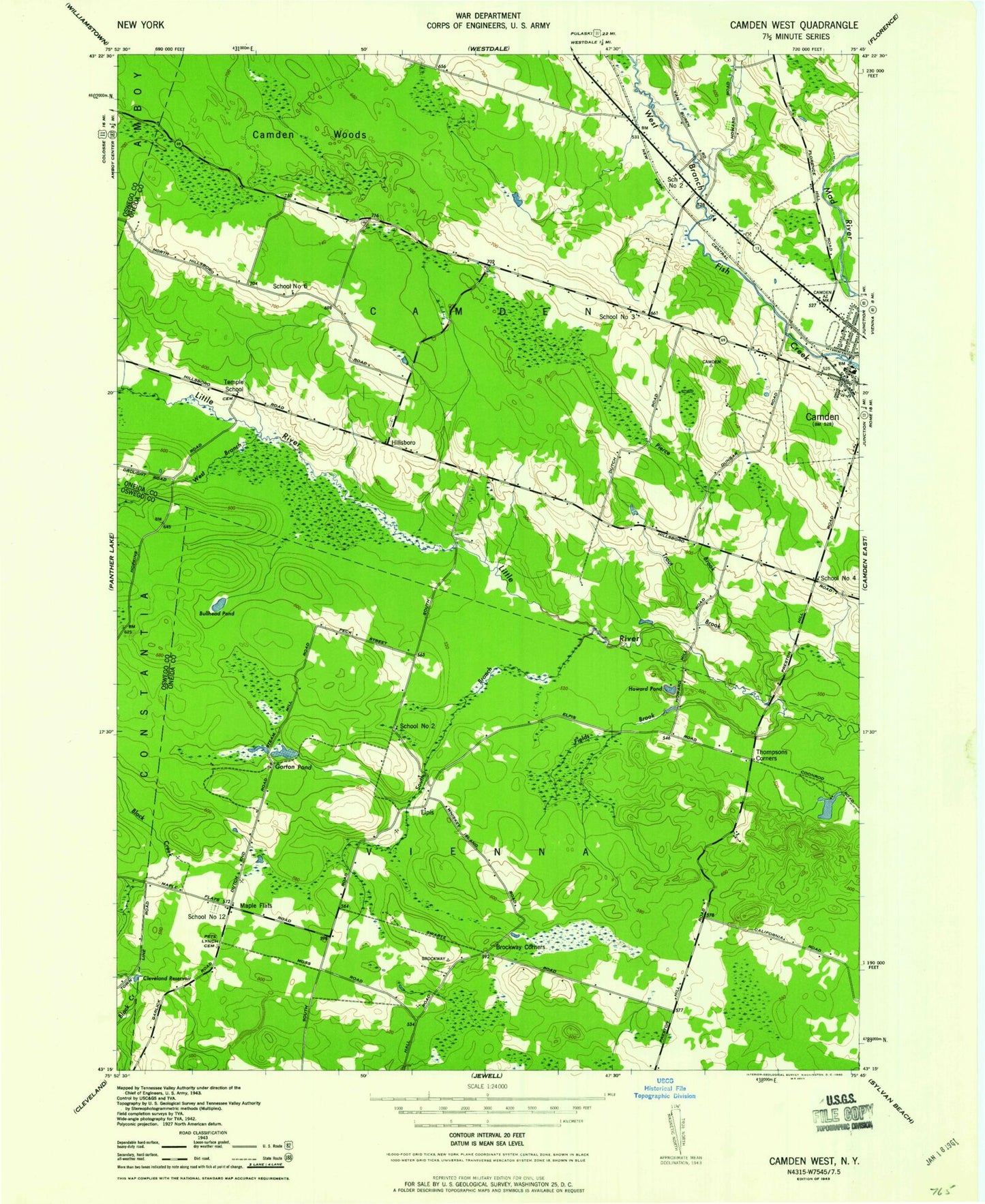
Classic USGS Camden West New York 7.5'x7.5' Topo Map
Couldn't load pickup availability
Historical USGS topographic quad map of Camden West in the state of New York. Map scale may vary for some years, but is generally around 1:24,000. Print size is approximately 24" x 27"
This quadrangle is in the following counties: Oneida, Oswego.
The map contains contour lines, roads, rivers, towns, and lakes. Printed on high-quality waterproof paper with UV fade-resistant inks, and shipped rolled.
Contains the following named places: Brockway Brook, Brockway Corners, Bullhead Brook, Bullhead Pond, Camden High School, Camden Pit, Cleveland Reservoir, Elpis, Fields Brook, Gorton Brook, Gorton Pond, Hillsboro, Howard Pond, Lynch Cemetery, Maple Flats, Pierce Brook, Preston Hill, School Number 12, School Number 2, School Number 3, School Number 4, School Number 6, Servants Baptist Church, South Branch Little River, Starkweather Pond, Temple Cemetery, Temple School, The Abundant Life Community Church, Thompsons Branch, Thompsons Corner, Town of Camden, Trout Brook, West Branch Little River, Wetmor Brook, ZIP Code: 13042