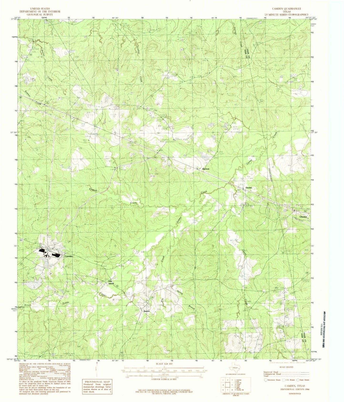
MyTopo
Classic USGS Camden Texas 7.5'x7.5' Topo Map
Couldn't load pickup availability
Historical USGS topographic quad map of Camden in the state of Texas. Map scale may vary for some years, but is generally around 1:24,000. Print size is approximately 24" x 27"
This quadrangle is in the following counties: Polk, Tyler.
The map contains contour lines, roads, rivers, towns, and lakes. Printed on high-quality waterproof paper with UV fade-resistant inks, and shipped rolled.
Contains the following named places: Barnes, Barnum, Barnum Lake, Barnum Lake Dam, Camden, Camden Post Office, Caney Creek Church, Carter Lake, Carter Lake Dam, Dabbs Branch, Dabbs Creek, Darden Cemetery, Darden Palestine School, Davis Cemetery, Elm Creek, Lily Island, Lily Island Cemetery, Nowlin Cemetery, Old Barnum, Peach Tree Village Cemetery, Pine Grove Church, Pine Pond, Pine Pond Dam, Pullen Cemetery, Whitehead Cemetery