MyTopo
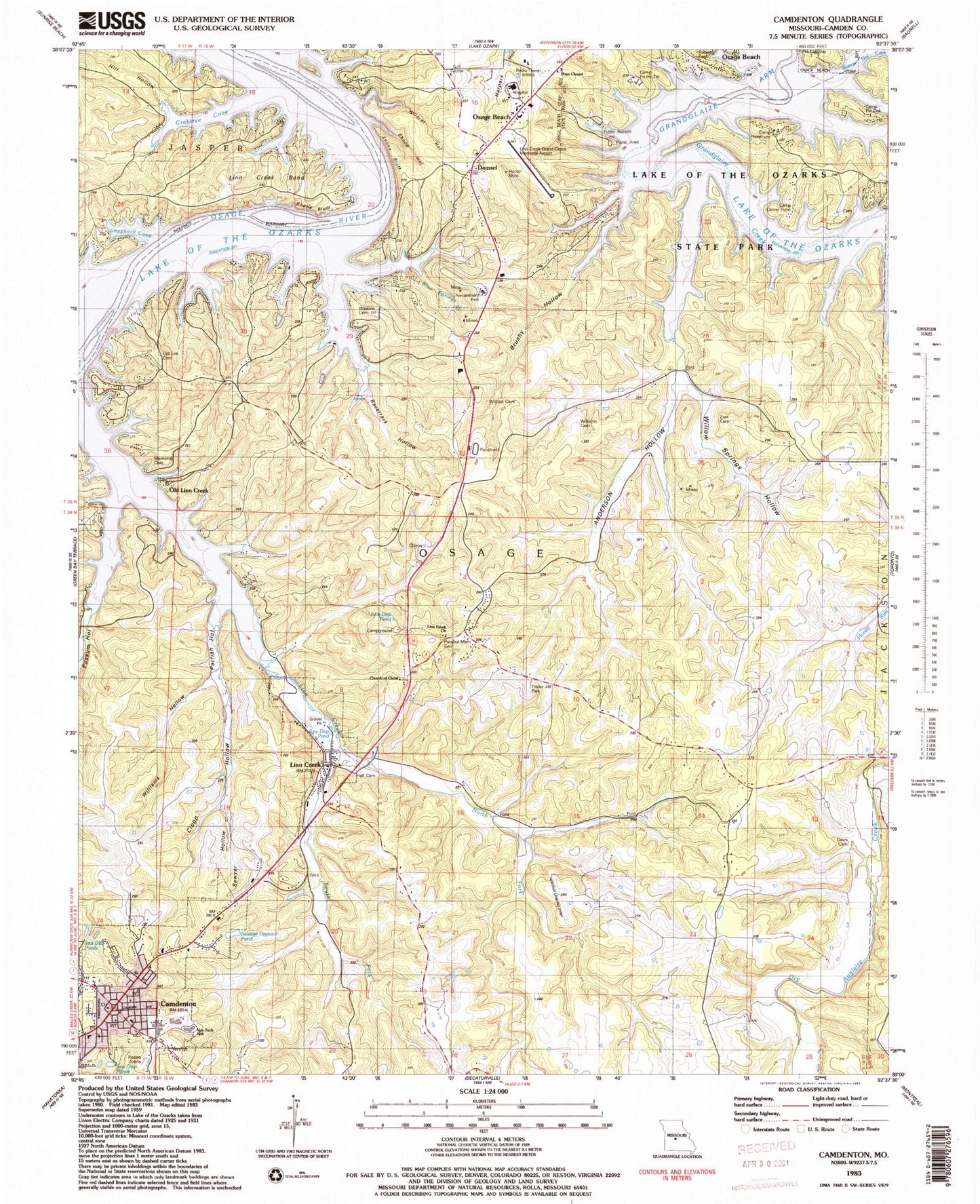
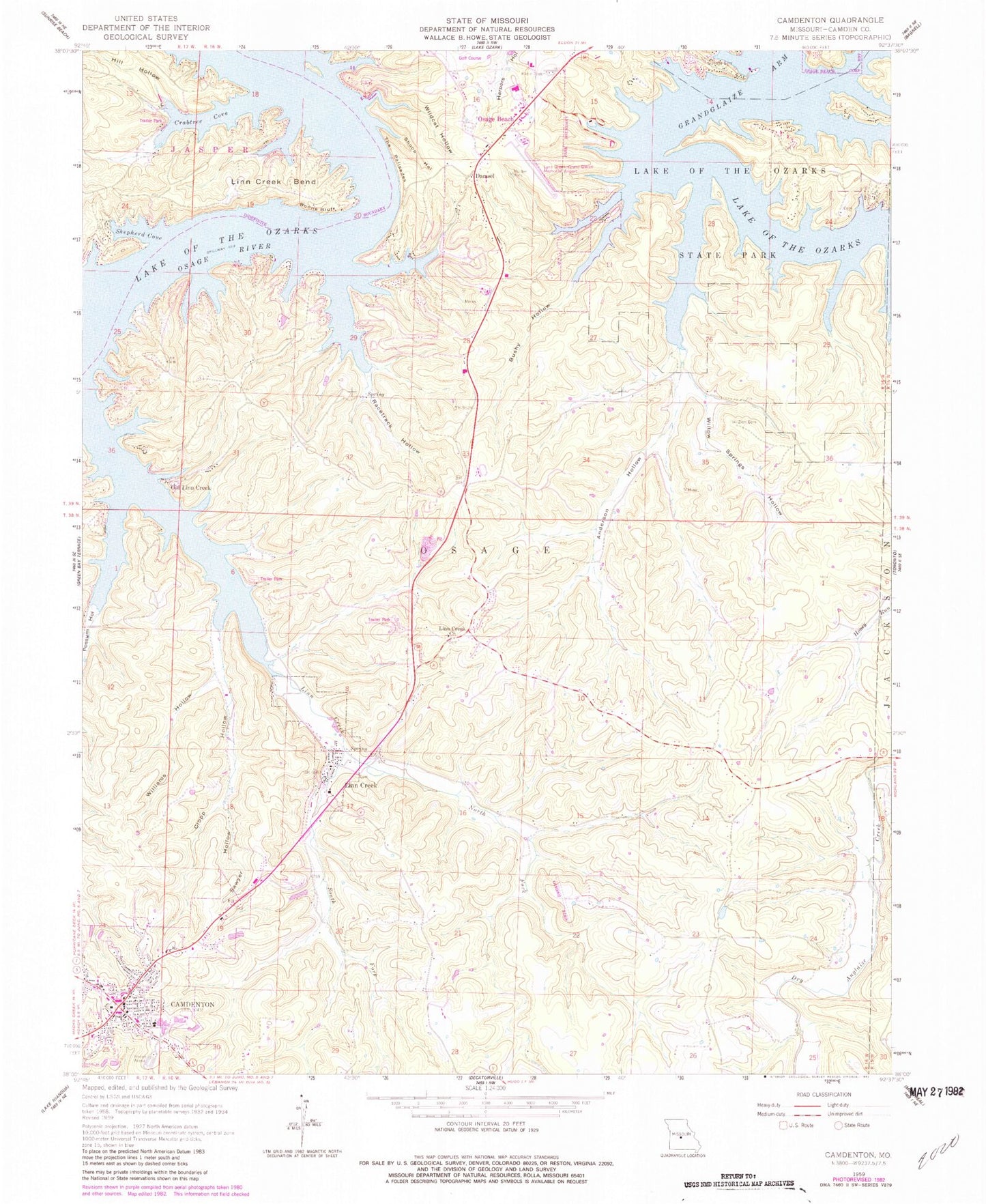
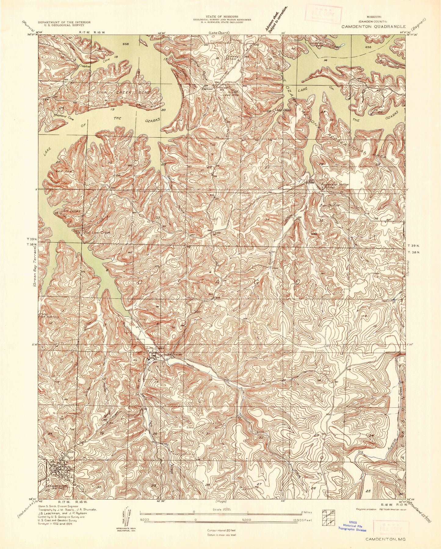
Classic USGS Camdenton Missouri 7.5'x7.5' Topo Map
Couldn't load pickup availability
Historical USGS topographic quad map of Camdenton in the state of Missouri. Typical map scale is 1:24,000, but may vary for certain years, if available. Print size: 24" x 27"
This quadrangle is in the following counties: Camden.
The map contains contour lines, roads, rivers, towns, and lakes. Printed on high-quality waterproof paper with UV fade-resistant inks, and shipped rolled.
Contains the following named places: Anderson Hollow, Boone Bluff, Brushy Hollow, Camdenton, Clopp Hollow, Conway Cemetery, Crabtree Cove, Hill Hollow, Hunter Mine, Linn Creek, Linn Creek, Linn Creek Bend, Linn Creek Church, North Fork Linn Creek, Old Linn Creek, Possum Hollow, Racetrack Hollow, Sawyer Hollow, Shepherd Cove, Shoop Hollow, South Fork Linn Creek, Lyons Bluff, Wildcat Hollow, Williams Hollow, Willow Springs Hollow, Zion Cemetery, Parrish Hollow, Blue Springs Branch, Damsel, Outlets Limited, Rodeo Arena, Voc-Tech School, Camdenton High School, Davis Cemetery, Selby - Hall Cemetery, Percival Memorial Cemetery, Church of Christ, Memorial Cemetery, Old Erie Cemetery, Hopkins Cemetery, Williams Cemetery, Camp Clover Point, Camp Pin Oak, Camp Hawthorn, Camp Pa He Tsi, Heritage Landing Strip (historical), Conway School (historical), Anderson Hollow School (historical), Zion Church (historical), KADI-AM (Camdenton), Hospital Property Heliport, Grand Glaize-Osage Beach Airport, KYLC-FM (Osage Beach), KRMS-AM (Osage Beach), Steinberg Lake Dam, Township of Osage, Township of Kiheka, City of Camdenton, City of Linn Creek, Township of Pawhuska, Osage Beach Fire Protection District Station 2, Camdenton Fire Department, Mid County Fire Protection District Station 1 Headquarters, Osage Beach Fire Protection District Station 3, Lake Regional Health System, Camden County Sheriff's Office, Linn Creek Police Department, Linn Creek Post Office, Anderson Hollow, Boone Bluff, Brushy Hollow, Camdenton, Clopp Hollow, Conway Cemetery, Crabtree Cove, Hill Hollow, Hunter Mine, Linn Creek, Linn Creek, Linn Creek Bend, Linn Creek Church, North Fork Linn Creek, Old Linn Creek, Possum Hollow, Racetrack Hollow, Sawyer Hollow, Shepherd Cove, Shoop Hollow, South Fork Linn Creek, Lyons Bluff, Wildcat Hollow, Williams Hollow, Willow Springs Hollow, Zion Cemetery, Parrish Hollow, Blue Springs Branch, Damsel, Outlets Limited, Rodeo Arena, Voc-Tech School, Camdenton High School, Davis Cemetery, Selby - Hall Cemetery, Percival Memorial Cemetery, Church of Christ, Memorial Cemetery, Old Erie Cemetery, Hopkins Cemetery, Williams Cemetery, Camp Clover Point, Camp Pin Oak, Camp Hawthorn, Camp Pa He Tsi, Heritage Landing Strip (historical), Conway School (historical), Anderson Hollow School (historical), Zion Church (historical), KADI-AM (Camdenton), Hospital Property Heliport, Grand Glaize-Osage Beach Airport, KYLC-FM (Osage Beach), KRMS-AM (Osage Beach), Steinberg Lake Dam, Township of Osage, Township of Kiheka, City of Camdenton, City of Linn Creek, Township of Pawhuska, Osage Beach Fire Protection District Station 2, Camdenton Fire Department, Mid County Fire Protection District Station 1 Headquarters, Osage Beach Fire Protection District Station 3, Lake Regional Health System, Camden County Sheriff's Office, Linn Creek Police Department, Linn Creek Post Office