MyTopo
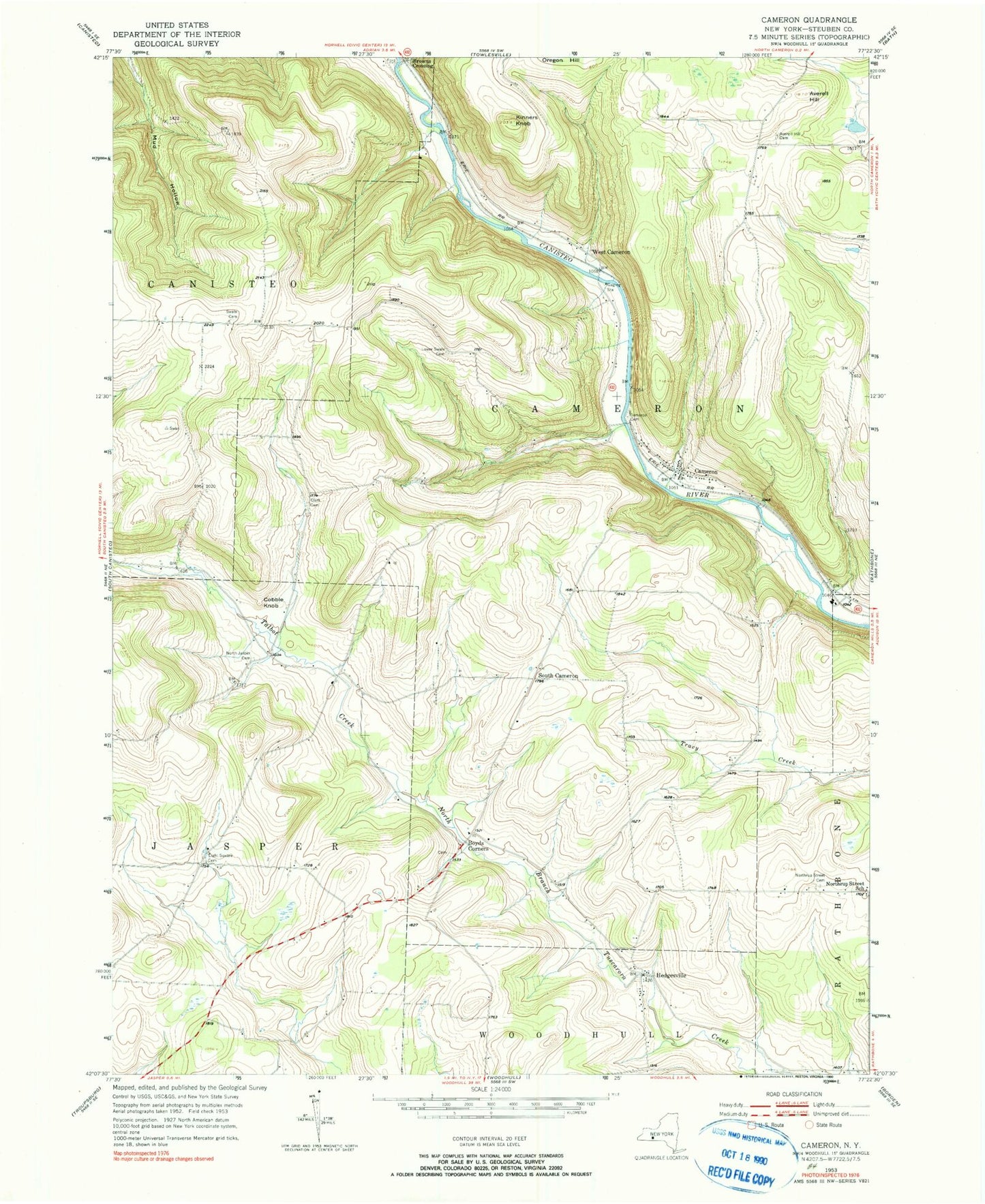
Classic USGS Cameron New York 7.5'x7.5' Topo Map
Couldn't load pickup availability
Historical USGS topographic quad map of Cameron in the state of New York. Typical map scale is 1:24,000, but may vary for certain years, if available. Print size: 24" x 27"
This quadrangle is in the following counties: Steuben.
The map contains contour lines, roads, rivers, towns, and lakes. Printed on high-quality waterproof paper with UV fade-resistant inks, and shipped rolled.
Contains the following named places: Averell Hill, Averell Hill Cemetery, Boyds Corners, Cameron, Cameron Cemetery, Clark Cemetery, Cobble Knob, Eight Square Cemetery, Hedgesville, Kinners Knob, Lower Swale Cemetery, Talbot Creek Cemetery, Northrup Hill Cemetery, Northrup Street School (historical), Upper Swale Cemetery, Talbot Creek, West Cameron, Browns Crossing, South Cameron, Town of Cameron, Allen School (historical), Boyd School (historical), Eight Square School (historical), French School (historical), Gerdner School (historical), Gothic School (historical), Lower Swale School (historical), North Jasper School (historical), Roosa School (historical), South Hill School (historical), Upper Swale School (historical), Randall's Roost Airport, Boyd Cemetery, Hedgesville Cemetery, Valley Elementary School, Boyd Corners Baptist Church, Cameron Volunteer Fire Department, Cameron Mills Post Office