MyTopo
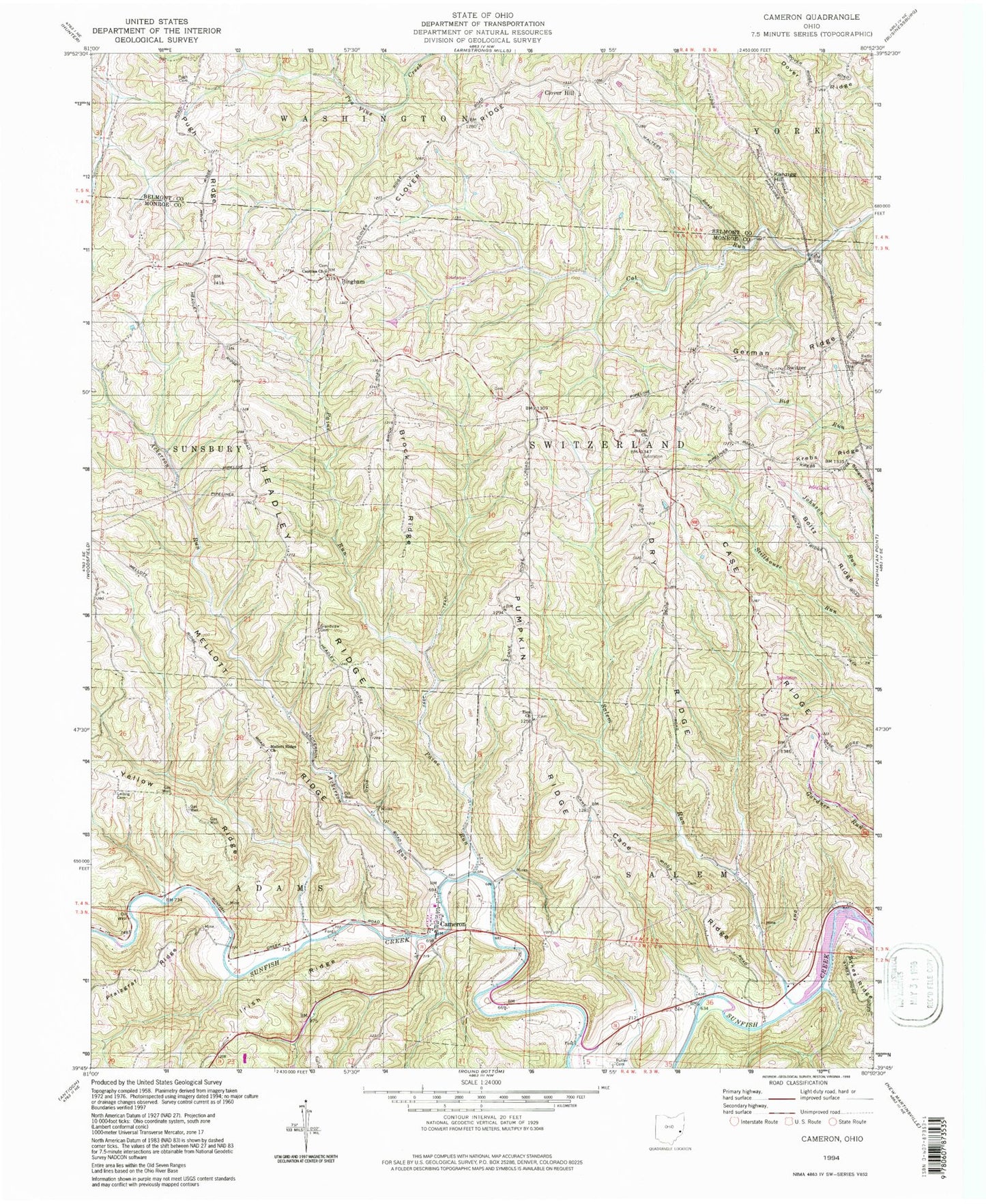
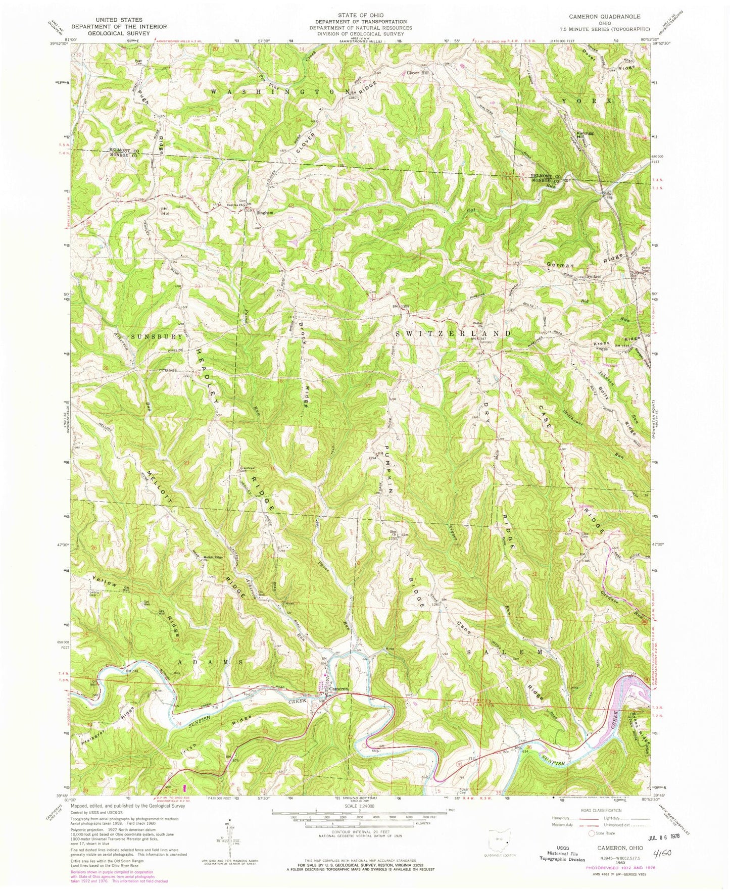
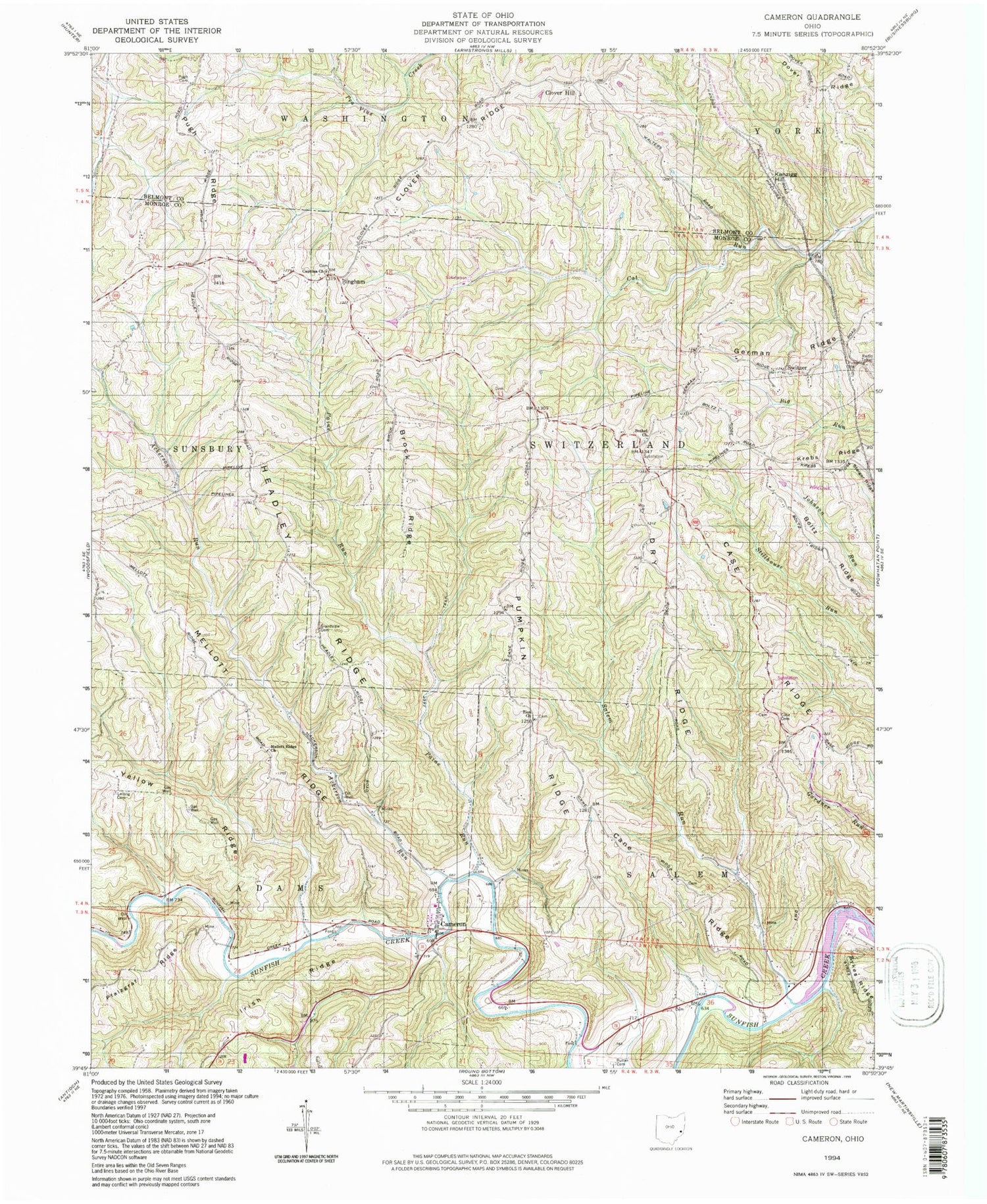
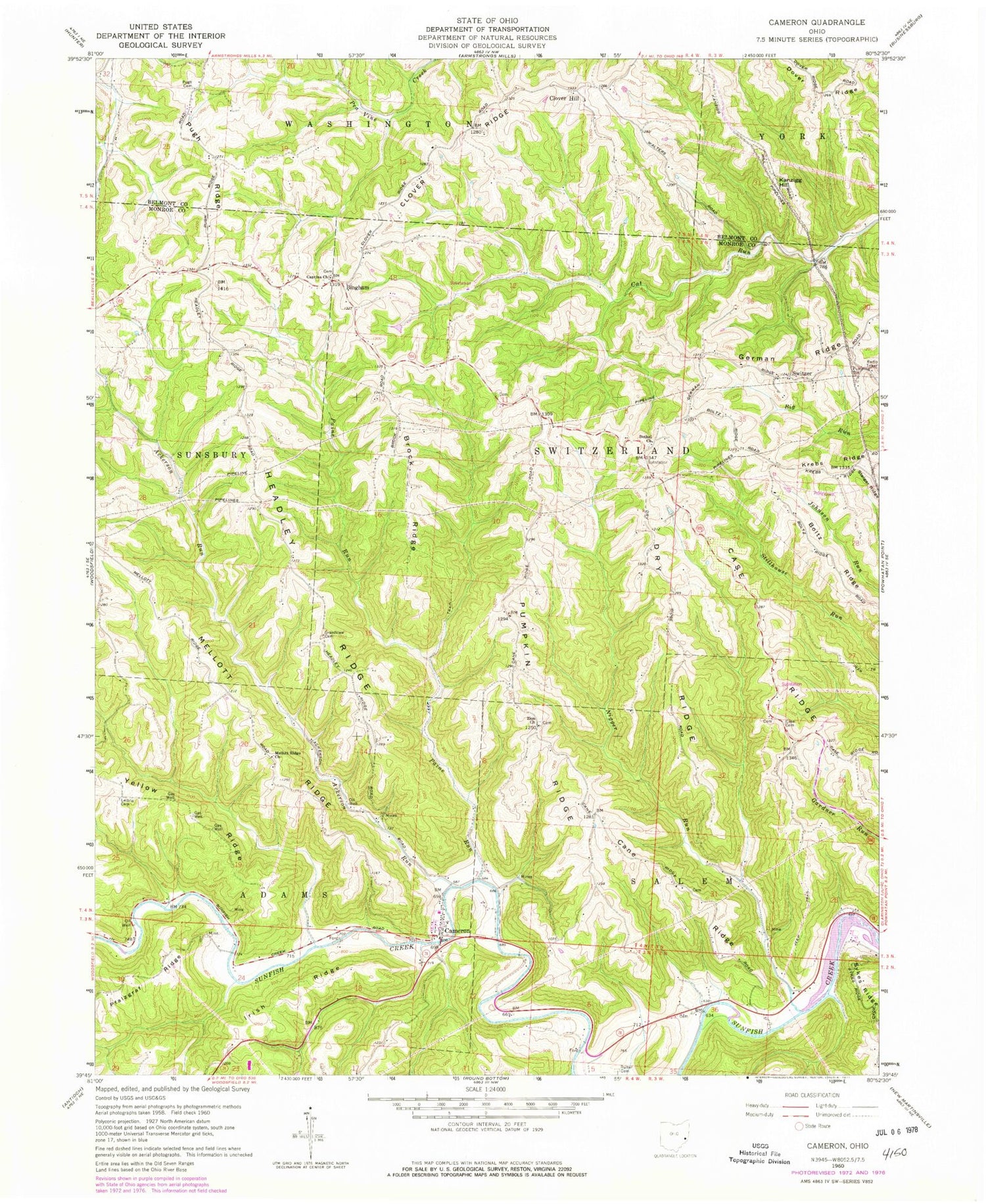
Classic USGS Cameron Ohio 7.5'x7.5' Topo Map
Couldn't load pickup availability
Historical USGS topographic quad map of Cameron in the state of Ohio. Typical map scale is 1:24,000, but may vary for certain years, if available. Print size: 24" x 27"
This quadrangle is in the following counties: Belmont, Monroe.
The map contains contour lines, roads, rivers, towns, and lakes. Printed on high-quality waterproof paper with UV fade-resistant inks, and shipped rolled.
Contains the following named places: Ackerson Run, Bethel Church, Brock Ridge, Cane Ridge, Case Cemetery, Case Ridge, Clover Ridge, Dover Ridge, Dry Ridge, Grandview Cemetery, Headley Ridge, Irish Ridge, Krebs Ridge, Leiblig Cemetery, Mellott Ridge, Mellott Ridge Church, Salem Run, Pugh Cemetery, Pugh Ridge, Rutter Cemetery, Steiger Ridge, Switzer, Zion Methodist Church, Kanzigg Hill, Dwight, Cameron, Bingham, Paine Run, Captina Church, Clover Hill, Captina Cemetery, Township of Adams, Township of Salem, Township of Switzerland, Bethel Cemetery, Cain Cemetery, Hartline Cemetery, Old Case Cemetery, Pontius Cemetery, Ruble Cemetery, Zesiger Cemetery, Zion Methodist Cemetery, Bingham Post Office (historical), Dwight Post Office (historical), Switzer Post Office (historical), Cameron Post Office