MyTopo
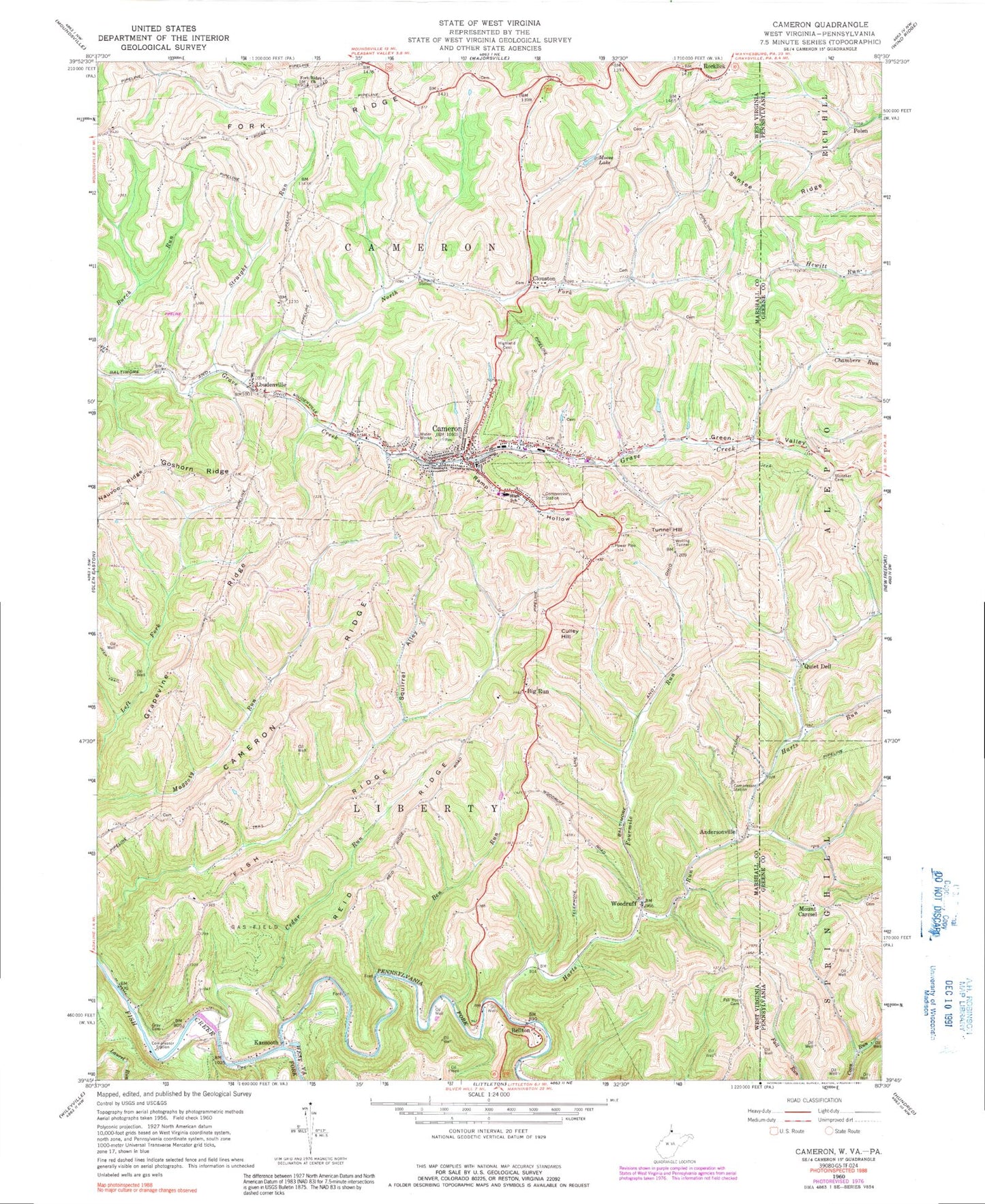
Classic USGS Cameron West Virginia 7.5'x7.5' Topo Map
Couldn't load pickup availability
Historical USGS topographic quad map of Cameron in the states of West Virginia, Pennsylvania. Map scale may vary for some years, but is generally around 1:24,000. Print size is approximately 24" x 27"
This quadrangle is in the following counties: Greene, Marshall.
The map contains contour lines, roads, rivers, towns, and lakes. Printed on high-quality waterproof paper with UV fade-resistant inks, and shipped rolled.
Contains the following named places: Adaline School, Andersonville, Bane Cemetery, Bellton, Ben Run, Big Run, Big Run Cemetery, Big Run Christian Church, Big Run Community Center, Big Run School, Cameron, Cameron Cemetery, Cameron City Hall, Cameron Elementary School, Cameron High School, Cameron Police Department, Cameron Post Office, Cameron Public Library, Cameron Ridge, Cameron Volunteer Emergency Squad, Cameron Volunteer Fire Department, Cedar Run, Church of Christ, City of Cameron, Clouston, Clouston Cemetery, Clouston School, Clouston United Methodist Church, Coe School, Courtwright School, Culley Hill, Fall Run Cemetery, Fall Run Church, First Baptist Church, First Brethren Church, First Christian Church, First Presbyterian Church, First United Methodist Church, Fish Ridge, Fish School, Fletcher - Earliwine Cemetery, Fork Ridge Cemetery, Fork Ridge Church, Fourmile Run, George Wahl Spring, Goshorn Ridge, Grapevine Ridge, Gray Cemetery, Green Valley, Green Valley School, Greenwood School, Hall-Doty-Lewis-Bruhn-Chambers Cemetery, Harts Run, Hicks School, Highland Cemetery, Hinkle School, House of Prayer Church, Howard Cemetery, Hubbs Cemetery, Hupp School, James E Blake Spring, Joseph Shepherd Spring, Kausooth, Kausooth School, Loudenville, Loudenville School, Lowe School, McDonald School, Moose Lake, Mount Carmel, Mount Carmel Cemetery, North Fork Grave Creek, Pennsylvania Fork Fish Creek, Polen, Quiet Dell, Ramp Hollow, Reid Ridge, Rock Lick Cemetery, Rock Lick Church, Rock Lick School, Rocklick, Saint Martins Catholic Church, Santee Ridge, Slonaker Cemetery, Squirrel Alley, Squirrel Alley School, Straight Run, Strope Cemetery, Township Hall School, Tunnel Hill, Tunnel Hill School, Upper Bane School, Upper Grave Creek Structure Number Eight Dam, Upper Grave Creek Structure Number Five Dam, Upper Grave Creek Structure Number Four Dam, Upper Grave Creek Structure Number Nine Dam, Upper Grave Creek Structure Number One Dam, Upper Grave Creek Structure Number Seven Dam, Upper Grave Creek Structure Number Three Dam, Welling Tunnel, Wells, West Virginia Fork Fish Creek, White Cemetery, Wise Cemetery, Woodruff, ZIP Code: 26033