MyTopo
Classic USGS Caminada Pass Louisiana 7.5'x7.5' Topo Map
Regular price
$16.95
Regular price
Sale price
$16.95
Unit price
per
Couldn't load pickup availability
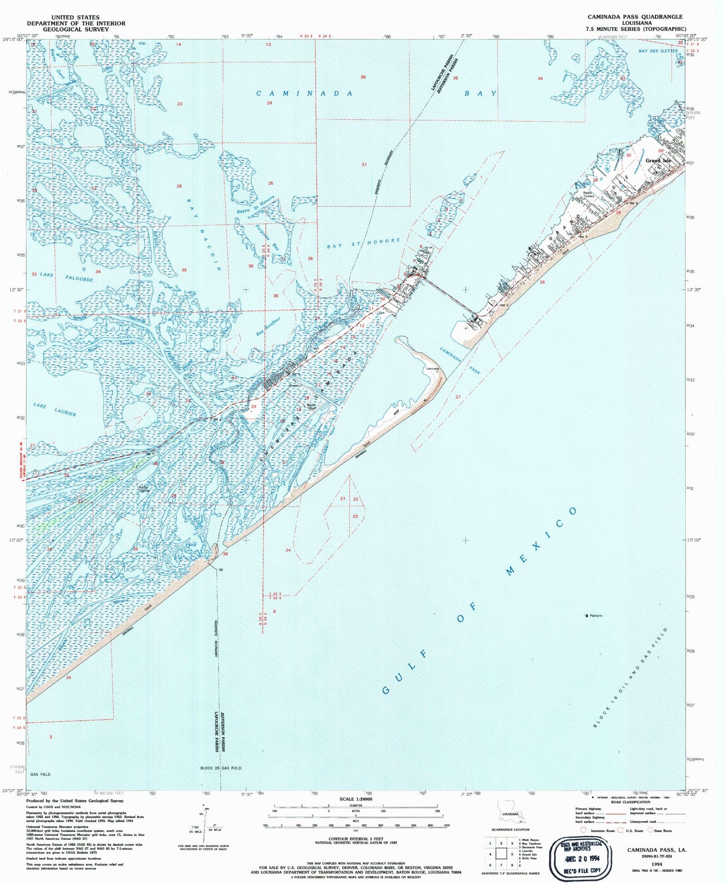
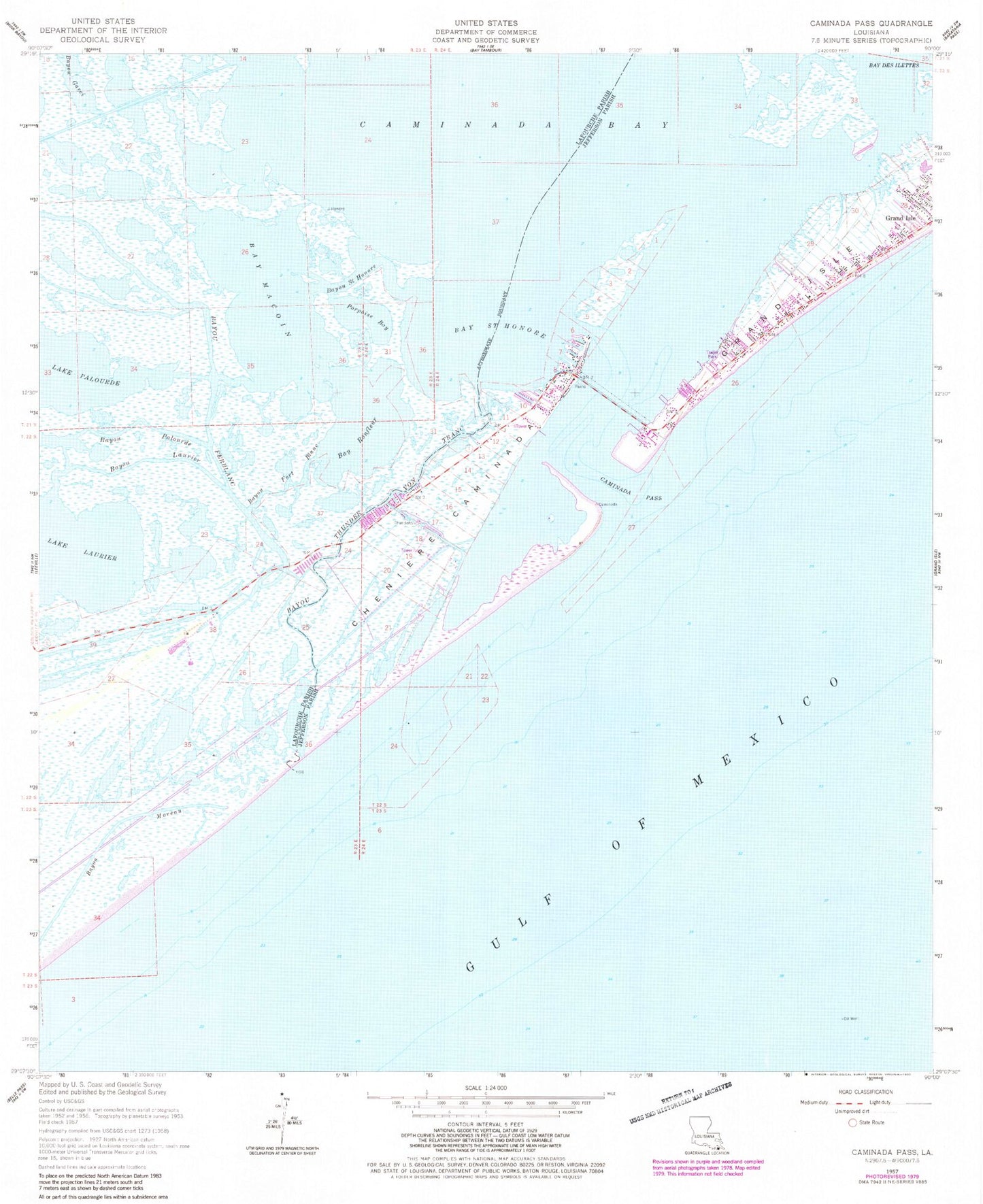
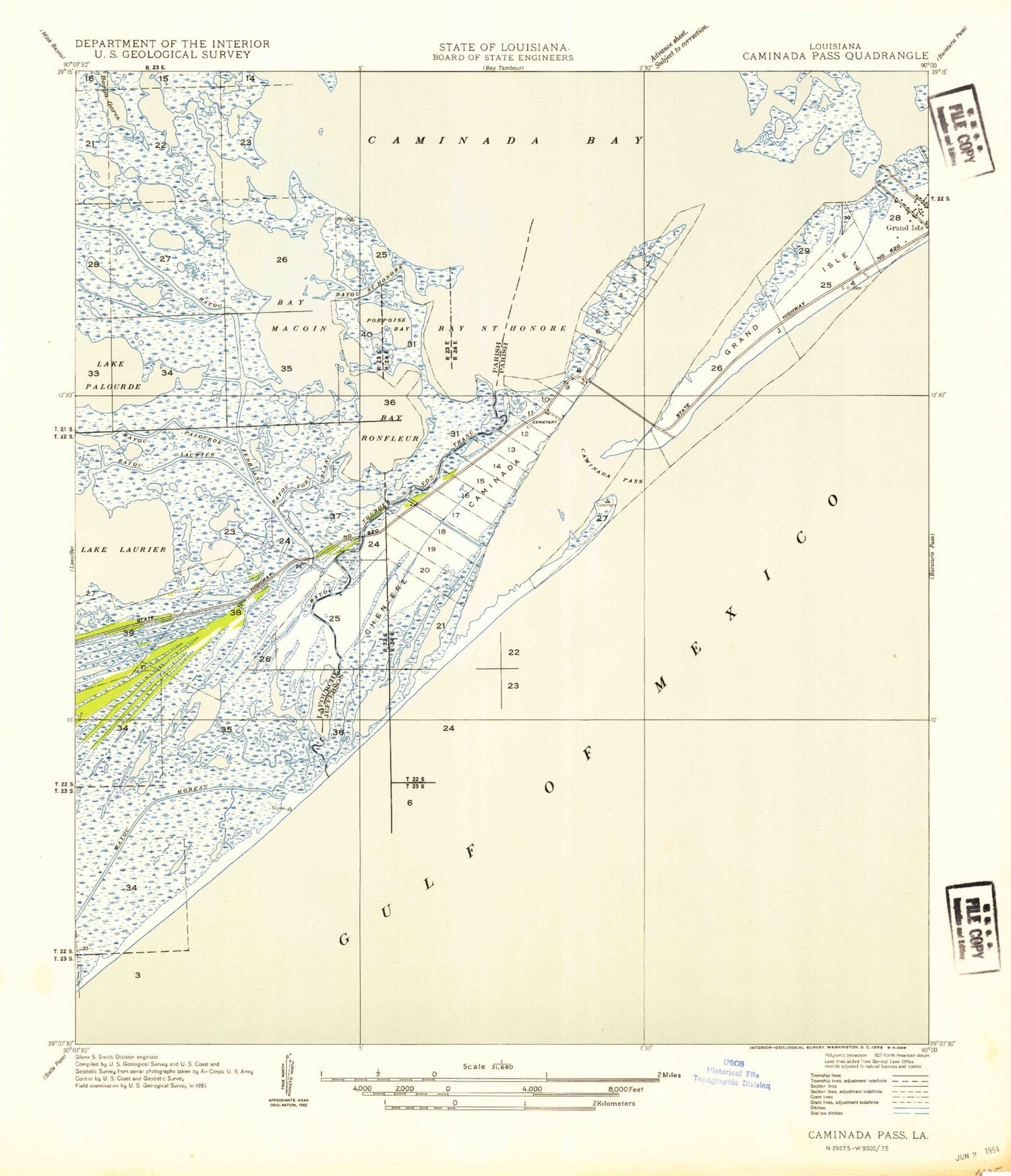
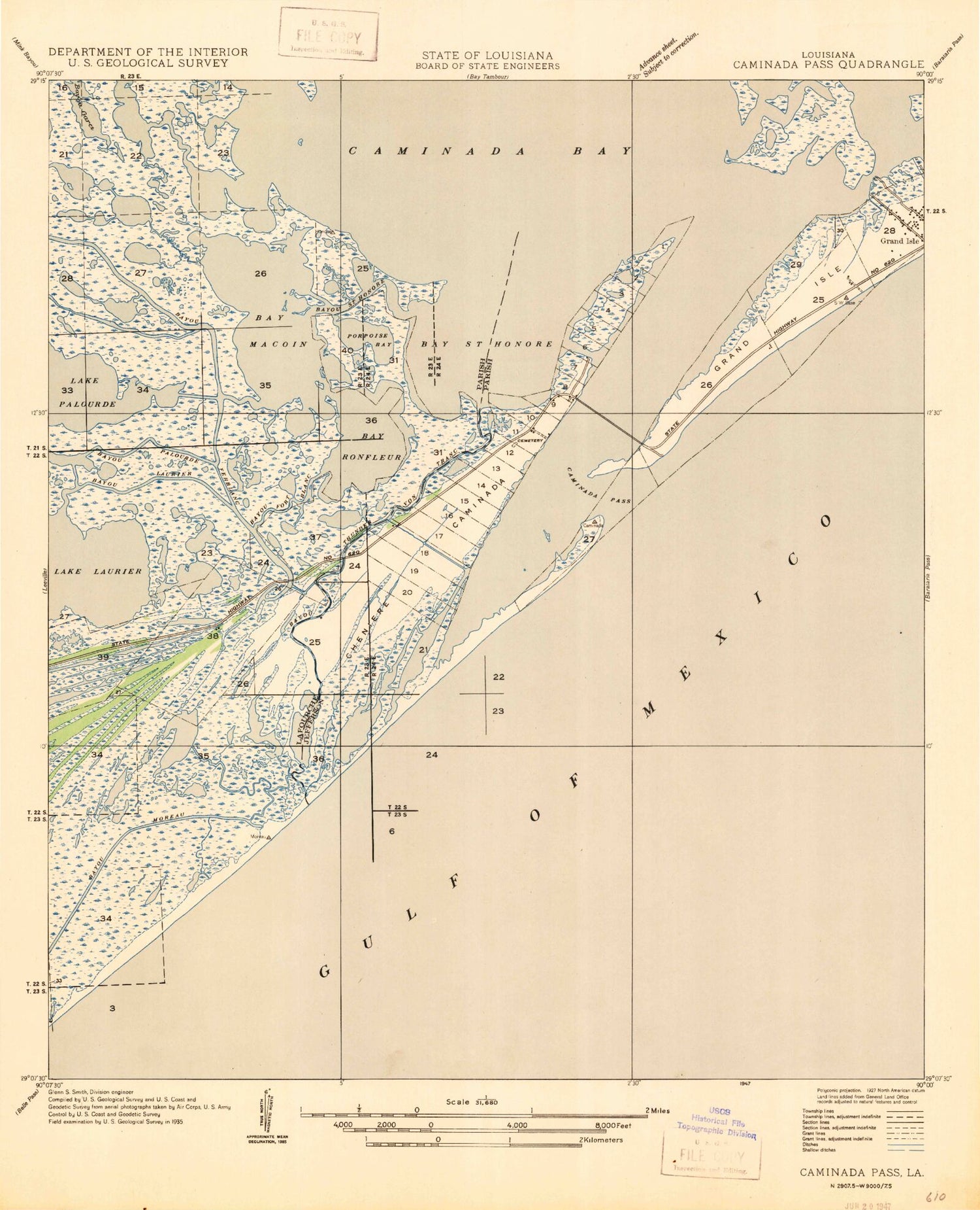
Historical USGS topographic quad map of Caminada Pass in the state of Louisiana. Map scale may vary for some years, but is generally around 1:24,000. Print size is approximately 24" x 27"
This quadrangle is in the following counties: Jefferson, Lafourche.
The map contains contour lines, roads, rivers, towns, and lakes. Printed on high-quality waterproof paper with UV fade-resistant inks, and shipped rolled.
Contains the following named places: Bay Saint Honore, Bayou Ferblanc, Bayou Laurier, Bayou Palourde, Bayou Thunder Von Tranc, Chemin Du Fort Blanc, Cheniere Caminada, Cheniere Caminada Cemetery, Elmers Island, Fort Blanc, Town of Grand Isle, Ward Eleven, ZIP Code: 70358