
MyTopo
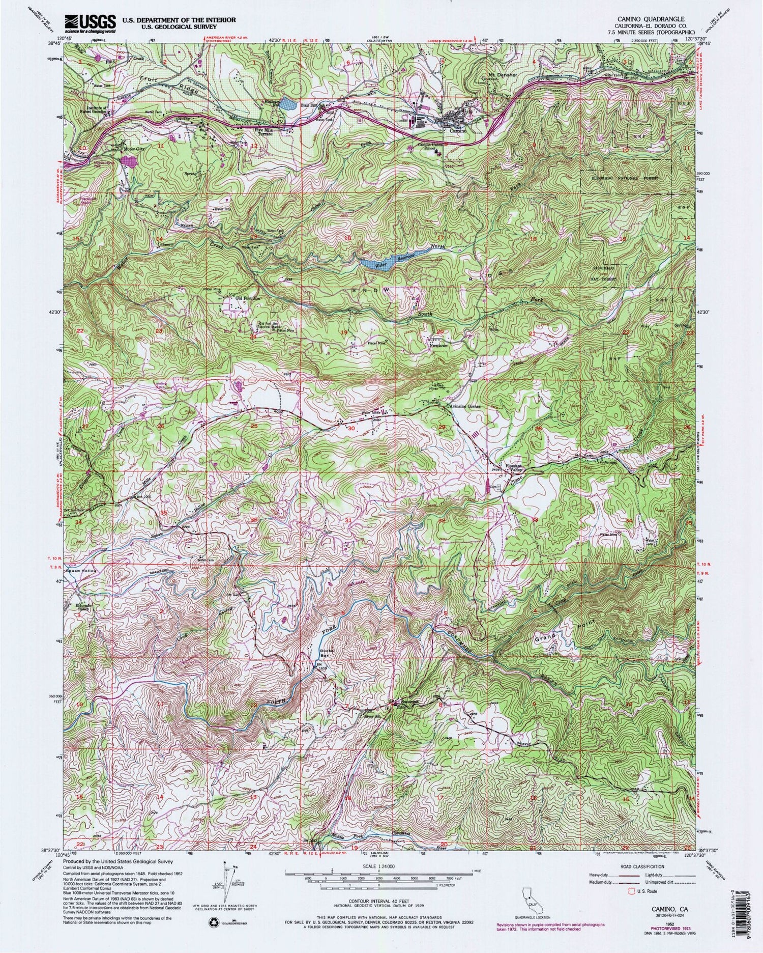
Classic USGS Camino California 7.5'x7.5' Topo Map
Couldn't load pickup availability
Historical USGS topographic quad map of Camino in the state of California. Map scale may vary for some years, but is generally around 1:24,000. Print size is approximately 24" x 27"
This quadrangle is in the following counties: El Dorado.
The map contains contour lines, roads, rivers, towns, and lakes. Printed on high-quality waterproof paper with UV fade-resistant inks, and shipped rolled.
Contains the following named places: Abels Apple Acres, Avinsino Corner, Blair District School, Blakeley Reservoir, Blakely 53-002 Dam, Boca Vista Orchards, Bucks Bar, Bucks Bar Campground, Butte Creek, California Department of Forestry and Fire Protection Station 20 Mount Danaher, Camino, Camino Census Designated Place, Camino Elementary School, Camino Heights, Camino Post Office, Camino School, Camp Creek, Carson Ridge Evergreens, Cedar Grove, China Creek, Clear Creek, Crawford Ditch, Cross Family Vineyards, Diamond Continuation High School, Eight Mile House, Eight Mile House State Historic Landmark, El Dorado County Fire District Station 19, El Dorado County Fire District Station 21, Eldorado National Forest Visitors Center, Eldorado Ranch, Fay Gunby 1464-002 Dam, Five Mile Terrace, Fruit Ridge, Gold Oak Elementary School, Goldbud Farms, Grand Point, High Hill Ranch, High Hill Ranch Heliport, Institute of Forest Genetics, Jackass Canyon, Lava Cap Winery, Long Ravine, Madrona Vineyards, Mills Creek, Mining Brook Ranch, Motor City, Mount Danaher, Mount Danaher Ranger Unit Headquarters, New Weber Ditch, Newtown, North Fork Weber Creek, Oak Hill Cemetery, Old Fort Jim, Old Fort Jim Historical Marker, Old Jim Mine, Perry Creek, Perryman Airport, Pioneer Fire Protection District Station 32 Sand Ridge, Placerville District Office Eldorado National Forest, Placerville Ranger Station, Pleasant Valley, Pleasant Valley Cemetery, Pleasant Valley School, Rancho del Sol, River School, Santas Acres, Seventh Day Adventist Community Service Center, Sierra Vista Winery, Snow Ridge, Somerset, Somerset Post Office, South Fork Weber Creek, Summerfield Berry Farm, The Big Apple Orchard, The Fruit Tree Orchard, Wakeley Special Education Center, Webber 53-000 Dam, Weber Reservoir


