MyTopo
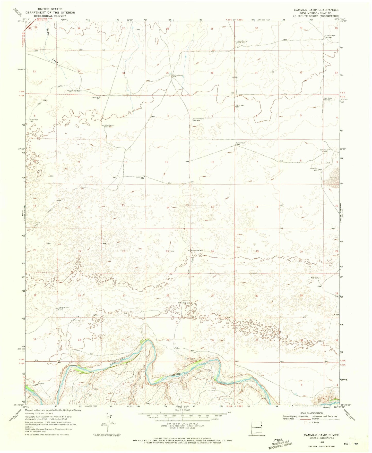
Classic USGS Cammak Camp New Mexico 7.5'x7.5' Topo Map
Couldn't load pickup availability
Historical USGS topographic quad map of Cammak Camp in the state of New Mexico. Map scale may vary for some years, but is generally around 1:24,000. Print size is approximately 24" x 27"
This quadrangle is in the following counties: Quay.
The map contains contour lines, roads, rivers, towns, and lakes. Printed on high-quality waterproof paper with UV fade-resistant inks, and shipped rolled.
Contains the following named places: 05243 Water Well, 05245 Water Well, 05246 Water Well, 05247 Water Well, 05252 Water Well, 05253 Water Well, 05254 Water Well, 05255 Water Well, 05256 Water Well, 05257 Water Well, 05499 Water Well, Cammak Camp, Carter Well, Collins Camp, Dempster Well, Dergy Well, Ditterline Well, East Durham Well, Fifty Well, Flag Ranch Well, Hayne Well, New Jackson Well, North Well, Red Well, Sager Draw, Schoonermaker Well, Scott Well, Two Story Well, West Durham Well, Wiggan Well