MyTopo
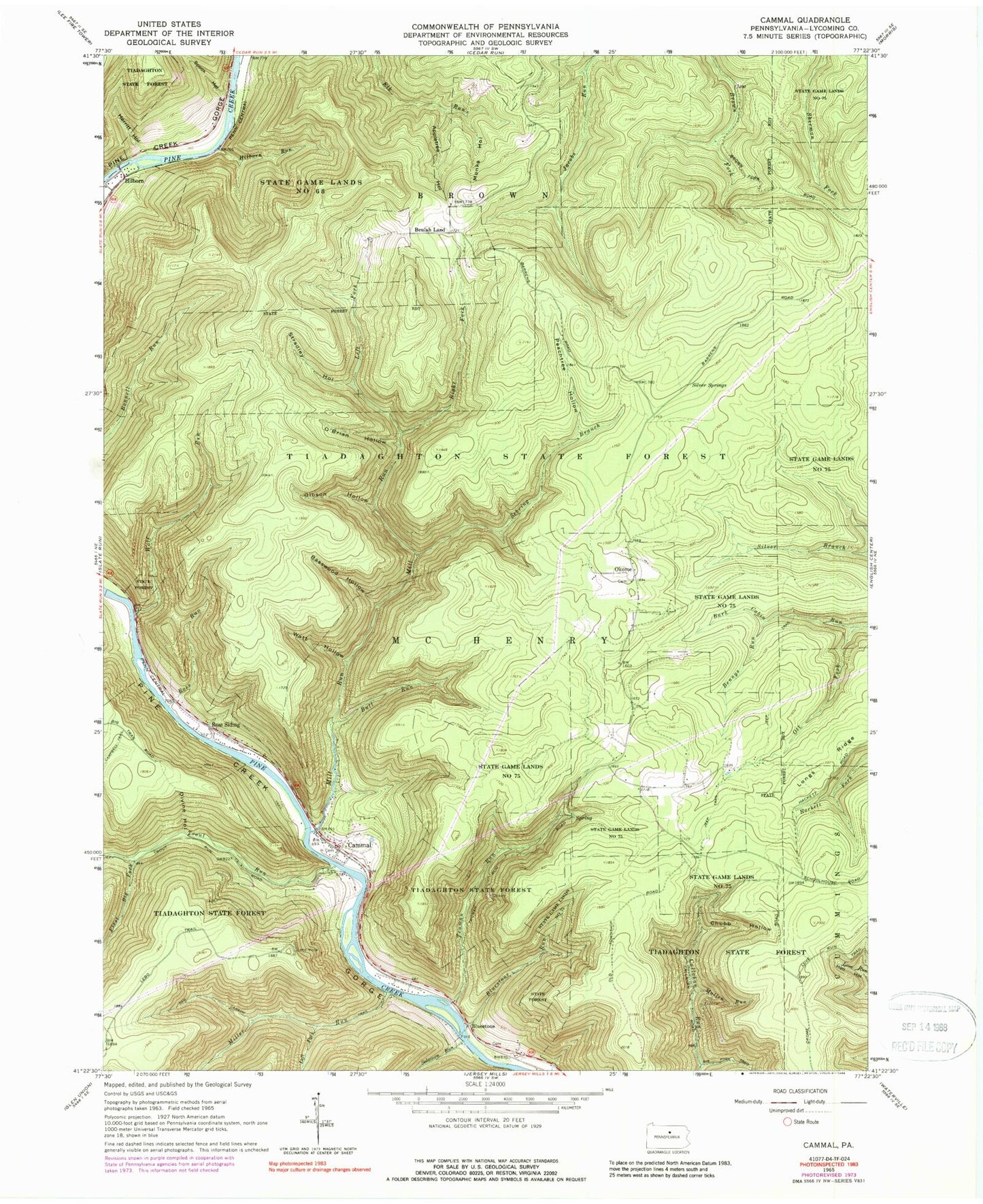
Classic USGS Cammal Pennsylvania 7.5'x7.5' Topo Map
Couldn't load pickup availability
Historical USGS topographic quad map of Cammal in the state of Pennsylvania. Typical map scale is 1:24,000, but may vary for certain years, if available. Print size: 24" x 27"
This quadrangle is in the following counties: Lycoming.
The map contains contour lines, roads, rivers, towns, and lakes. Printed on high-quality waterproof paper with UV fade-resistant inks, and shipped rolled.
Contains the following named places: Cammal, Bluestone Cemetery, Okome Cemetery, Watson Fork, Appletree Hollow, Basswood Hollow, Bennys Run, Bluestone Run, Bull Run, Chubb Hollow, Divine Hollow, Gibson Hollow, Hilborn Run, Holt Trail, Left Fork Mill Run, Left Fork Miller Run, Mill Run, Miller Run, Monks Hollow, Mullen Run, O'Brian Hollow, Okome, Ott Fork, Peachtree Hollow, Right Fork Mill Run, Ross Run, Ross Siding, Sam Carson Trail, Sebring Branch, Silver Springs, Spook Hollow, State Game Lands Number 68, Stradley Hollow, Truman Run, Watt Hollow, Wolf Run, First Big Fork, Herritt Hollow, Solomon Run, Trout Run, Big Trail Vista, Bark Cabin Natural Area, Wolf Run Wild Area, Wolf Rock, Beulah Land, Bluestone, Hilborn, Lebo Vista, Pikes Peak Trail, Hell Hollow Trail, Wildcat Trail, Dry Run Trail, Cammal Trail, Cabin Trail, Chubb Trail, Jack Hebrit Trail, Township of Brown, Township of McHenry, Pine Creek Independent Volunteer Fire Company, Cammal Cemetery