MyTopo
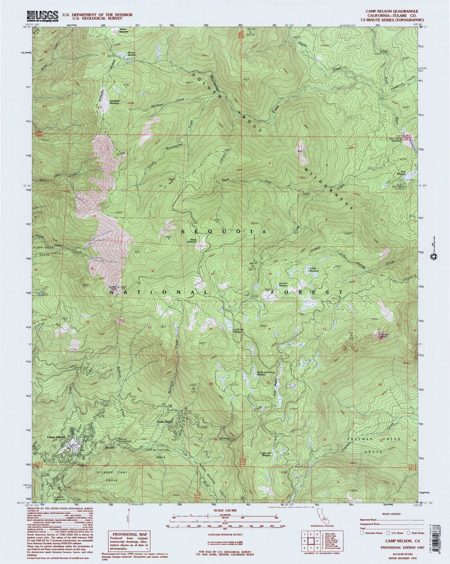
Classic USGS Camp Nelson California 7.5'x7.5' Topo Map
Couldn't load pickup availability
Historical USGS topographic quad map of Camp Nelson in the state of California. Typical map scale is 1:24,000, but may vary for certain years, if available. Print size: 24" x 27"
This quadrangle is in the following counties: Tulare.
The map contains contour lines, roads, rivers, towns, and lakes. Printed on high-quality waterproof paper with UV fade-resistant inks, and shipped rolled.
Contains the following named places: Alpine Creek, Alpine Meadow, Bear Creek, Belknap Camp Grove, Belknap Creek, Boulder Creek, Clicks Creek, Coffee Mill Meadow, Coy Creek, Coy Flat, Deep Meadow, Freeman Creek Grove, Grey Meadow, Jacobsen Meadow, Jacobson Creek, Jordan Peak, Junction Meadow, Log Cabin Meadow, Loggy Meadows, McIntyre Creek, McIntyre Grove, Mountaineer Creek, Mowery Meadow, Nelson Creek, North Fork Clicks Creek, Sagebrush Gulch, Smith and Failing Meadow, South Mountaineer Creek, Table Meadow Creek, Wheel Meadow Grove, White Meadow, Big Tree Water Tanks, Parole Cabin, Jordan Peak Lookout, Camp Nelson, Cedar Slope, Belknap Campground, Coy Flat Campground, Grey Meadow Forest Service Station, Hermit Rock, Camp Nelon Post Office (historical), Camp Nelson Census Designated Place, Cedar Slope Census Designated Place, Tulare County Fire Department Battalion 2 Camp Nelson Fire Station 23, Camp Nelson Volunteer Ambulance