MyTopo
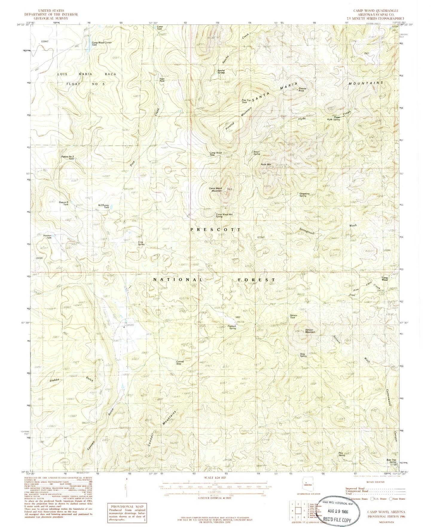
Classic USGS Camp Wood Arizona 7.5'x7.5' Topo Map
Couldn't load pickup availability
Historical USGS topographic quad map of Camp Wood in the state of Arizona. Map scale may vary for some years, but is generally around 1:24,000. Print size is approximately 24" x 27"
This quadrangle is in the following counties: Yavapai.
The map contains contour lines, roads, rivers, towns, and lakes. Printed on high-quality waterproof paper with UV fade-resistant inks, and shipped rolled.
Contains the following named places: Apache Springs, Bar Thirtyseven Ranch, Bear Trap Spring, Brown Spring, Camp Wood, Camp Wood Corner Dam, Camp Wood Corner Tank, Camp Wood Mountain, Camp Wood Mountain Spring, Camp Wood Ranger Guard Station, Camp Wood Tank, Carter Tank, Connell Mountains, Connell Seep, Granite Knob, Grapevine Spring, Harmon Tank, Hunt Tank, Hyde Creek Mountain, Hyde Mountain Lookout Tower, L O Spring, Live Oak Well, McElhaney Tank, Merritt Spring, Paddock Ranch, Paddock Spring, Panther Spring, Pasture B Tank, Pasture Number Three Tank, Pine Flats, Pine Spring, Pinetop Mountain, Pinetop Tank, Pinetop Trick Tank, Ranger Guard Station, Rock House Spring, Rock Spring, Ruins Tank, Santa Maria Mountains, Seven Up Ranch, Seven Up Spring, Shivers Trap Spring, Snag Spring, Stinson Mountain, Stinson Tank, Stinson Wash, Triangle HC Ranch, Upper Hyde Spring, Williamson Valley School, Yolo Ranch, Yolo Ranch Airport, ZIP Code: 86305