MyTopo
Classic USGS Camp Arkansas 7.5'x7.5' Topo Map
Couldn't load pickup availability
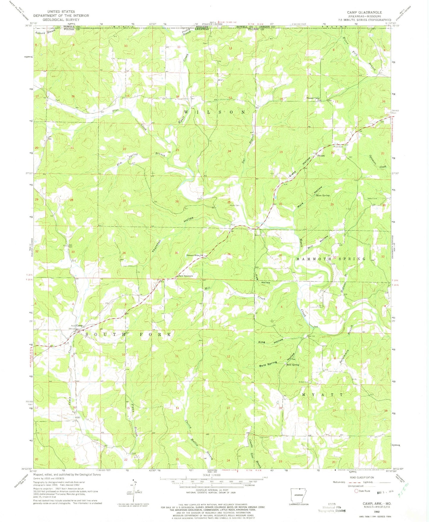
Historical USGS topographic quad map of Camp in the state of Arkansas. Map scale may vary for some years, but is generally around 1:24,000. Print size is approximately 24" x 27"
This quadrangle is in the following counties: Fulton, Howell, Oregon.
The map contains contour lines, roads, rivers, towns, and lakes. Printed on high-quality waterproof paper with UV fade-resistant inks, and shipped rolled.
Contains the following named places: Bald Spring, Bald Spring Hollow, Bethel Cemetery, Camp, Camp Creek, Camp Post Office, Camp Volunteer Fire Department, Dye Branch, Elm Spring Branch, Faith Tabernacle, Flag Hollow, Flynn Branch, Fryatt, Fryatt Cemetery, Glass Hollow, Hickman Branch, Kerby Cemetery, King Hollow, Mill Creek, Mill Hollow, More Hollow, More Spring, Persimmon Branch, Pine Creek, Pleasant Ridge Church, Pleasant Valley Church, Presley Branch, Shiloh Cemetery, Thornton Hollow, Township of South Fork, Township of Wilson, ZIP Code: 72520