
MyTopo
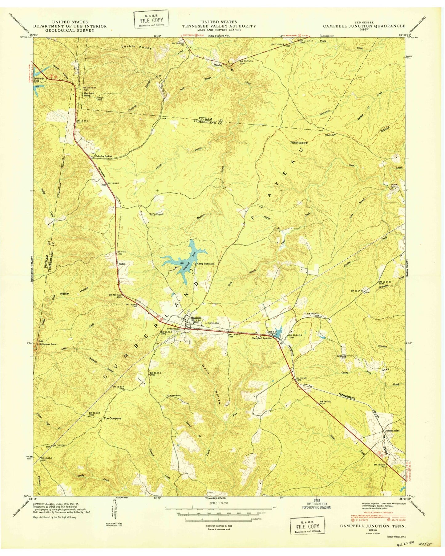
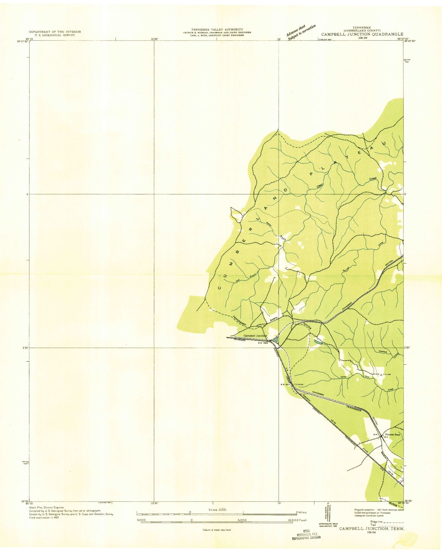
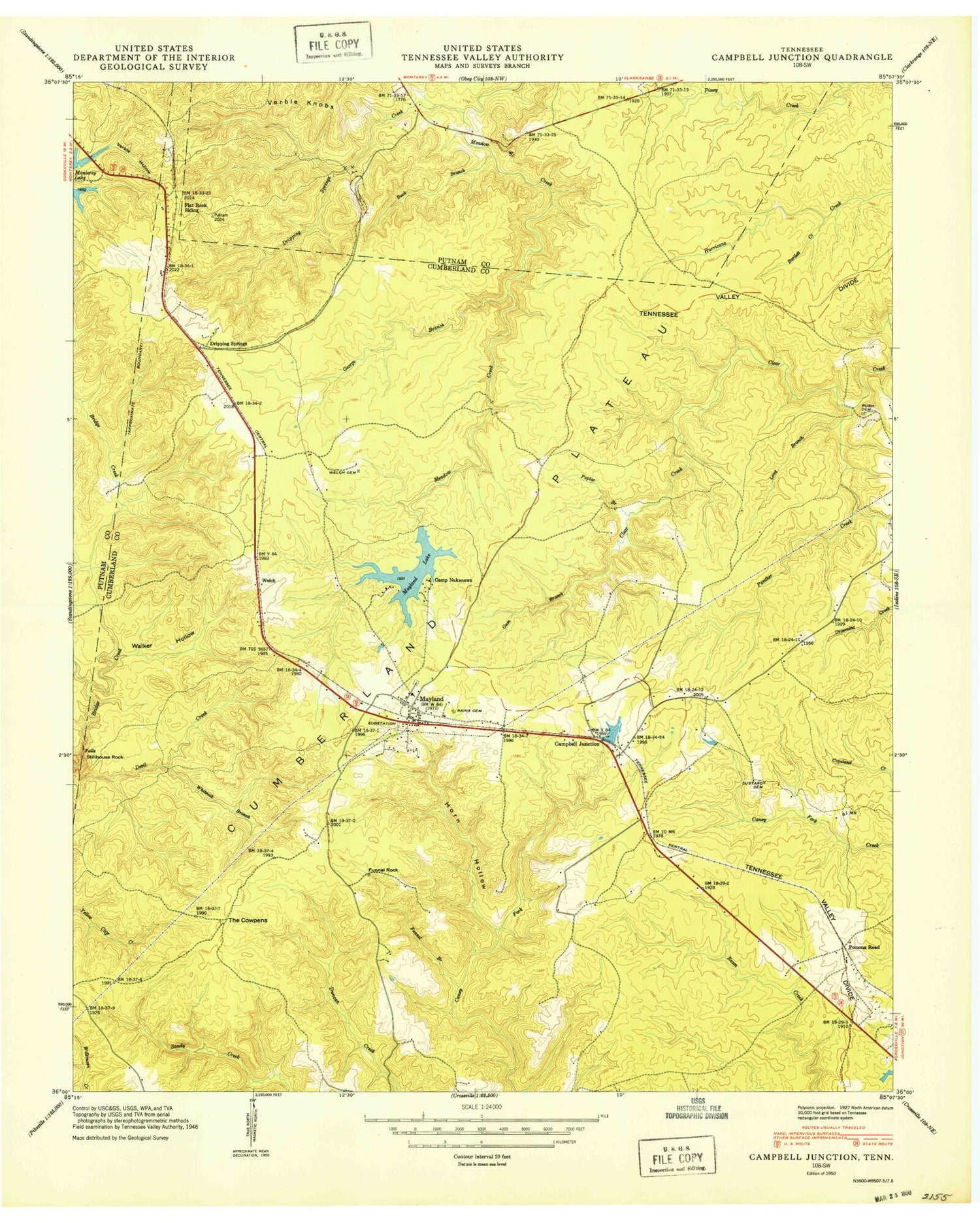
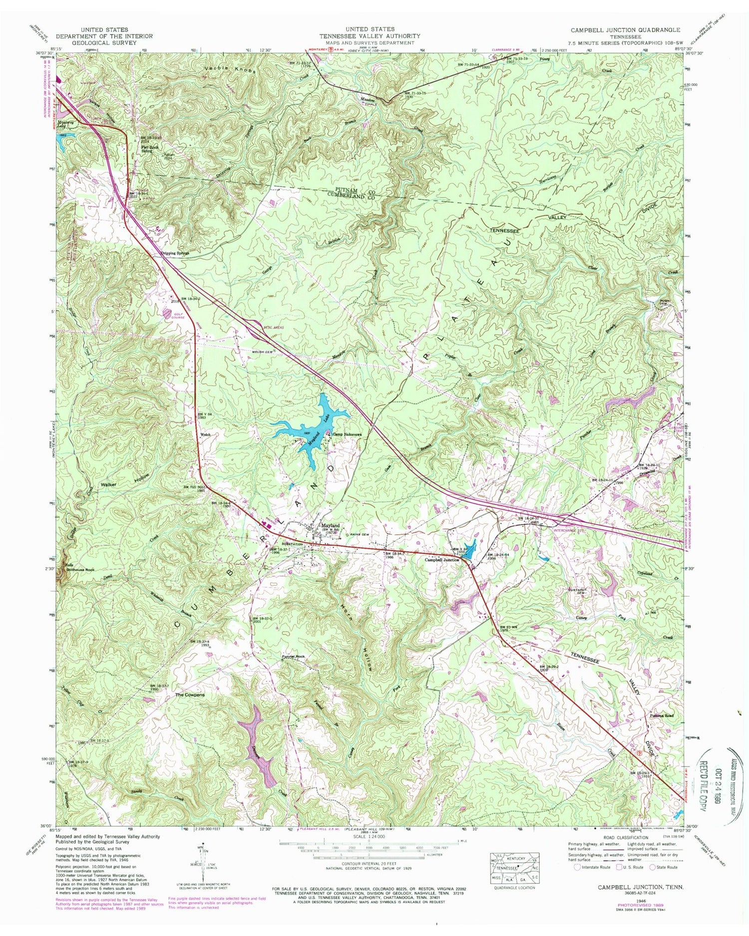
Classic USGS Campbell Junction Tennessee 7.5'x7.5' Topo Map
Couldn't load pickup availability
Historical USGS topographic quad map of Campbell Junction in the state of Tennessee. Map scale may vary for some years, but is generally around 1:24,000. Print size is approximately 24" x 27"
This quadrangle is in the following counties: Cumberland, Putnam.
The map contains contour lines, roads, rivers, towns, and lakes. Printed on high-quality waterproof paper with UV fade-resistant inks, and shipped rolled.
Contains the following named places: Bartlett Creek, Buck Branch, Camp Nakanawa, Campbell Junction, Cumberland County Fire Department Station 7, Cumberland County Fire Department Station 7 - 2, Custard Cemetery, Devil Creek, Dripping Springs, Dripping Springs Creek, Drowning Creek, Flat Rock Siding, Funnel Branch, Funnel Rock, George Branch, Gum Branch, Hillwood Estates, Hood Lake, Hood Lake Dam, Horn Hollow, Long Branch, Mayland, Mayland Baptist Church, Mayland Cemetery, Mayland Census Designated Place, Mayland Lake, Mayland Lake Dam, Mayland School, Mayland Town Hall, Panther Creek, Pomana Road, Pomona Road, Poplar Branch, Pugh Cemetery, Rains Cemetery, Stillhouse Rock, The Cowpens, Verble Hollow, Verble Knobs, Walker Hollow, Welch, Welch Cemetery, Whiteoak Branch