MyTopo
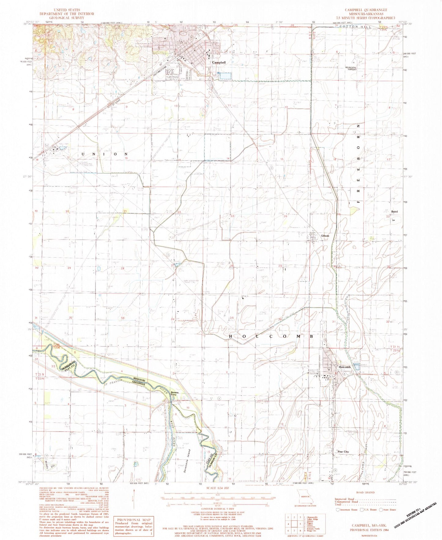
Classic USGS Campbell Missouri 7.5'x7.5' Topo Map
Couldn't load pickup availability
Historical USGS topographic quad map of Campbell in the states of Missouri, Arkansas. Map scale may vary for some years, but is generally around 1:24,000. Print size is approximately 24" x 27"
This quadrangle is in the following counties: Clay, Dunklin.
The map contains contour lines, roads, rivers, towns, and lakes. Printed on high-quality waterproof paper with UV fade-resistant inks, and shipped rolled.
Contains the following named places: Austin Church, Austin School, Baird, Browns Ferry, Brown's Ferry Gage, Campbell, Campbell Ambulance Service, Campbell Municipal Airport, Campbell Police Department, Campbell Post Office, Campbell Volunteer Fire Department, Canaan Cemetery, Canaan Church, Canaan Island, Caney Slough, Case School, City of Campbell, City of Holcomb, Columbia School, Ditch Number 1, Gibson, Gibson Church, Gibson School, Gravel Hill Cemetery, Groff School, Harp School, Holcomb, Holcomb Island, Holcomb Police Department, Holcomb Post Office, Holcomb Volunteer Fire Department, Johnson School, Lateral Number 1, Little Brown Church, Lloyd Cemetery, Lynne Oak Cemetery, Lynne Oak Church, Main Ditch District Number 10, McElyea School, North Canaan School, Old Methodist Church, Peedee School, Pine City, Pine City Cemetery, Poplar Creek Lateral District Number 16, Sandfield, South Canaan Church, South Canaan School, Township of Holcomb, Whitaker Church, ZIP Code: 63847