MyTopo
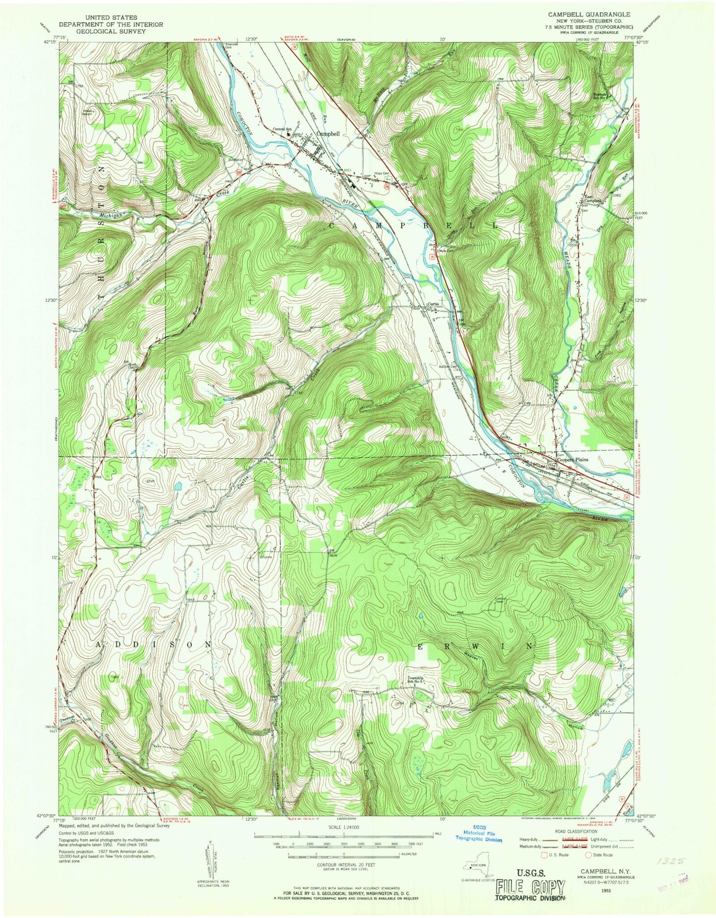
Classic USGS Campbell New York 7.5'x7.5' Topo Map
Couldn't load pickup availability
Historical USGS topographic quad map of Campbell in the state of New York. Typical map scale is 1:24,000, but may vary for certain years, if available. Print size: 24" x 27"
This quadrangle is in the following counties: Steuben.
The map contains contour lines, roads, rivers, towns, and lakes. Printed on high-quality waterproof paper with UV fade-resistant inks, and shipped rolled.
Contains the following named places: Balcom Cemetery, Burr Hollow, Campbell, Campbell - Savona Junior / Senior High School, Curtis Creek, Dry Run, East Campbell, Erwin Pond, Frog Hollow, Hope Cemetery, Michigan Creek, Nellie Ayres Memorial Park, Hillside Cemetery, Onawasa Creek, Frank F Pierce Early Childhood Center, Stony Run, Weaver Hollow, Coopers Plains, McNutt Run, Wolf Run, Curtis, Town of Addison, Town of Campbell, Town of Erwin, Green Hill School (historical), Mount Pleasant School (historical), Stony Knoll School (historical), Town Line School (historical), Coopers Plains Cemetery, East Campbell Cemetery, Campbell Alliance Church, Campbell United Methodist Church, Kingdom Hall of Jehovahs Witnesses, Saint Joseph Church, Christian and Missionary Church, Curtis Baptist Bible Church, Campbell Post Office, Coopers Plains Post Office, Hidden Forest Mobile Home Park, Seager Trailer Park, Smith Road Bridge, Campbell Rest Area, Campbell Census Designated Place, Coopers Plains Census Designated Place, Coopers Plains Long Acres Fire Department, Campbell Fire Department, East Campbell Fire Department