MyTopo
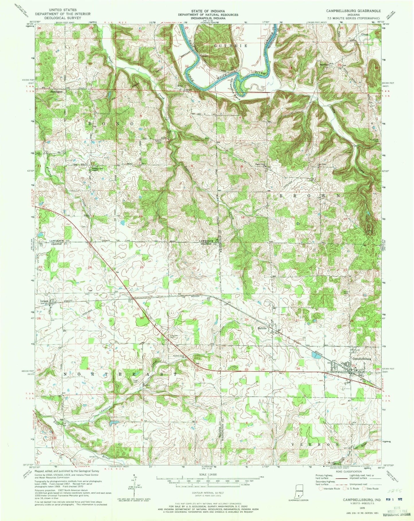
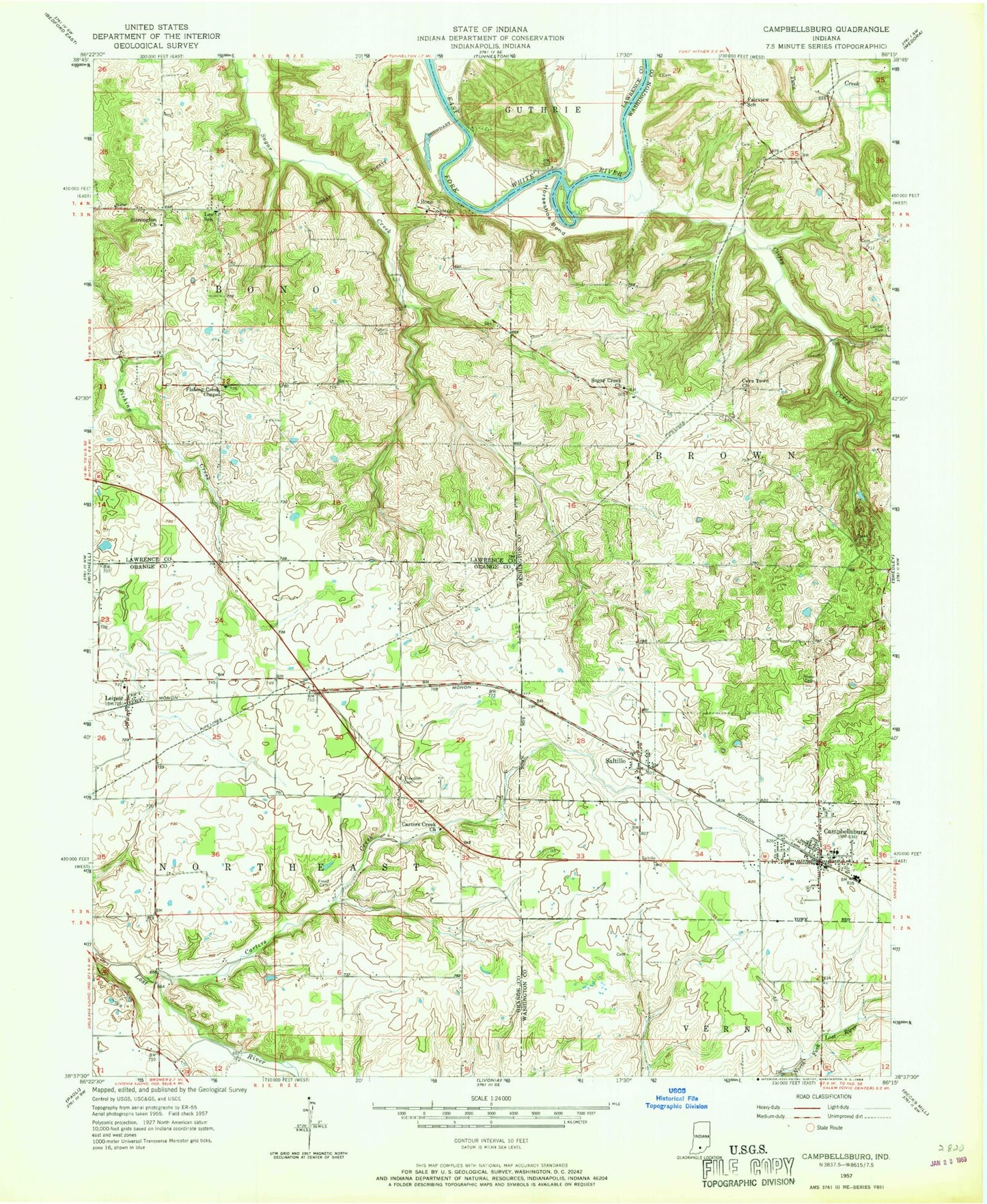
Classic USGS Campbellsburg Indiana 7.5'x7.5' Topo Map
Couldn't load pickup availability
Historical USGS topographic quad map of Campbellsburg in the state of Indiana. Map scale may vary for some years, but is generally around 1:24,000. Print size is approximately 24" x 27"
This quadrangle is in the following counties: Lawrence, Orange, Washington.
The map contains contour lines, roads, rivers, towns, and lakes. Printed on high-quality waterproof paper with UV fade-resistant inks, and shipped rolled.
Contains the following named places: Bono, Brimstone Corners, Campbellsburg, Campbellsburg Post Office, Campbellsburg Volunteer Fire Department, Carters Creek, Carters Creek Church, Cave Town Church, Clifty Creek, Fairview, Fishing Creek Chapel, Freed Cemetery, Freedom Cemetery, Horseshoe Bend, Leipsic, Lynhurst Baptist Church, Mount Carmel Cemetery, New Hope Cemetery, Saltillo, Stonington, Sugar Creek Church, Talbott Cemetery, Town of Campbellsburg, Town of Saltillo, Township of Bono, Township of Brown, Township of Northeast