MyTopo
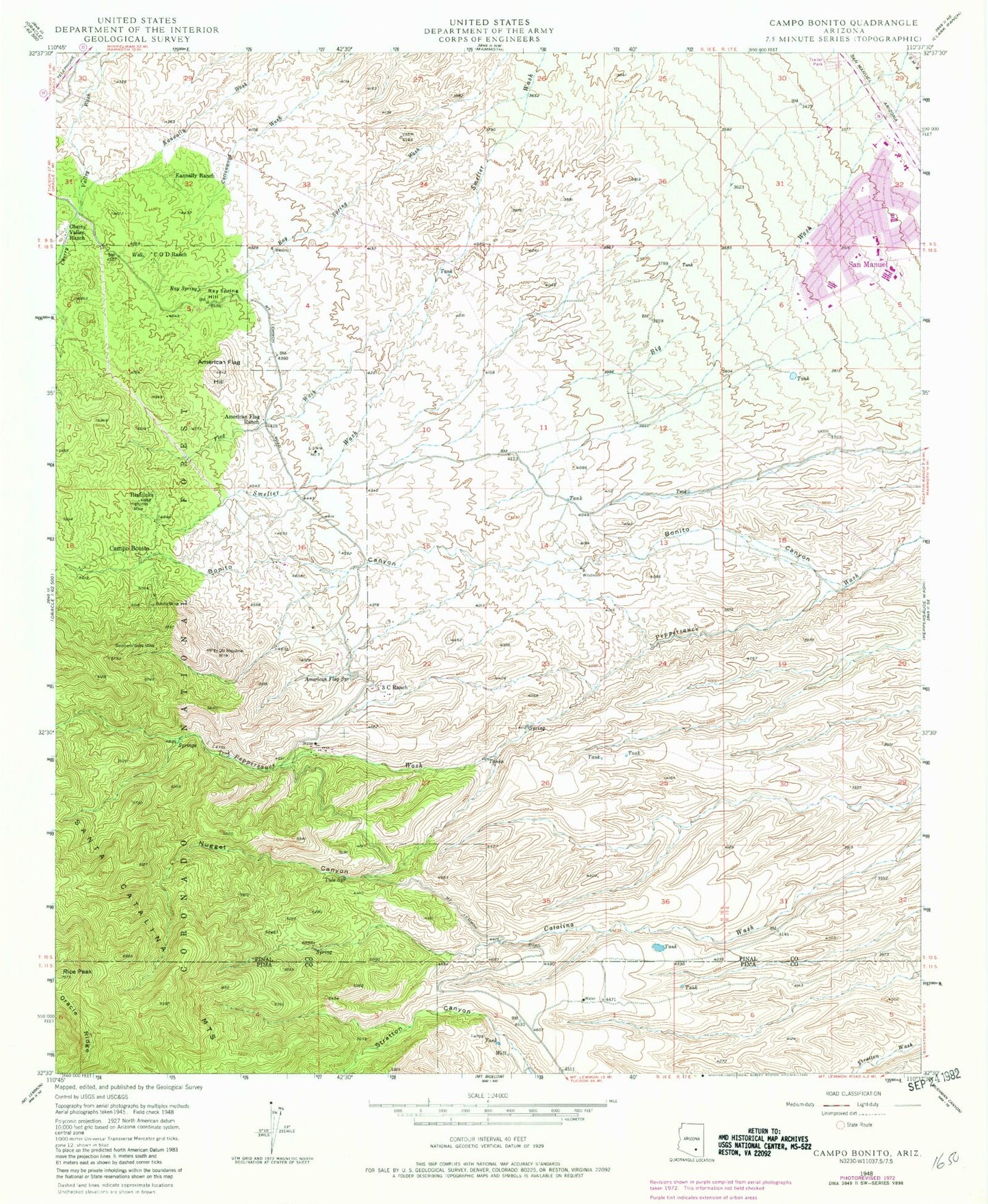
Classic USGS Campo Bonito Arizona 7.5'x7.5' Topo Map
Couldn't load pickup availability
Historical USGS topographic quad map of Campo Bonito in the state of Arizona. Map scale may vary for some years, but is generally around 1:24,000. Print size is approximately 24" x 27"
This quadrangle is in the following counties: Pima, Pinal.
The map contains contour lines, roads, rivers, towns, and lakes. Printed on high-quality waterproof paper with UV fade-resistant inks, and shipped rolled.
Contains the following named places: American Flag Hill, American Flag Ranch, American Flag Spring, American Flag Tank, Assembly of God Church, Avenue B Elementary School, Bonito Canyon, Bonito Mine, C O D Ranch, Campo Bonito, Campo Bonito Census Designated Place, Chain Link Tank, Cherry Valley Ranch, City Park, Cody Trailhead, Dead Bull Mine, First Avenue Elementary School, First Baptist Church in San Manuel, Flag Wash, Highjinks, Highjinks Mine, Kannally Ranch, Mammoth Copper Corporation Hospital, Nugget Canyon, Old Maudina Mine, Pela Seca Spring, Peppersauce Campground, Peppersauce Group Campground, Pinal County Sheriff's Office San Manuel Region B, Ray Spring, Ray Spring Hill, Ray Spring Wash, Rice Peak, Rock Spring, Saint Bartholomew's Church, Salvation Army Camp Wood, San Manuel, San Manuel Census Designated Place, San Manuel Copper Hospital, San Manuel Junior Senior High School, San Manuel Post Office, San Manuel Public Library, Southern Belle Mine, Stratton Tank, Three C Ranch, Tule Spring, Young Mens Christian Association Camp